Download
Preview
Add to list
More
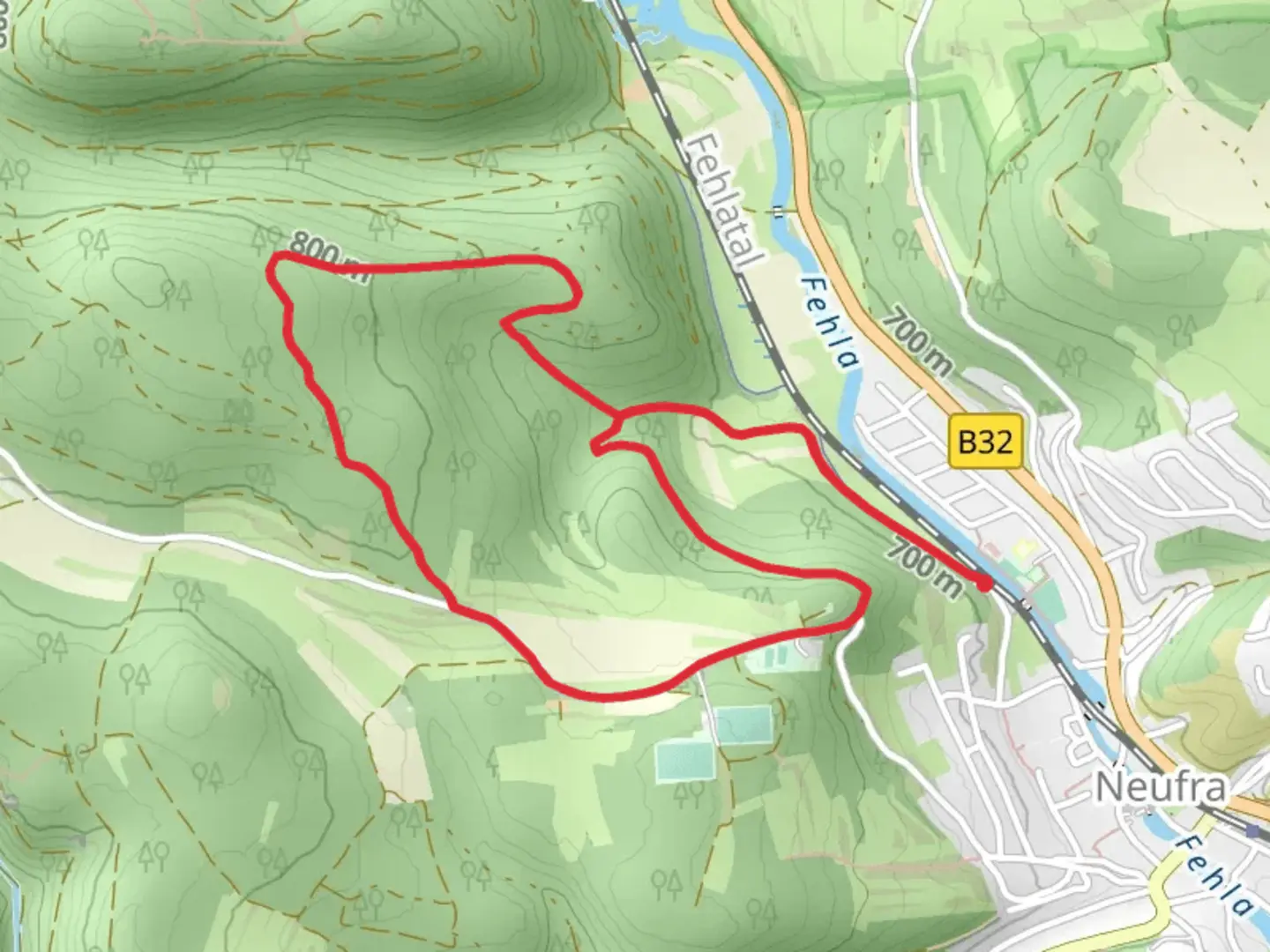
5.5 km
~1 hrs 23 min
178 m
Loop
“Explore the Swabian Jura's lush landscapes and historical landmarks on this moderately challenging loop trail.”
Nestled in the picturesque region near Sigmaringen, Germany, this loop trail offers a delightful journey through the heart of the Swabian Jura. Spanning approximately 5 kilometers (about 3.1 miles) with an elevation gain of around 100 meters (328 feet), this trail is rated as medium difficulty, making it suitable for hikers with some experience.### Getting ThereTo reach the trailhead, travelers can opt for public transport or drive. If you're using public transport, Sigmaringen is well-connected by train, with regular services from major cities like Stuttgart and Ulm. From the Sigmaringen train station, local buses or a short taxi ride can take you to the trailhead. For those driving, Sigmaringen is accessible via the B313 and B32 highways, with ample parking available near the trail's starting point.### Trail HighlightsAs you embark on this loop, you'll be greeted by the lush landscapes characteristic of the Swabian Jura. The trail meanders through dense forests and open meadows, offering a rich tapestry of flora and fauna. Keep an eye out for native wildlife such as deer and a variety of bird species that inhabit the area.### Historical SignificanceThe region around Sigmaringen is steeped in history. As you hike, you'll be walking through an area that has been inhabited since prehistoric times. The nearby Sigmaringen Castle, visible from certain points on the trail, is a testament to the area's historical importance. This Hohenzollern castle, with its striking architecture, dates back to the 11th century and has been a significant landmark throughout the region's history.### Navigation and LandmarksThe trail is well-marked, but it's always wise to have a reliable navigation tool like HiiKER to ensure you stay on track. Along the route, you'll encounter several notable landmarks. Approximately halfway through the loop, you'll come across a scenic viewpoint offering panoramic views of the Danube River valley. This is an ideal spot to pause and soak in the natural beauty.### Nature and WildlifeThe trail's diverse ecosystems provide a habitat for a variety of plant and animal life. In spring and summer, the meadows burst into color with wildflowers, while the forested sections offer a cool respite during warmer months. Birdwatchers will appreciate the opportunity to spot species such as the European robin and the black woodpecker.### Final StretchAs you near the end of the loop, the trail gently descends back towards the starting point, offering a serene conclusion to your hike. The combination of natural beauty, historical context, and moderate challenge makes this trail a rewarding experience for those looking to explore the Swabian Jura's unique landscape.

Comments and Reviews
User comments, reviews and discussions about the Radwanderkarte Loop, Germany.
4.0
average rating out of 5
1 rating(s)