Download
Preview
Add to list
More
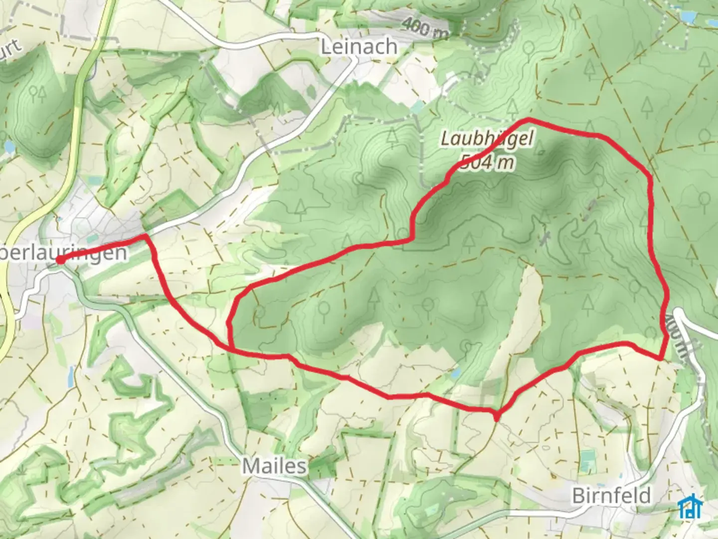
11.8 km
~2 hrs 41 min
209 m
Loop
“Explore stunning geology, rich history, and vibrant wildlife on the captivating 12 km Geologieweg Stadtlauringen trail.”
Starting near the charming town of Schweinfurt, Germany, the Geologieweg Stadtlauringen trail offers a captivating 12 km (7.5 miles) loop with an elevation gain of approximately 200 meters (656 feet). This medium-difficulty trail is perfect for hikers looking to explore the geological wonders and historical significance of the region.
Getting There
To reach the trailhead, you can drive or use public transport. If driving, head towards Stadtlauringen, which is well-signposted from Schweinfurt. There is ample parking available near the trailhead. For those using public transport, take a train to Schweinfurt and then a bus to Stadtlauringen. The nearest significant landmark to the trailhead is the Stadtlauringen Town Hall.
Trail Highlights
The trail begins with a gentle ascent through lush forests, offering a serene start to your hike. As you progress, you'll encounter several geological formations that give the trail its name. These formations are well-marked with informational plaques, providing insights into the region's geological history.
Historical Significance
Around the 3 km (1.9 miles) mark, you'll come across the ruins of an old quarry, which dates back to the early 19th century. This quarry was once a significant source of limestone, used in various construction projects in the region. The remnants of the quarry offer a glimpse into the industrial past of Stadtlauringen.
Nature and Wildlife
The trail is rich in biodiversity. As you hike, keep an eye out for local wildlife such as deer, foxes, and a variety of bird species. The forested sections are particularly vibrant in spring and autumn, with wildflowers blooming and leaves changing color, respectively.
Midway Point
At approximately 6 km (3.7 miles), you'll reach the highest point of the trail, offering panoramic views of the surrounding countryside. This is an excellent spot for a break and some photography. The elevation gain to this point is about 150 meters (492 feet), making it a moderate climb.
Navigation
The trail is well-marked, but it's always a good idea to have a reliable navigation tool. HiiKER is highly recommended for this trail, as it provides detailed maps and real-time updates to ensure you stay on track.
Final Stretch
The descent from the highest point is gradual, taking you through more forested areas and open meadows. As you near the end of the loop, you'll pass by a small lake, which is a popular spot for locals to relax and enjoy the natural beauty.
Practical Tips
- Wear sturdy hiking boots, as some sections of the trail can be rocky and uneven.
- Bring plenty of water and snacks, especially if you plan to take your time exploring the geological formations and historical sites.
- Check the weather forecast before you go, as the trail can become slippery in wet conditions.
This trail offers a perfect blend of natural beauty, geological wonders, and historical intrigue, making it a must-visit for any hiking enthusiast.

Comments and Reviews
User comments, reviews and discussions about the Geologieweg Stadtlauringen, Germany.
4.0
average rating out of 5
1 rating(s)