Download
Preview
Add to list
More
16.9 km
~4 hrs 14 min
514 m
Point-to-Point
“Journey through lush landscapes and medieval history on a scenic, accessible trail in Hohenlohe, Germany.”
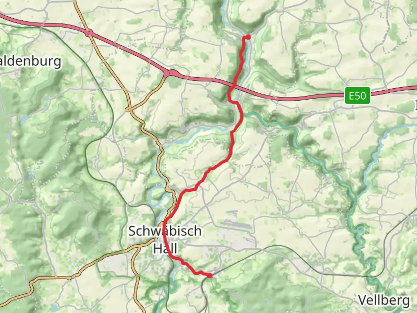
Nestled in the picturesque landscapes of southern Germany, the trail from Burgbretzingen to Braunsbach offers a delightful journey through the heart of the Hohenlohe region. This 17 km (approximately 10.5 miles) point-to-point trail begins near the charming town of Schwäbisch Hall, a place known for its half-timbered houses and rich history. With an elevation gain of around 500 meters (approximately 1,640 feet), this trail is rated as easy, making it accessible for hikers of all skill levels.### Getting to the TrailheadTo reach the starting point near Schwäbisch Hall, travelers can opt for public transport or drive. If you're using public transport, the nearest major city is Stuttgart. From Stuttgart, take a train to Schwäbisch Hall, which is well-connected by regional rail services. From Schwäbisch Hall, local buses or taxis can take you to the trailhead. For those driving, Schwäbisch Hall is accessible via the A6 motorway, with ample parking available in the town.### Trail Highlights and LandmarksAs you set off from Burgbretzingen, the trail meanders through lush forests and open fields, offering a serene escape into nature. The initial stretch is relatively flat, allowing you to ease into the hike while enjoying the tranquil surroundings. Keep an eye out for local wildlife, including deer and a variety of bird species that inhabit the area.About 5 km (3 miles) into the hike, you'll encounter the ruins of an ancient castle, a testament to the region's medieval past. This site offers a glimpse into the history of the Hohenlohe region, which was once dotted with fortresses and castles that played significant roles in local governance and defense.### Nature and SceneryContinuing along the trail, you'll traverse through a mix of deciduous and coniferous forests. The trail gently ascends, providing panoramic views of the rolling hills and valleys that characterize this part of Germany. In spring and summer, the path is lined with wildflowers, adding vibrant splashes of color to the landscape.Around the 10 km (6.2 miles) mark, the trail reaches its highest point, offering breathtaking views of the surrounding countryside. This is an ideal spot for a rest and a picnic, allowing you to soak in the beauty of the Hohenlohe region.### Historical SignificanceThe trail passes through areas steeped in history, with several small villages that have retained their traditional charm. These villages often feature historic churches and buildings that date back several centuries. The region's history is closely tied to the noble families that once ruled here, and remnants of their influence can still be seen in the architecture and local culture.### Final Stretch to BraunsbachAs you descend towards Braunsbach, the trail follows the course of the Kocher River, a serene waterway that adds to the trail's scenic appeal. The final few kilometers are relatively easy, with gentle slopes leading you into the quaint village of Braunsbach. Here, you can explore the local cafes and shops, or simply relax by the riverbank.For navigation, consider using the HiiKER app to ensure you stay on track and make the most of your hiking experience. This trail offers a perfect blend of natural beauty, historical intrigue, and cultural exploration, making it a must-visit for anyone traveling through southern Germany.

Comments and Reviews
User comments, reviews and discussions about the Burgbretzingen to Braunsbach Walk, Germany.
average rating out of 5
0 rating(s)