Download
Preview
Add to list
More
14.5 km
~3 hrs 25 min
320 m
Loop
“Explore scenic landscapes and historical landmarks on this 14 km trail near Schmalkalden-Meiningen, Germany.”
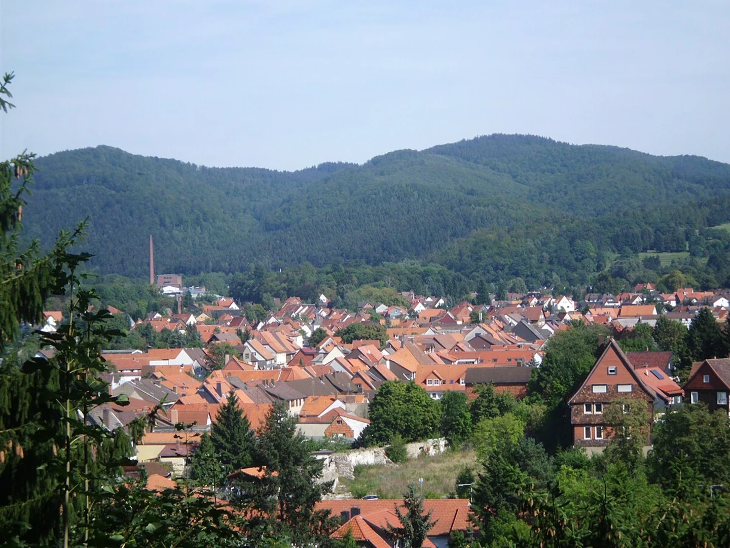
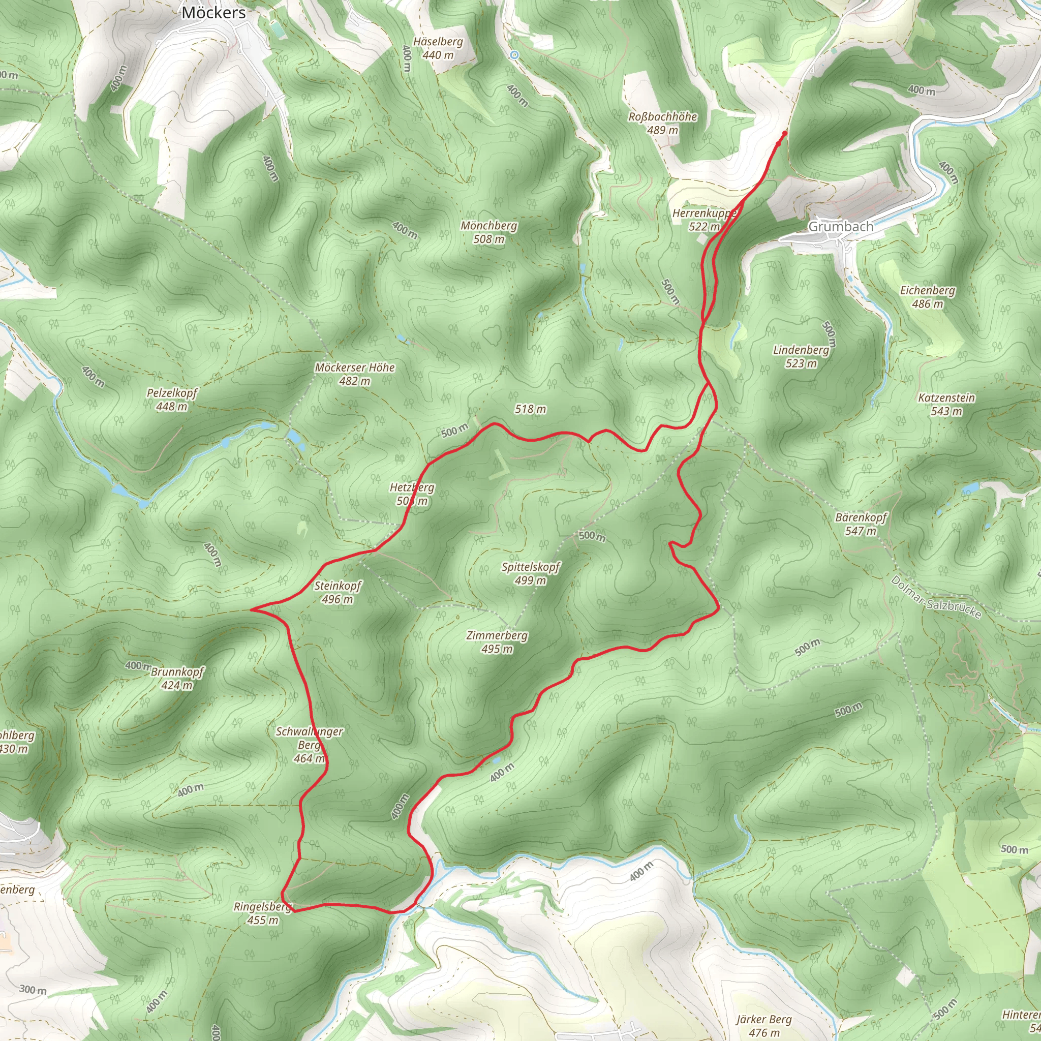
Starting near the picturesque town of Schmalkalden-Meiningen in Germany, this 14 km (8.7 miles) loop trail offers a delightful mix of natural beauty and historical intrigue. With an elevation gain of around 300 meters (984 feet), the trail is rated as medium difficulty, making it suitable for moderately experienced hikers.### Getting There To reach the trailhead, you can either drive or use public transport. If you're driving, set your GPS to Schmalkalden-Meiningen, and look for parking near the town center. For those using public transport, take a train to the Schmalkalden-Meiningen station. From there, local buses or a short taxi ride will get you to the trailhead.### Trail Overview The trail begins near the town center, quickly leading you into the serene German countryside. The initial section is relatively flat, allowing you to ease into the hike. As you progress, the trail starts to ascend gently, offering panoramic views of the surrounding hills and valleys.### Key Landmarks and Sections#### Hohe Straße Around the 3 km (1.9 miles) mark, you'll encounter the historic Hohe Straße, an ancient trade route that has been in use since medieval times. This section of the trail is particularly scenic, with lush forests and occasional clearings that provide stunning vistas.#### Hetzberg Hill At approximately 5 km (3.1 miles), you'll begin your ascent of Hetzberg Hill. The climb is steady but manageable, with an elevation gain of about 150 meters (492 feet). Keep an eye out for diverse flora and fauna, including deer and various bird species. The summit offers a perfect spot for a short break, with breathtaking views of the Thuringian Forest.#### Schwallunger Berg Hill Continuing on, you'll reach Schwallunger Berg Hill around the 9 km (5.6 miles) point. This section involves another ascent, adding another 150 meters (492 feet) to your elevation gain. The trail here is well-marked but can be rocky, so sturdy hiking boots are recommended. The hilltop provides another excellent vantage point, ideal for photography or simply soaking in the natural beauty.### Historical Significance The region around Schmalkalden-Meiningen is steeped in history. The town itself dates back to the 8th century and was an important center during the Reformation. As you hike, you'll pass by remnants of old trade routes and possibly even ancient boundary markers, offering a glimpse into the area's rich past.### Navigation and Safety For navigation, it's highly recommended to use the HiiKER app, which provides detailed maps and real-time updates. The trail is generally well-marked, but having a reliable navigation tool will ensure you stay on track.### Wildlife and Flora The trail is home to a variety of wildlife, including deer, foxes, and numerous bird species. The flora is equally diverse, with dense forests of beech and oak, interspersed with meadows filled with wildflowers, especially in the spring and summer months.### Final Stretch The last few kilometers of the trail are a gentle descent back towards Schmalkalden-Meiningen. This section is relatively easy, allowing you to cool down and reflect on the hike. As you approach the town, you'll pass through charming rural landscapes, dotted with traditional German houses and farms.This loop trail offers a perfect blend of natural beauty, moderate physical challenge, and historical significance, making it a rewarding experience for any hiker.
What to expect?
Activity types
Comments and Reviews
User comments, reviews and discussions about the Hetzberg and Schwallunger Berg Hill Loop via Hohe Straße, Germany.
4.5
average rating out of 5
4 rating(s)

