Download
Preview
Add to list
More
9.8 km
~2 hrs 22 min
245 m
Loop
“Explore the Thuringian Forest on a captivating 10 km loop with scenic views and historical intrigue.”
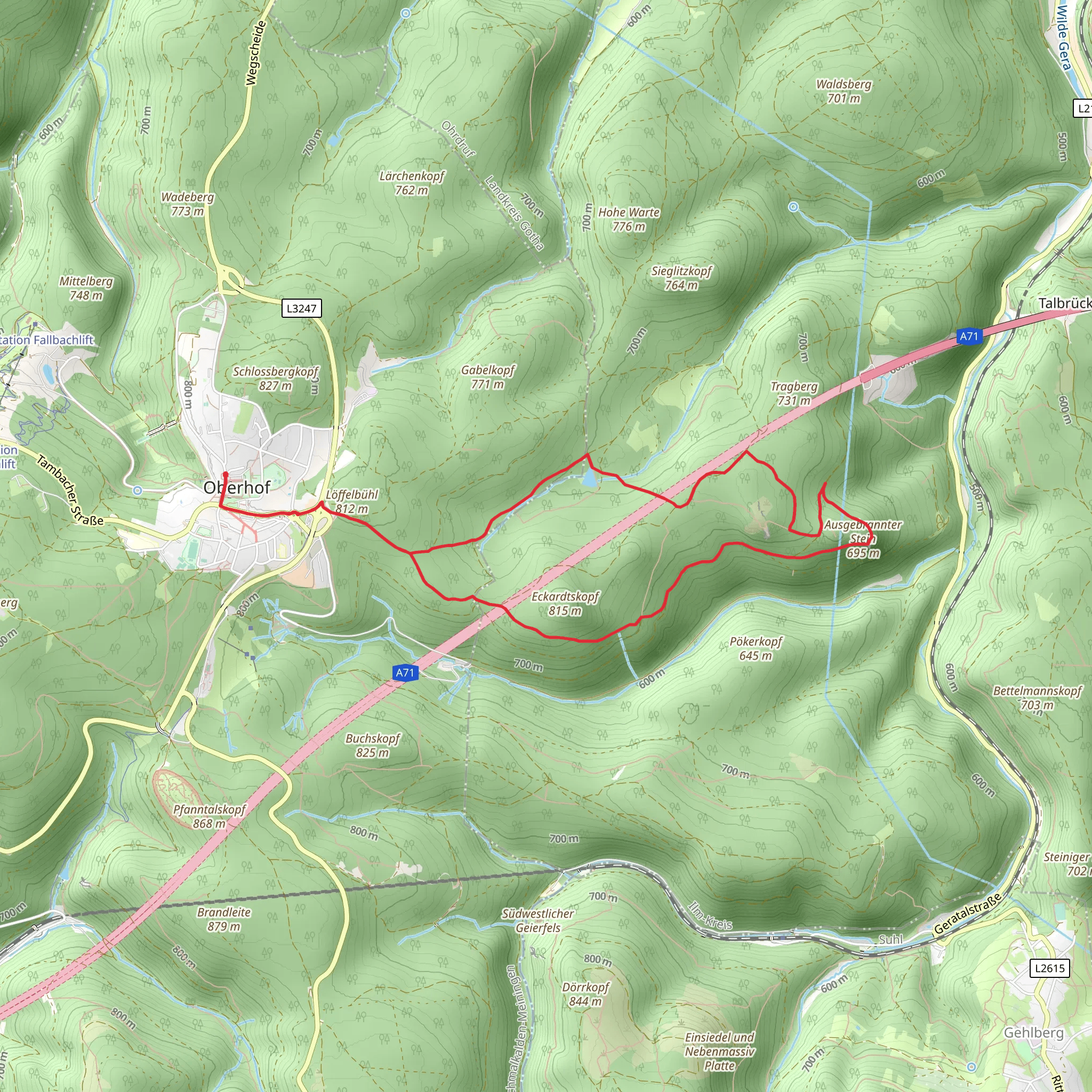
Starting your hike near the town of Schmalkalden-Meiningen in Germany, the Ausgebrannter Stein, Oberer Sieglitzteich Loop - Oberhof is a captivating 10 km (6.2 miles) loop trail with an elevation gain of approximately 200 meters (656 feet). This trail is rated as medium difficulty, making it suitable for moderately experienced hikers.
Getting There To reach the trailhead, you can either drive or use public transport. If driving, set your GPS to Oberhof, a well-known town in the Thuringian Forest. There are several parking areas available near the trailhead. For those using public transport, take a train to the Oberhof station and then a local bus or taxi to the starting point.
Trail Highlights #### Ausgebrannter Stein One of the first significant landmarks you'll encounter is the Ausgebrannter Stein, a striking rock formation that stands out against the lush forest backdrop. This geological feature is a great spot for a short break and some photos. The rock formation is located approximately 3 km (1.9 miles) into the hike, with a gentle ascent leading up to it.
#### Oberer Sieglitzteich Continuing along the trail, you'll come across the Oberer Sieglitzteich, a serene pond surrounded by dense forest. This is an excellent spot for bird-watching and enjoying the tranquility of nature. The pond is situated around the halfway mark of the loop, roughly 5 km (3.1 miles) from the start.
Flora and Fauna The trail meanders through a diverse range of ecosystems, from dense coniferous forests to open meadows. Keep an eye out for local wildlife such as deer, foxes, and a variety of bird species. The flora is equally impressive, with seasonal wildflowers adding splashes of color to the landscape.
Historical Significance The region around Oberhof has a rich history, particularly related to its role in the timber and glass industries. As you hike, you'll notice remnants of old logging paths and perhaps even some historical markers detailing the area's past. These markers provide a fascinating glimpse into the lives of those who once worked in these forests.
Navigation Given the trail's moderate difficulty and the dense forest sections, it's advisable to use a reliable navigation tool like HiiKER to stay on track. The trail is well-marked, but having a digital map can provide extra assurance.
Final Stretch As you near the end of the loop, the trail descends gently back towards the starting point. This section offers panoramic views of the surrounding Thuringian Forest, making it a perfect way to conclude your hike. The final 2 km (1.2 miles) are relatively easy, allowing you to cool down and reflect on the natural beauty you've experienced.
This 10 km loop offers a balanced mix of natural beauty, historical intrigue, and moderate physical challenge, making it a rewarding hike for those looking to explore the Thuringian Forest.
What to expect?
Activity types
Comments and Reviews
User comments, reviews and discussions about the Ausgebrannter Stein, Oberer Sieglitzteich Loop - Oberhof, Germany.
4.88
average rating out of 5
8 rating(s)

