Schrammsteine, Hinterer Torsteinkegel and Kleiner Falknerturm Loop via Malerweg
Download
Preview
Add to list
More
7.9 km
~2 hrs 27 min
524 m
Loop
“Embark on an 8 km trail in Saxon Switzerland for stunning vistas, historical landmarks, and challenging terrain.”
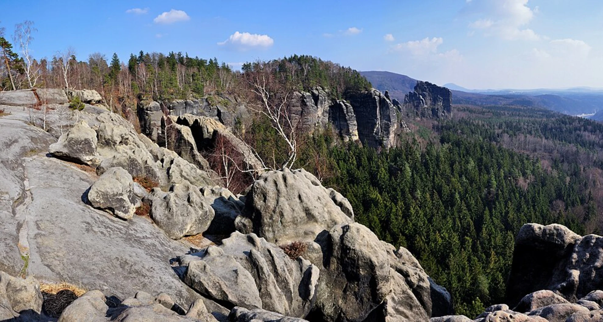
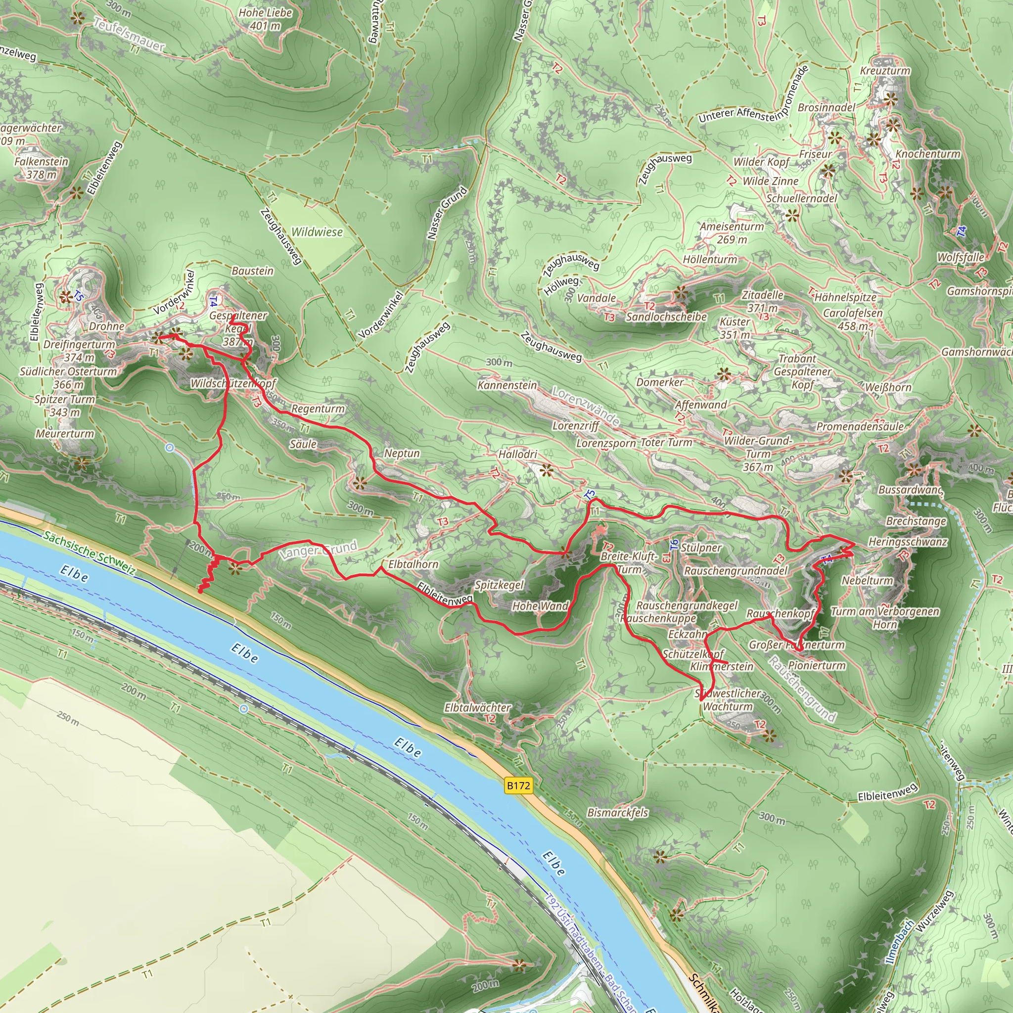
Starting your adventure near the picturesque region of Sächsische Schweiz-Osterzgebirge in Germany, this 8 km (5 miles) loop trail offers a captivating blend of natural beauty, challenging terrain, and historical significance. With an elevation gain of approximately 500 meters (1,640 feet), this medium-difficulty hike is perfect for those looking to experience the stunning landscapes of Saxon Switzerland.### Getting There To reach the trailhead, you can either drive or use public transport. If driving, set your GPS to the nearest known address: Schrammsteine, 01814 Bad Schandau, Germany. For public transport, take a train to Bad Schandau station. From there, you can catch a bus or a taxi to the trailhead, which is a short distance away.### Trail Overview The loop begins with a gentle ascent through dense forests, where you’ll be greeted by the serene sounds of nature. As you progress, the trail becomes steeper, leading you to the first significant landmark: the Schrammsteine rock formation. This series of jagged sandstone peaks offers breathtaking panoramic views of the Elbe Sandstone Mountains. ### Schrammsteine At around 2 km (1.2 miles) into the hike, you’ll reach the Schrammsteine viewpoint. The elevation gain here is approximately 200 meters (656 feet). Take a moment to soak in the expansive vistas, which are particularly stunning at sunrise or sunset. The rugged terrain and narrow paths require careful navigation, so make sure to use HiiKER for accurate trail guidance.### Hinterer Torsteinkegel Continuing along the trail, you’ll encounter the Hinterer Torsteinkegel at around the 4 km (2.5 miles) mark. This section involves a steep climb, adding another 150 meters (492 feet) to your elevation gain. The Hinterer Torsteinkegel is a prominent rock tower that offers another excellent vantage point. The area is rich in flora, with various species of mosses and lichens adorning the rocks.### Kleiner Falknerturm The next highlight is the Kleiner Falknerturm, located approximately 6 km (3.7 miles) into the hike. This smaller rock formation is less crowded, providing a peaceful spot to rest and enjoy the surrounding nature. The elevation gain here is about 100 meters (328 feet). Keep an eye out for local wildlife, including deer and various bird species that inhabit the area.### Historical Significance The region of Saxon Switzerland has a rich history dating back to the 13th century. The sandstone formations were once used as fortifications and hideouts during various historical conflicts. The Malerweg, or Painter’s Way, which this loop partially follows, was a favorite route for 18th and 19th-century artists who were inspired by the dramatic landscapes.### Final Stretch As you make your way back to the trailhead, the descent offers a more relaxed pace. The final 2 km (1.2 miles) of the loop take you through lush forests and along gentle streams, providing a tranquil end to your hike. The total elevation gain for the entire loop is around 500 meters (1,640 feet), making it a rewarding yet manageable challenge.### Preparation Tips Ensure you have sturdy hiking boots, as the terrain can be rocky and uneven. Carry enough water and snacks, and consider bringing trekking poles for added stability. The trail is well-marked, but using HiiKER will help you stay on track and provide additional information about the route.This loop trail offers a perfect blend of natural beauty, physical challenge, and historical intrigue, making it a must-visit for any hiking enthusiast exploring Saxon Switzerland.
Comments and Reviews
User comments, reviews and discussions about the Schrammsteine, Hinterer Torsteinkegel and Kleiner Falknerturm Loop via Malerweg, Germany.
4.67
average rating out of 5
9 rating(s)
