Download
Preview
Add to list
More
10.9 km
~3 hrs 9 min
596 m
Loop
“Explore history and nature on this scenic 11 km loop to Koenigstein Fortress in Saxon Switzerland.”
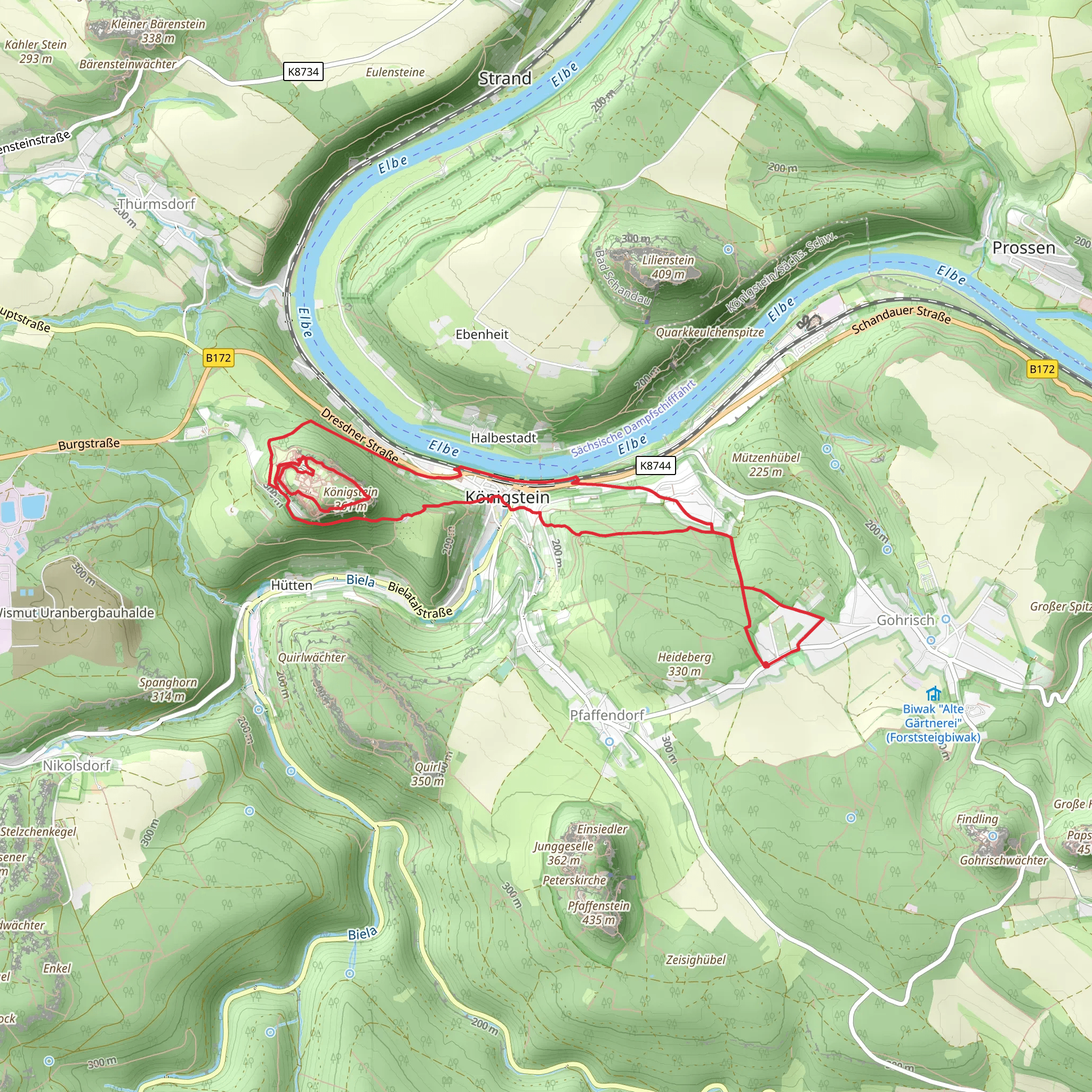
Starting your adventure near Sächsische Schweiz-Osterzgebirge, Germany, the Koenigstein Fortress via Alte Festungsstraße and Malerweg trail is a captivating loop that spans approximately 11 km (6.8 miles) with an elevation gain of around 500 meters (1,640 feet). This medium-difficulty trail offers a blend of historical intrigue, natural beauty, and panoramic vistas.
Getting There To reach the trailhead, you can either drive or use public transport. If driving, set your GPS to the nearest significant landmark, the town of Königstein. For those opting for public transport, take a train to Königstein (Sächs Schweiz) station. From there, it's a short walk to the trailhead.
Trail Overview The trail begins near the town of Königstein, a picturesque locale nestled in the heart of the Saxon Switzerland National Park. As you set off, you'll follow the Alte Festungsstraße, a historic route that has been used for centuries. The initial section is relatively gentle, allowing you to ease into the hike while soaking in the lush greenery and the sounds of the forest.
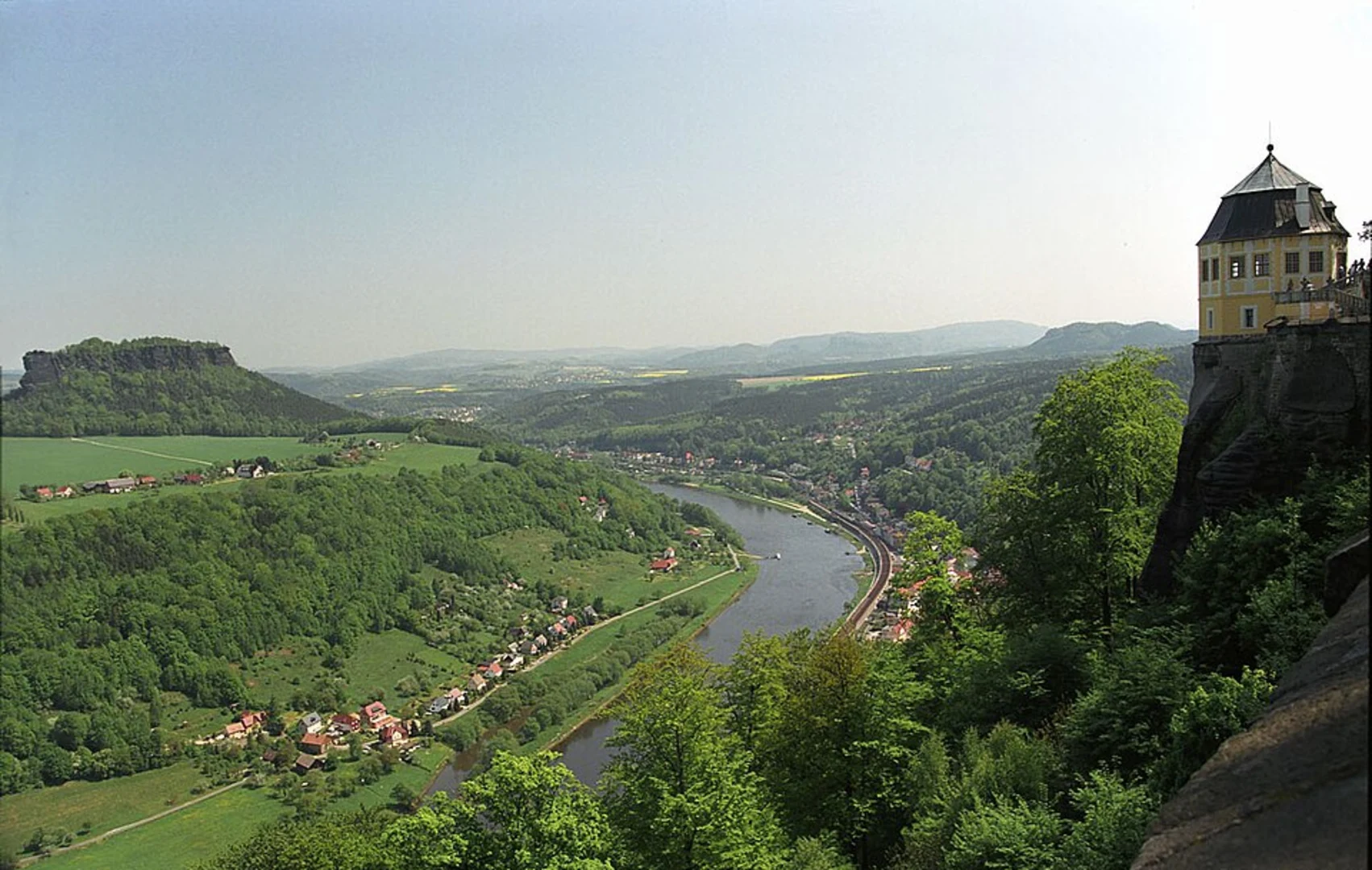
Historical Significance One of the highlights of this trail is the Koenigstein Fortress, a massive hilltop fortress that dates back to the 13th century. As you approach the fortress, you'll notice its imposing walls and strategic location, offering a glimpse into its historical importance as a military stronghold. The fortress has never been captured in battle, making it a fascinating site for history enthusiasts.
Nature and Wildlife As you continue along the trail, you'll transition onto the Malerweg, a renowned hiking path that has inspired countless artists over the years. This section of the trail is particularly scenic, with towering sandstone cliffs, dense forests, and the occasional glimpse of the Elbe River. Keep an eye out for local wildlife, including deer, foxes, and a variety of bird species.
Key Landmarks - **Koenigstein Fortress**: Approximately 3 km (1.9 miles) into the hike, you'll reach the fortress. Take some time to explore its extensive grounds and enjoy the panoramic views of the surrounding landscape. - **Lilienstein**: Around the halfway mark, you'll have a clear view of Lilienstein, one of the most iconic table mountains in the region. This is a great spot for a rest and some photos. - **Elbe River Views**: As you loop back towards Königstein, the trail offers several vantage points overlooking the Elbe River, providing stunning photo opportunities.
Navigation and Safety Given the trail's moderate difficulty, it's advisable to use a reliable navigation tool like HiiKER to stay on track. The path is well-marked, but having a digital map can be reassuring, especially in the denser forest sections. Wear sturdy hiking boots, bring plenty of water, and pack some snacks to keep your energy levels up.
Final Stretch The last leg of the hike brings you back to Königstein, where you can relax and perhaps enjoy a meal at one of the local eateries. The town itself is charming, with cobblestone streets and traditional German architecture, making it a pleasant end to a rewarding hike.
This trail offers a perfect blend of history, natural beauty, and moderate physical challenge, making it a must-do for any hiking enthusiast visiting the Saxon Switzerland region.
What to expect?
Activity types
Comments and Reviews
User comments, reviews and discussions about the Koenigstein Fortress via Alte Festungsstraße and Malerweg, Germany.
4.33
average rating out of 5
3 rating(s)

