Kanapee, Basteiaussicht, Ferdinandstein and Felsenburg Loop via Basteirundweg
Download
Preview
Add to list
More
3.7 km
~1 hrs 18 min
351 m
Loop
“Explore breathtaking views, historical landmarks, and diverse wildlife on this 4 km trail in Saxon Switzerland.”
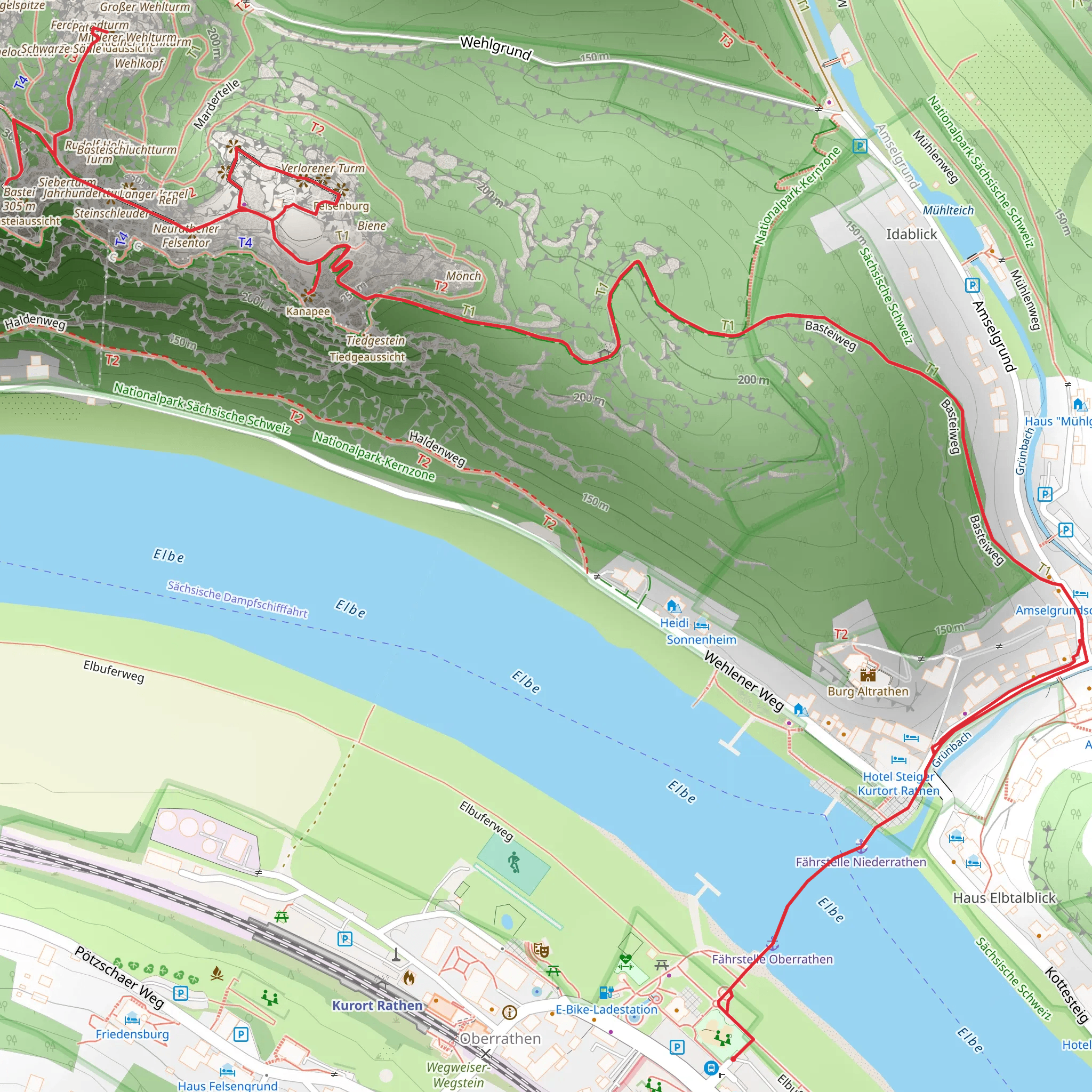
Starting near the picturesque region of Sächsische Schweiz-Osterzgebirge in Germany, this 4 km (2.5 miles) loop trail offers a moderate challenge with an elevation gain of approximately 300 meters (984 feet). The trailhead is conveniently accessible by both public transport and car. If you're traveling by public transport, you can take a train to the Kurort Rathen station, which is the nearest significant landmark. From there, it's a short walk to the trailhead. For those driving, parking is available near the trailhead.### Trail Highlights and Landmarks#### Kanapee The trail begins with a gentle ascent through lush forest, leading you to the Kanapee viewpoint. This spot offers breathtaking views of the Elbe Sandstone Mountains, a unique geological formation that has been shaped over millions of years. The panoramic vistas here are a perfect introduction to the natural beauty of the region.#### Basteiaussicht Continuing along the trail, you'll reach the Basteiaussicht, one of the most famous viewpoints in the Saxon Switzerland National Park. The Bastei Bridge, a sandstone bridge built in 1851, spans a series of towering rock formations and offers stunning views of the Elbe River below. This area is rich in history, having been a popular tourist destination since the early 19th century. The bridge itself is an architectural marvel, blending seamlessly with the natural landscape.#### Ferdinandstein Next, the trail takes you to Ferdinandstein, another notable viewpoint. Named after King Frederick Augustus II of Saxony, this spot provides a quieter, more secluded vantage point compared to the bustling Basteiaussicht. The views here are equally impressive, offering a different perspective of the surrounding cliffs and valleys.#### Felsenburg As you continue, you'll encounter the ruins of Felsenburg Neurathen, an ancient rock castle dating back to the Middle Ages. This historical site offers a glimpse into the region's past, with remnants of fortifications and living quarters carved directly into the rock. Interpretive signs provide information about the castle's history and its strategic importance during medieval times.### Flora and FaunaThe trail is enveloped by a diverse array of flora and fauna. The dense forest is home to various species of trees, including beech, oak, and pine. In spring and summer, the forest floor is carpeted with wildflowers, adding vibrant splashes of color to the landscape. Wildlife enthusiasts may spot deer, foxes, and a variety of bird species, including the rare peregrine falcon.### Navigation and SafetyGiven the moderate difficulty of the trail, it's advisable to use a reliable navigation tool like HiiKER to stay on track. The trail is well-marked, but having a digital map can provide additional peace of mind. Wear sturdy hiking boots, as some sections can be rocky and uneven. Carry enough water and snacks, especially during warmer months, as there are no facilities along the trail.### Getting ThereTo reach the trailhead, take a train to Kurort Rathen station if you're using public transport. From the station, it's a short walk to the starting point of the trail. If you're driving, parking is available near the trailhead, making it convenient for those traveling by car. The nearest significant landmark for navigation purposes is the Kurort Rathen station.This loop trail offers a perfect blend of natural beauty, historical significance, and moderate physical challenge, making it an ideal choice for hikers looking to explore the stunning landscapes of Saxon Switzerland.
What to expect?
Activity types
Comments and Reviews
User comments, reviews and discussions about the Kanapee, Basteiaussicht, Ferdinandstein and Felsenburg Loop via Basteirundweg, Germany.
4.29
average rating out of 5
7 rating(s)
