Download
Preview
Add to list
More
9.4 km
~2 hrs 39 min
467 m
Loop
“Embark on a 9 km loop through lush forests, historic landmarks, and stunning vistas in Sächsische Schweiz.”
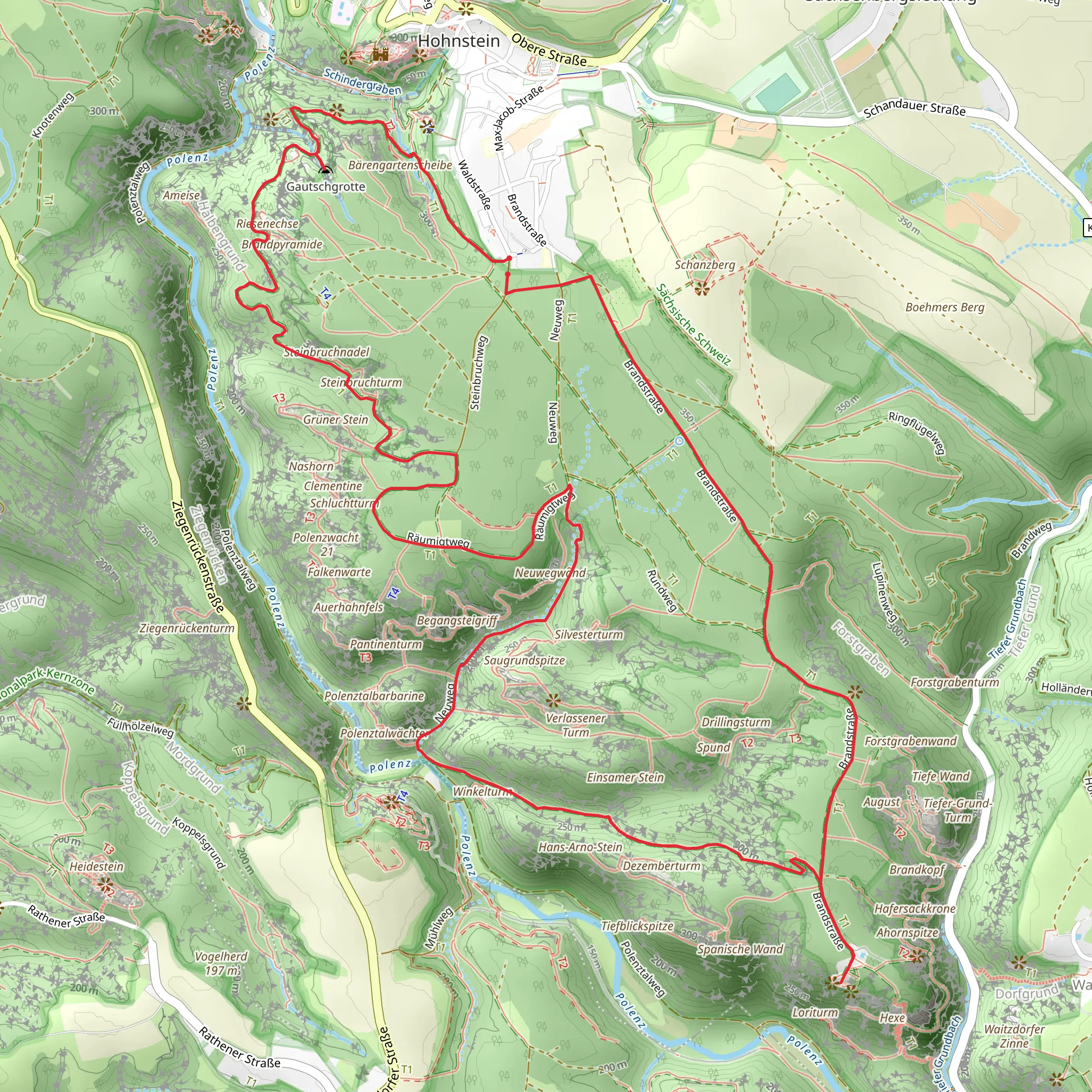
Starting your hike near Sächsische Schweiz-Osterzgebirge, Germany, you'll embark on a 9 km (5.6 miles) loop trail with an elevation gain of approximately 400 meters (1,312 feet). This trail is rated as medium difficulty, making it suitable for moderately experienced hikers.
Getting There To reach the trailhead, you can drive or use public transport. If driving, set your GPS to the nearest known address, which is in the vicinity of the town of Bad Schandau. For those using public transport, take a train to Bad Schandau station. From there, you can catch a bus or taxi to the trailhead.
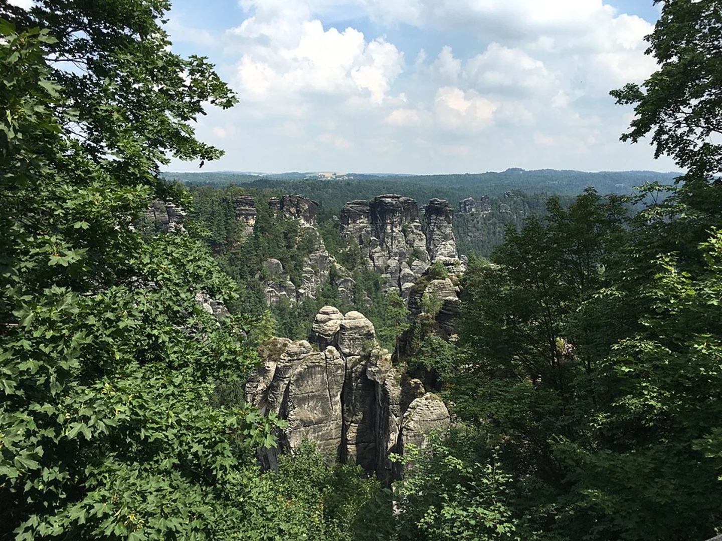
Trail Overview The trail begins with a gentle ascent through lush forests, offering a serene start to your hike. As you progress, the path becomes steeper, leading you to the first significant landmark, the Gautschgrotte. This grotto is a natural rock formation that provides a cool, shaded area perfect for a short rest.
Malerweg Section Continuing along the Malerweg, you'll encounter a series of viewpoints that offer stunning vistas of the surrounding Sächsische Schweiz National Park. The Malerweg, or Painter's Way, is historically significant as it inspired many 18th and 19th-century artists. Keep an eye out for interpretive signs that provide insights into the area's artistic heritage.
Kamenz Kuhstall Around the halfway mark, you'll reach the Kamenz Kuhstall, a massive rock arch that once served as a shelter for livestock. This natural wonder is one of the largest rock arches in Europe and offers panoramic views of the Elbe Sandstone Mountains. The elevation gain to this point is about 200 meters (656 feet), making it a good spot to take a break and enjoy the scenery.
Flora and Fauna The trail is rich in biodiversity. You'll pass through mixed forests of beech, oak, and pine, and may spot wildlife such as deer, foxes, and various bird species. The area is also home to rare plants like the lady's slipper orchid, so tread carefully to preserve these natural treasures.
Navigation and Safety Given the trail's moderate difficulty, it's advisable to use a reliable navigation tool like HiiKER to stay on track. The trail is well-marked, but having a digital map can be invaluable, especially in areas where the path may be less distinct.
Final Stretch The final section of the trail descends back towards the starting point, offering a mix of forested paths and open clearings. The descent is gradual, making for a comfortable end to your hike. As you near the trailhead, you'll pass through picturesque meadows that are particularly beautiful in the spring and summer months.
Historical Significance The region has a rich history, with evidence of human settlement dating back to prehistoric times. The rock formations and caves have been used for shelter and religious purposes over the centuries. The trail itself has been a popular route for hikers and artists alike, contributing to its cultural and historical significance.
By the time you complete the loop, you'll have experienced a diverse range of landscapes, historical landmarks, and natural beauty, making this hike a memorable adventure.
What to expect?
Activity types
Comments and Reviews
User comments, reviews and discussions about the Gautschgrotte via Malerweg and Kamenz Kuhstall, Germany.
4.5
average rating out of 5
6 rating(s)

