Bad Schandau to Beuthenfall via Elbe, Vergessener Kegel and Gruener Strich
Download
Preview
Add to list
More
11.6 km
~3 hrs 18 min
599 m
Point-to-Point
“This scenic 12 km trail near Bad Schandau combines natural beauty, moderate challenges, and historical intrigue.”
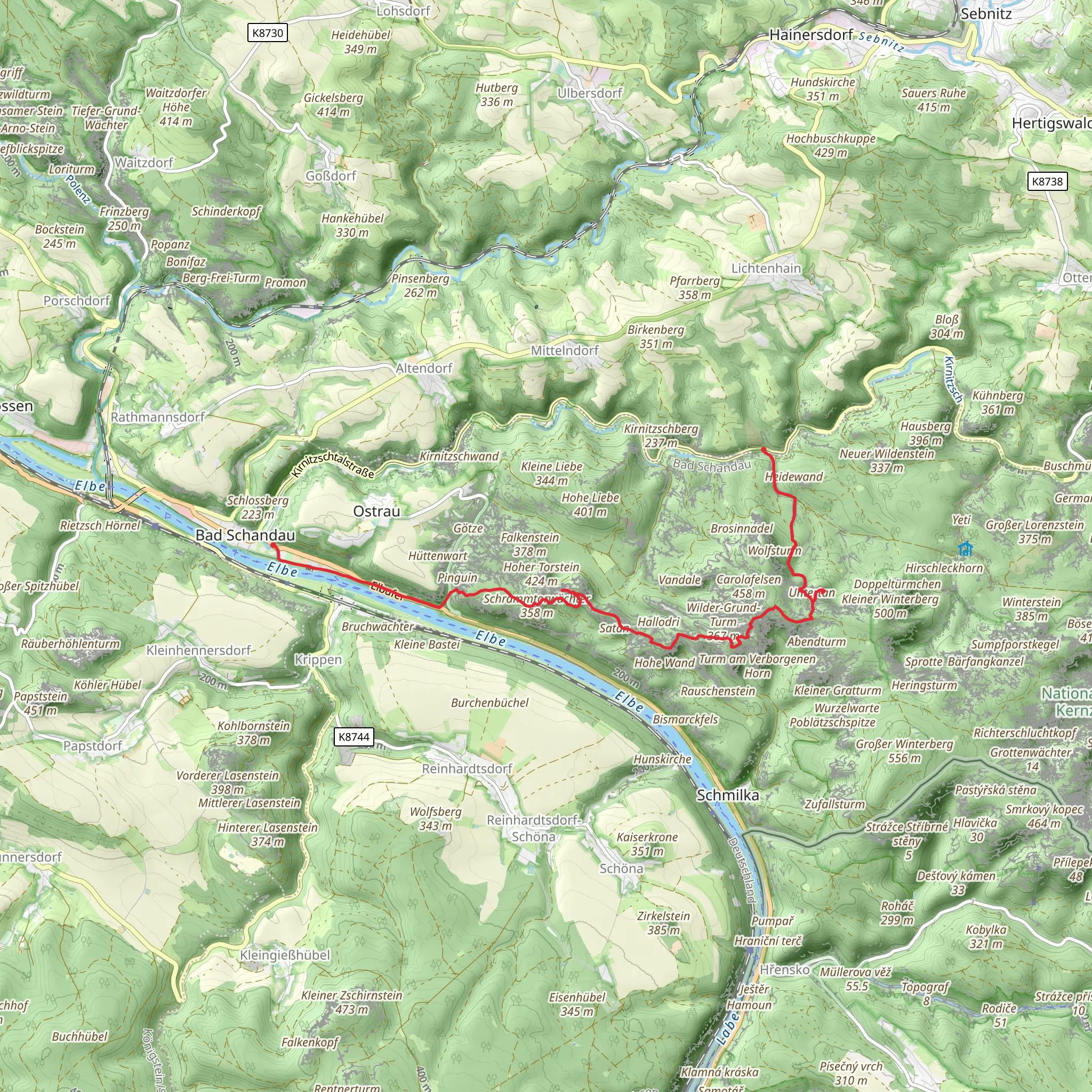
Starting near the picturesque town of Bad Schandau in the Sächsische Schweiz-Osterzgebirge region of Germany, this 12 km (7.5 miles) point-to-point trail offers a delightful mix of natural beauty, historical landmarks, and moderate physical challenge. With an elevation gain of approximately 500 meters (1,640 feet), hikers should be prepared for some uphill sections, but the rewards are well worth the effort.
Getting There To reach the trailhead, you can take a train to Bad Schandau from major cities like Dresden. The town is well-connected by public transport, and the train station is conveniently located near the start of the trail. If you prefer to drive, there are parking facilities available in Bad Schandau.
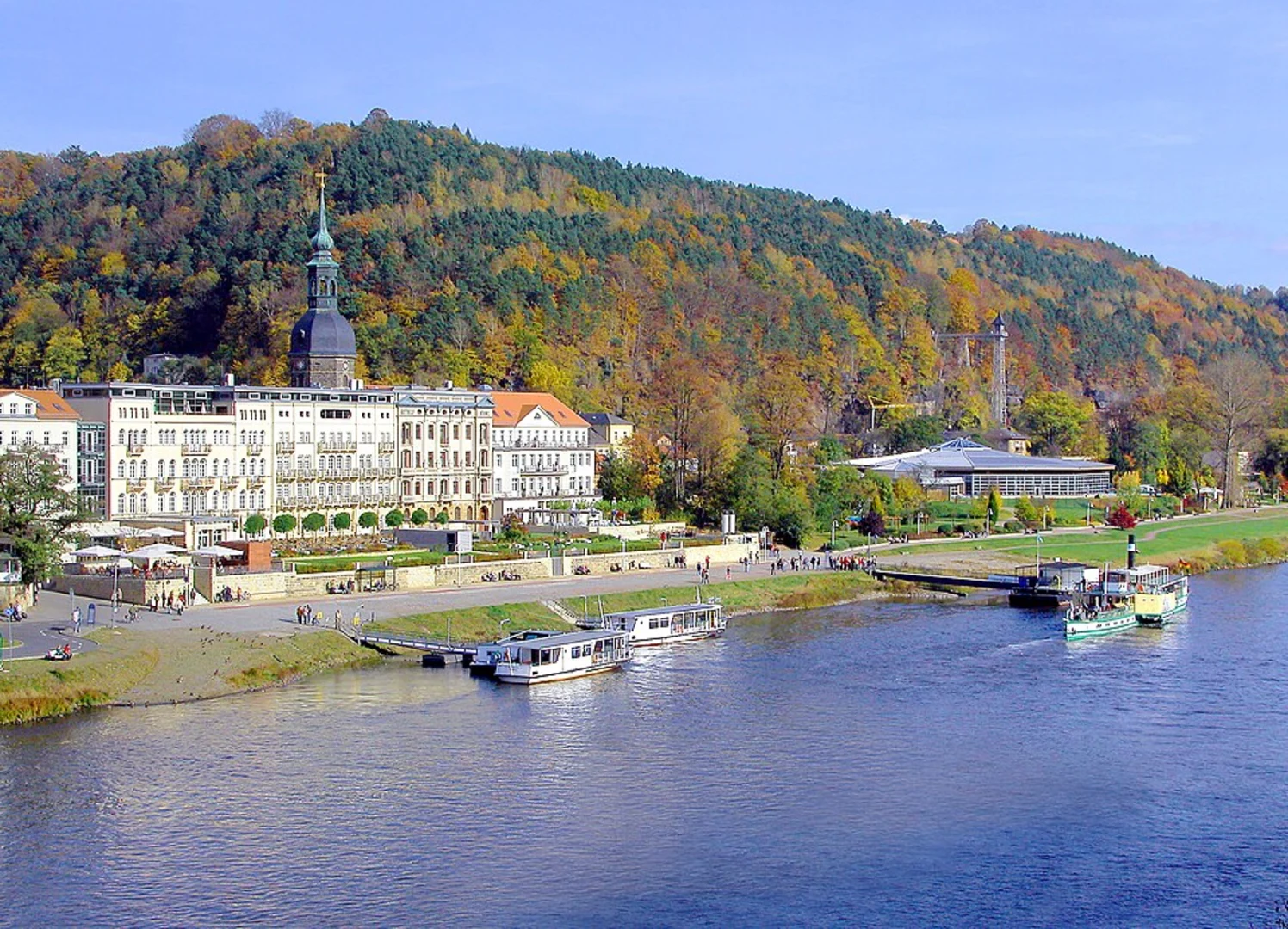
Trail Overview The trail begins in Bad Schandau, a charming spa town known for its historic architecture and scenic views of the Elbe River. As you set off, you'll follow the river for a short distance, enjoying the serene waters and lush greenery that line its banks.
Key Landmarks and Sections
#### Elbe River The initial part of the hike takes you along the Elbe River, offering stunning views and a relatively flat terrain. This section is perfect for warming up your legs and soaking in the natural beauty of the area. Keep an eye out for various bird species that frequent the riverbanks.
#### Vergessener Kegel As you move away from the river, the trail starts to ascend towards the Vergessener Kegel, a lesser-known but fascinating geological formation. This part of the hike involves a moderate climb, so take your time and enjoy the changing landscape. The Vergessener Kegel offers a unique vantage point to appreciate the surrounding forest and rock formations.
#### Gruener Strich Continuing on, you'll reach the Gruener Strich, a scenic stretch characterized by its dense forest and vibrant greenery. This section is relatively flat and provides a nice break from the earlier climb. The forest is home to a variety of wildlife, including deer and foxes, so keep your eyes peeled for any movement among the trees.
Historical Significance The region around Bad Schandau has a rich history, dating back to medieval times. The town itself was first mentioned in historical records in the 14th century and has long been a popular destination for those seeking the therapeutic benefits of its natural springs. Along the trail, you may come across remnants of old fortifications and ancient pathways that hint at the area's storied past.
Final Stretch to Beuthenfall The last part of the trail involves another ascent, leading you towards Beuthenfall. This section can be a bit challenging, but the panoramic views from the top are a fantastic reward. Beuthenfall is known for its beautiful waterfall, which is particularly impressive after a period of rain. The sound of cascading water and the sight of the falls provide a perfect end to your hike.
Navigation For navigation, it's highly recommended to use HiiKER, which offers detailed maps and real-time updates to ensure you stay on the right path. The trail is well-marked, but having a reliable navigation tool can enhance your hiking experience.
This trail offers a wonderful mix of natural beauty, moderate physical challenge, and historical intrigue, making it a must-do for any hiking enthusiast visiting the Sächsische Schweiz-Osterzgebirge region.
Comments and Reviews
User comments, reviews and discussions about the Bad Schandau to Beuthenfall via Elbe, Vergessener Kegel and Gruener Strich, Germany.
4.5
average rating out of 5
6 rating(s)
