Download
Preview
Add to list
More
6.2 km
~1 hrs 51 min
372 m
Loop
“Discover the scenic and historic beauty of Saxon Switzerland on this 6 km captivating loop trail.”
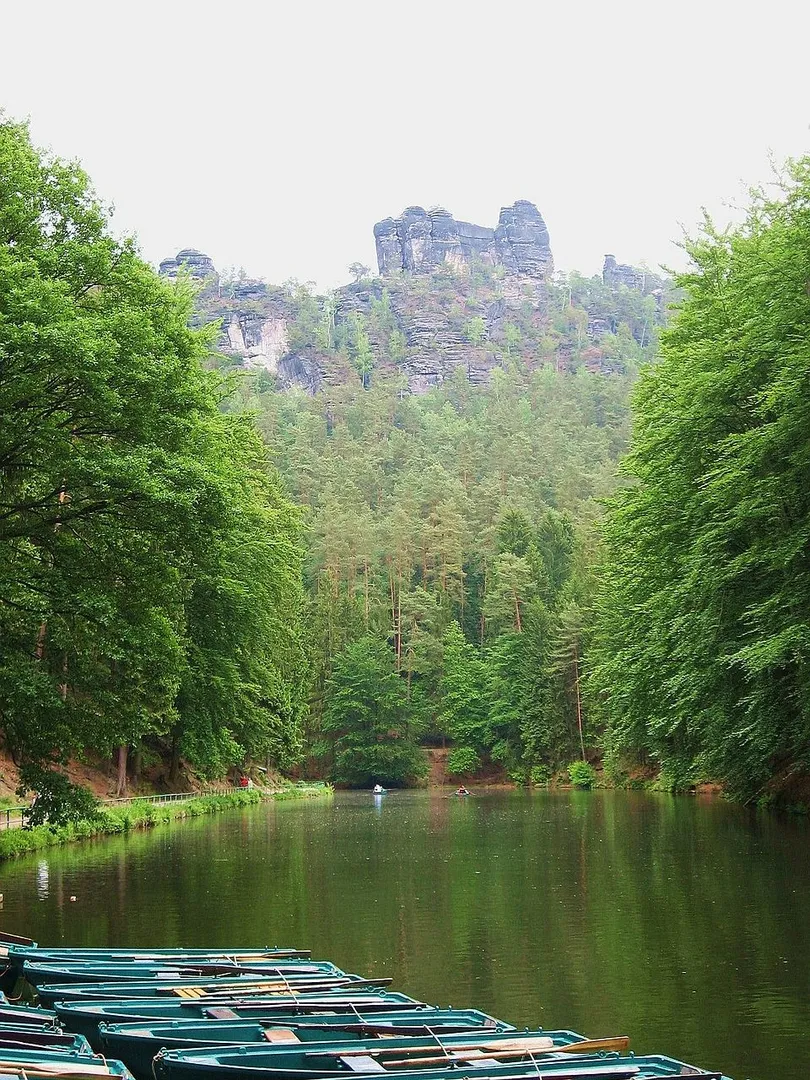
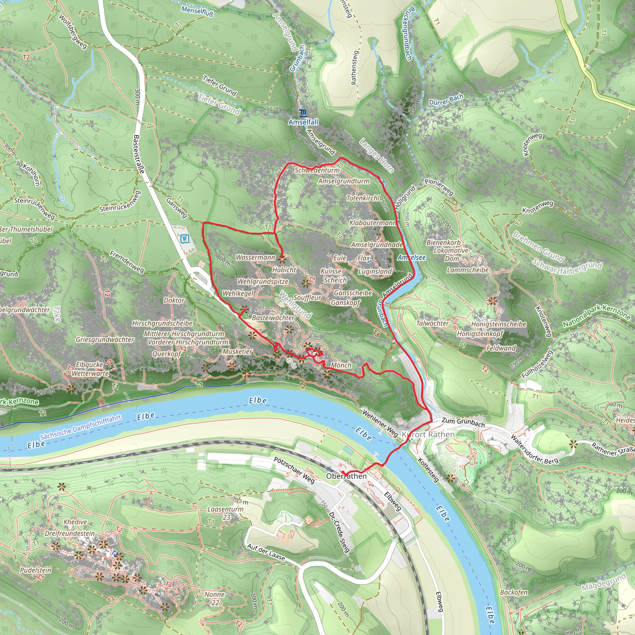
Starting your adventure near Sächsische Schweiz-Osterzgebirge, Germany, the Amselsee via Grosser Rundweg and Malerweg trail offers a captivating 6 km (3.7 miles) loop with an elevation gain of around 300 meters (984 feet). This medium-difficulty trail is perfect for those looking to experience the natural beauty and historical richness of the Saxon Switzerland National Park.### Getting There To reach the trailhead, you can either drive or use public transport. If you're driving, set your GPS to the nearest known address, which is the town of Rathen. For those using public transport, take a train to the Kurort Rathen station. From there, it's a short walk to the trailhead.### Trail Overview The trail begins near the picturesque Amselsee, a small lake surrounded by lush greenery and dramatic rock formations. As you start your hike, you'll be greeted by the serene waters of the lake, which is a popular spot for paddle boating. The initial part of the trail is relatively flat, making it an easy warm-up before you start gaining elevation.### Grosser Rundweg Section Approximately 1 km (0.6 miles) into the hike, you'll transition onto the Grosser Rundweg. This section of the trail takes you through dense forests and offers stunning views of the Elbe Sandstone Mountains. Keep an eye out for the diverse flora and fauna; the area is home to various bird species, deer, and even the occasional fox.### Malerweg Section Around the 3 km (1.9 miles) mark, you'll join the Malerweg, one of Germany's most famous hiking trails. This section is known for its historical significance, as it was a favorite among 18th and 19th-century painters who were inspired by the breathtaking landscapes. The trail here becomes more challenging, with steeper inclines and rocky paths, so make sure to wear sturdy hiking boots.### Key Landmarks As you continue, you'll encounter several significant landmarks. The Bastei Bridge, located about 4 km (2.5 miles) into the hike, is a must-see. This iconic sandstone bridge offers panoramic views of the Elbe River and the surrounding cliffs. Another notable spot is the Felsenbühne Rathen, an open-air theater nestled among the rocks, which hosts various performances during the summer months.### Navigation and Safety Given the trail's complexity, it's advisable to use a reliable navigation tool like HiiKER to keep track of your progress and ensure you stay on the right path. The trail is well-marked, but having a digital map can be incredibly helpful, especially in the more rugged sections.### Final Stretch The last 2 km (1.2 miles) of the trail take you back towards Amselsee, descending through a series of switchbacks. This part of the hike offers a gentle cooldown, allowing you to soak in the final views of the forest and rock formations. As you approach the trailhead, you'll have a chance to reflect on the diverse landscapes and historical sites you've encountered.This trail offers a perfect blend of natural beauty, historical significance, and moderate physical challenge, making it a rewarding experience for any hiker.
Comments and Reviews
User comments, reviews and discussions about the Amselsee via Grosser Rundweg and Malerweg, Germany.
4.75
average rating out of 5
8 rating(s)

