Download
Preview
Add to list
More
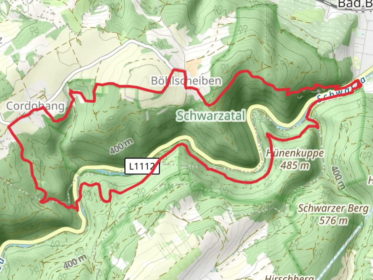
14.7 km
~3 hrs 59 min
625 m
Loop
“Discover the enchanting blend of nature and history on the captivating Schwarzatal Loop in Germany.”
Nestled in the picturesque Thuringian Forest, the Schwarzatal Loop offers a captivating journey through Germany's natural and historical landscapes. This 15 km (approximately 9.3 miles) loop trail, with an elevation gain of around 600 meters (about 1,970 feet), is a medium-difficulty hike that promises both challenge and reward.
Getting There
The trailhead is conveniently located near Saalfeld-Rudolstadt, a charming town in Thuringia. For those traveling by car, Saalfeld-Rudolstadt is accessible via the A4 and A9 highways, with ample parking available near the trailhead. If you prefer public transport, the town is well-connected by train, with regular services from major cities like Erfurt and Leipzig. From the Saalfeld train station, local buses or a short taxi ride will take you to the start of the trail.
Trail Highlights
As you embark on the Schwarzatal Loop, you'll find yourself immersed in a lush, verdant forest, with the soothing sounds of the Schwarza River accompanying you. The trail meanders through a diverse landscape, offering a mix of dense woodlands, open meadows, and rocky outcrops. Keep an eye out for the region's rich wildlife, including deer, foxes, and a variety of bird species.
Historical Significance
The Schwarzatal region is steeped in history, with roots tracing back to medieval times. As you hike, you'll encounter remnants of this past, including the ruins of old castles and fortifications. One notable landmark is the Burg Greifenstein, a medieval castle perched on a hilltop, offering panoramic views of the surrounding valley. This castle, dating back to the 12th century, played a significant role in the region's history and is a testament to the architectural prowess of the time.
Navigating the Trail
The Schwarzatal Loop is well-marked, but it's always wise to have a reliable navigation tool. HiiKER is an excellent choice for this trail, providing detailed maps and real-time updates to ensure you stay on track. The trail is a loop, so you'll return to your starting point, making logistics straightforward.
Nature and Scenery
The trail's elevation gain of 600 meters (1,970 feet) offers hikers a moderate challenge, with rewarding views at the higher points. As you ascend, the landscape opens up, revealing sweeping vistas of the Thuringian Forest. The trail is particularly stunning in the spring and autumn months, when the foliage bursts into vibrant colors.
Practical Tips
Given the trail's medium difficulty, it's advisable to wear sturdy hiking boots and bring plenty of water, especially during warmer months. Weather in the Thuringian Forest can be unpredictable, so packing a rain jacket and layers is recommended. The trail is accessible year-round, but conditions can vary, with snow possible in winter months.
The Schwarzatal Loop is a delightful blend of natural beauty and historical intrigue, offering hikers a memorable experience in one of Germany's most enchanting regions.

Comments and Reviews
User comments, reviews and discussions about the Schwarzatal Loop, Germany.
average rating out of 5
0 rating(s)