Download
Preview
Add to list
More
4.7 km
~1 hrs 15 min
191 m
Loop
“Experience the Walpersberg Loop: a 5 km hike blending natural beauty, historical intrigue, and moderate challenge.”
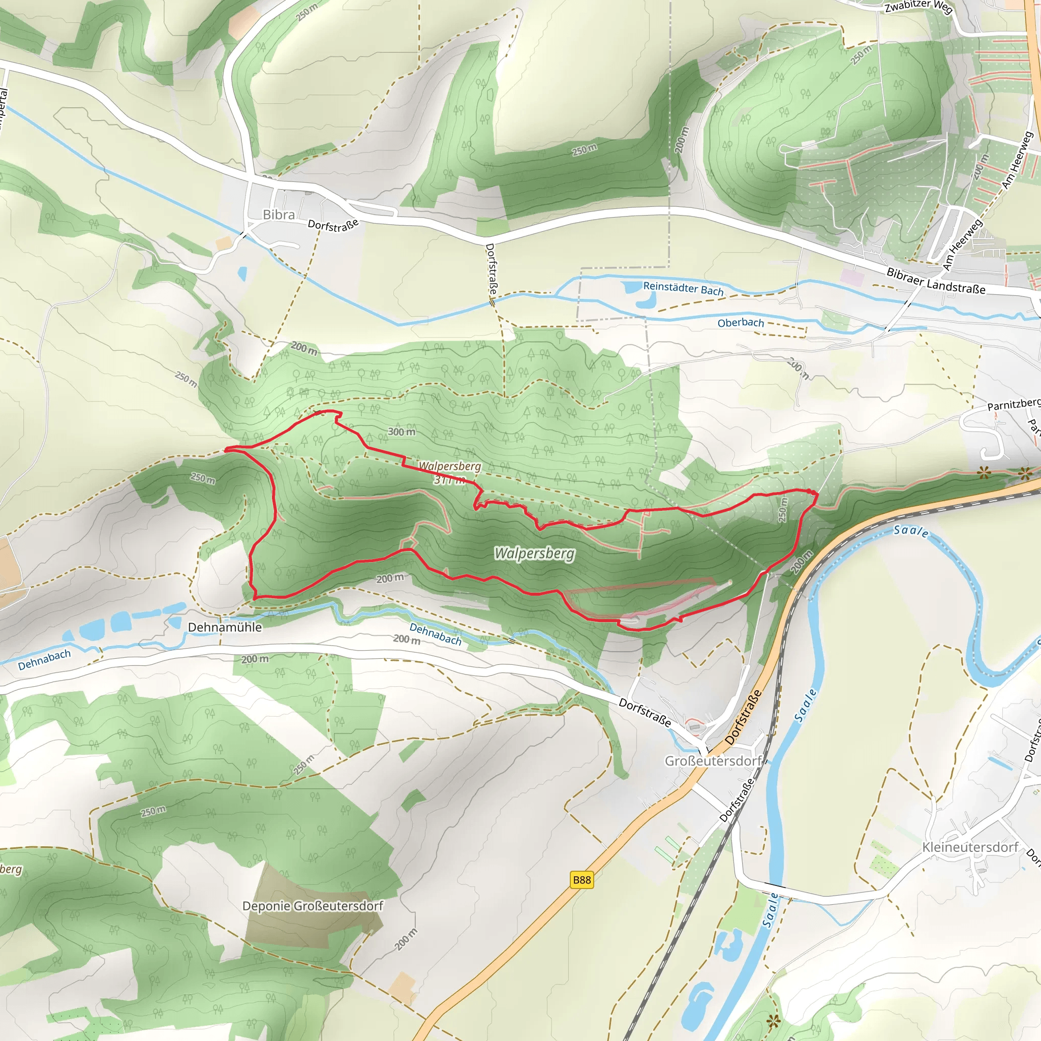
Starting your hike near Saale-Holzland-Kreis, Germany, the Walpersberg Loop is a delightful 5 km (3.1 miles) trail with an elevation gain of approximately 100 meters (328 feet). This loop trail is rated as medium difficulty, making it suitable for moderately experienced hikers.
Getting There To reach the trailhead, you can drive or use public transport. If driving, set your GPS to the nearest significant landmark, which is the town of Kahla. From Kahla, follow local signage to the trailhead. For those using public transport, take a train to Kahla station and then a local bus or taxi to the trailhead.
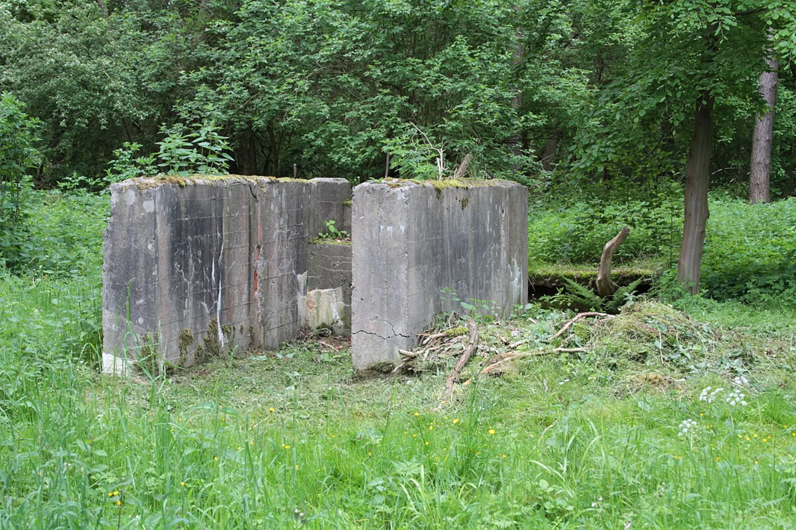
Trail Overview The trail begins with a gentle ascent through a mixed forest, offering a serene start to your hike. As you progress, the path becomes steeper, leading you to the first significant landmark, the Walpersberg hill. This hill is historically significant due to its use during World War II as a site for underground aircraft production. Remnants of these facilities can still be seen, adding a poignant historical layer to your hike.
Flora and Fauna The trail is rich in biodiversity. In the spring and summer months, you'll encounter a variety of wildflowers, including orchids and lilies. The forested sections are home to deer, foxes, and a variety of bird species, making it a great spot for wildlife observation. Keep an eye out for the European green woodpecker and the Eurasian jay, both commonly seen in this area.
Key Landmarks - **Walpersberg Hill**: Approximately 2 km (1.2 miles) into the hike, you'll reach the summit of Walpersberg. The elevation gain here is about 50 meters (164 feet). The hill offers panoramic views of the surrounding countryside, making it a perfect spot for a short break. - **Historical Sites**: As you descend from Walpersberg, you'll come across several historical markers and information boards detailing the area's significance during World War II. These are located around the 3 km (1.9 miles) mark. - **Saale River Views**: Near the 4 km (2.5 miles) point, the trail runs parallel to the Saale River, offering beautiful views and a peaceful ambiance. This section is relatively flat, providing a nice contrast to the earlier ascent.
Navigation and Safety For navigation, it's recommended to use the HiiKER app, which provides detailed maps and real-time updates. The trail is well-marked, but having a reliable navigation tool ensures you stay on track. Wear sturdy hiking boots, as some sections can be rocky and uneven. Carry enough water and snacks, especially if you plan to take breaks and enjoy the scenery.
Final Stretch The last kilometer (0.6 miles) of the trail loops back towards the starting point, descending gently through a forested area. This section is shaded and cool, providing a relaxing end to your hike. As you approach the trailhead, you'll pass through a small meadow, often filled with butterflies and bees in the warmer months.
This hike offers a blend of natural beauty, historical intrigue, and moderate physical challenge, making it a rewarding experience for those who undertake it.
What to expect?
Activity types
Comments and Reviews
User comments, reviews and discussions about the Walpersberg Loop, Germany.
4.33
average rating out of 5
3 rating(s)

