Download
Preview
Add to list
More
8.6 km
~2 hrs 35 min
520 m
Loop
“The Wanderweg 45 Samerberg trail offers a 9 km adventure through Bavarian Alps' beauty and history.”
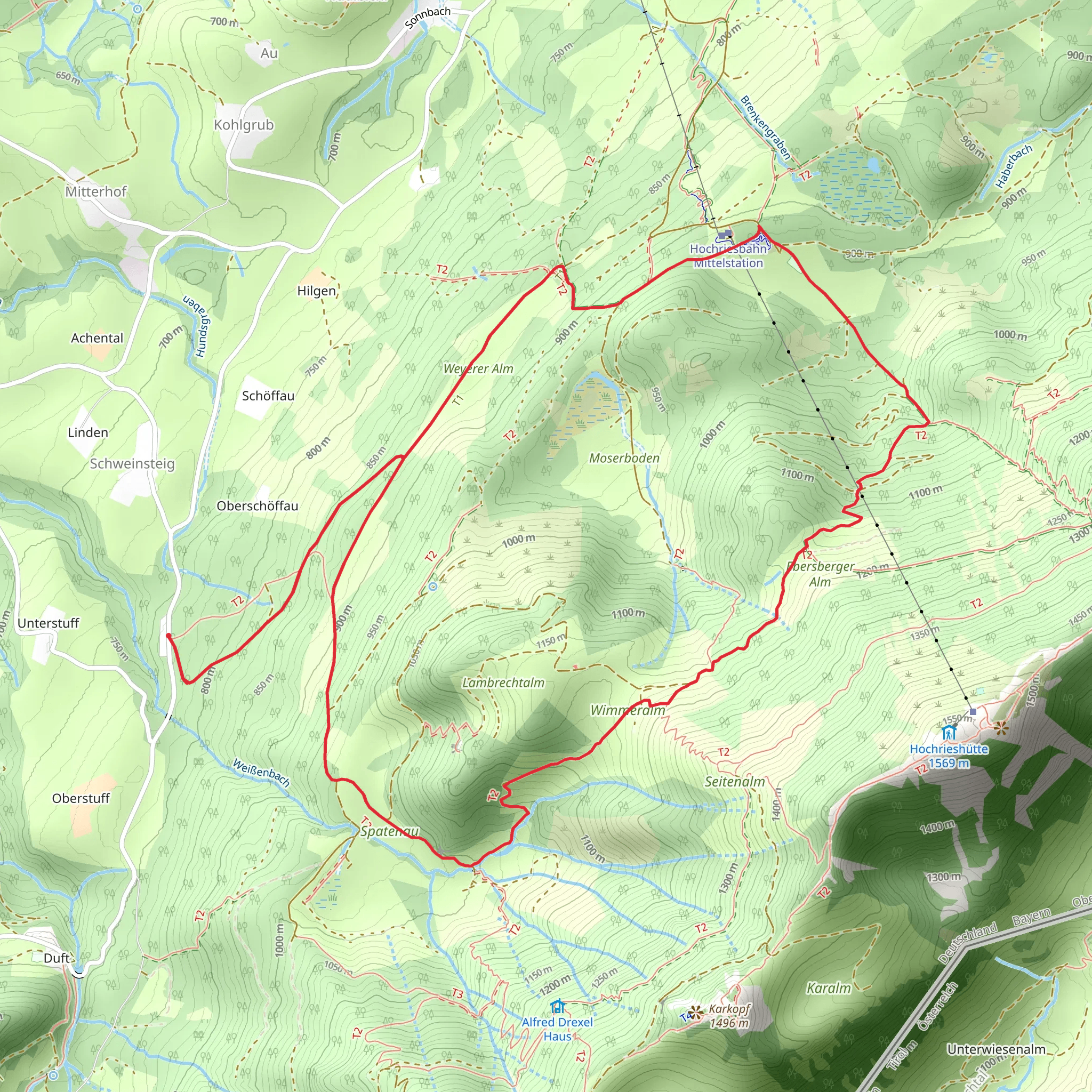
Starting near the picturesque town of Rosenheim, Germany, the Wanderweg 45 Samerberg trail offers a delightful 9 km (5.6 miles) loop with an elevation gain of approximately 500 meters (1,640 feet). This medium-difficulty trail is perfect for those looking to immerse themselves in the natural beauty and historical richness of the Bavarian Alps.
Getting There To reach the trailhead, you can either drive or use public transport. If driving, head towards the Samerberg region, which is well-signposted from Rosenheim. For those using public transport, take a train to Rosenheim and then a bus towards Samerberg. The nearest significant landmark to the trailhead is the Samerberg village center, which is easily accessible and offers parking facilities.
Trail Overview The trail begins in the charming village of Samerberg, known for its traditional Bavarian architecture and serene atmosphere. As you start your hike, you'll be greeted by lush meadows and rolling hills, typical of the region. The initial part of the trail is relatively gentle, allowing you to warm up and enjoy the surrounding scenery.
Key Landmarks and Points of Interest About 2 km (1.2 miles) into the hike, you'll come across the historic Törwang Chapel, a small yet significant religious site that dates back several centuries. This chapel is a great spot to take a short break and soak in the historical ambiance.
Continuing on, the trail gradually ascends, offering panoramic views of the Chiemgau Alps. Around the 4 km (2.5 miles) mark, you'll reach a viewpoint that provides a stunning vista of the Inn Valley and the distant peaks of the Kaisergebirge range. This is one of the highlights of the hike and a perfect place for photography enthusiasts.
Flora and Fauna The Wanderweg 45 Samerberg trail is rich in biodiversity. As you hike, you'll encounter a variety of flora, including alpine flowers, dense forests of spruce and fir, and expansive meadows. Wildlife is also abundant; keep an eye out for deer, foxes, and a variety of bird species, including the majestic golden eagle.
Elevation and Terrain The trail's elevation gain of 500 meters (1,640 feet) is spread out over the 9 km (5.6 miles), making it a manageable climb for most hikers. The terrain varies from well-maintained paths to more rugged sections, so sturdy hiking boots are recommended. The ascent is steady but not overly strenuous, making it suitable for hikers with a moderate level of fitness.
Navigation For navigation, it's advisable to use the HiiKER app, which provides detailed maps and real-time updates. The trail is well-marked, but having a reliable navigation tool can enhance your hiking experience and ensure you stay on the right path.
Historical Significance The Samerberg region has a rich history, dating back to the Roman era. The area was historically significant for its role in salt trading routes, and remnants of these ancient paths can still be seen along the trail. The name "Samerberg" itself is derived from the term "Samer," which refers to the pack animals used in salt transportation.
Final Stretch As you descend back towards Samerberg village, the trail takes you through dense forests and past bubbling brooks, offering a serene and peaceful end to your hike. The final 2 km (1.2 miles) are relatively flat, allowing you to cool down and reflect on the beautiful landscapes and historical landmarks you've encountered.
Whether you're a seasoned hiker or a nature enthusiast, the Wanderweg 45 Samerberg trail offers a perfect blend of natural beauty, historical intrigue, and moderate physical challenge.
Comments and Reviews
User comments, reviews and discussions about the Wanderweg 45 Samerberg, Germany.
4.5
average rating out of 5
4 rating(s)
