Download
Preview
Add to list
More
13.8 km
~4 hrs 15 min
898 m
Loop
“The OEL Check Trail near Rosenheim offers 14 km of breathtaking views, history, and diverse wildlife.”
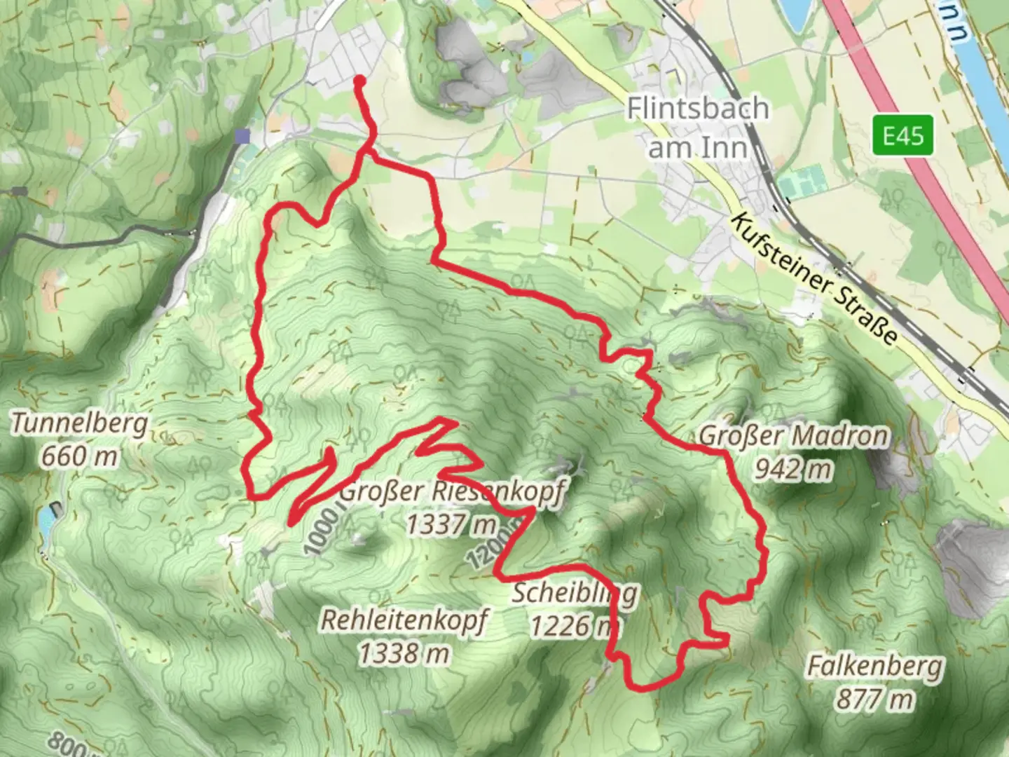
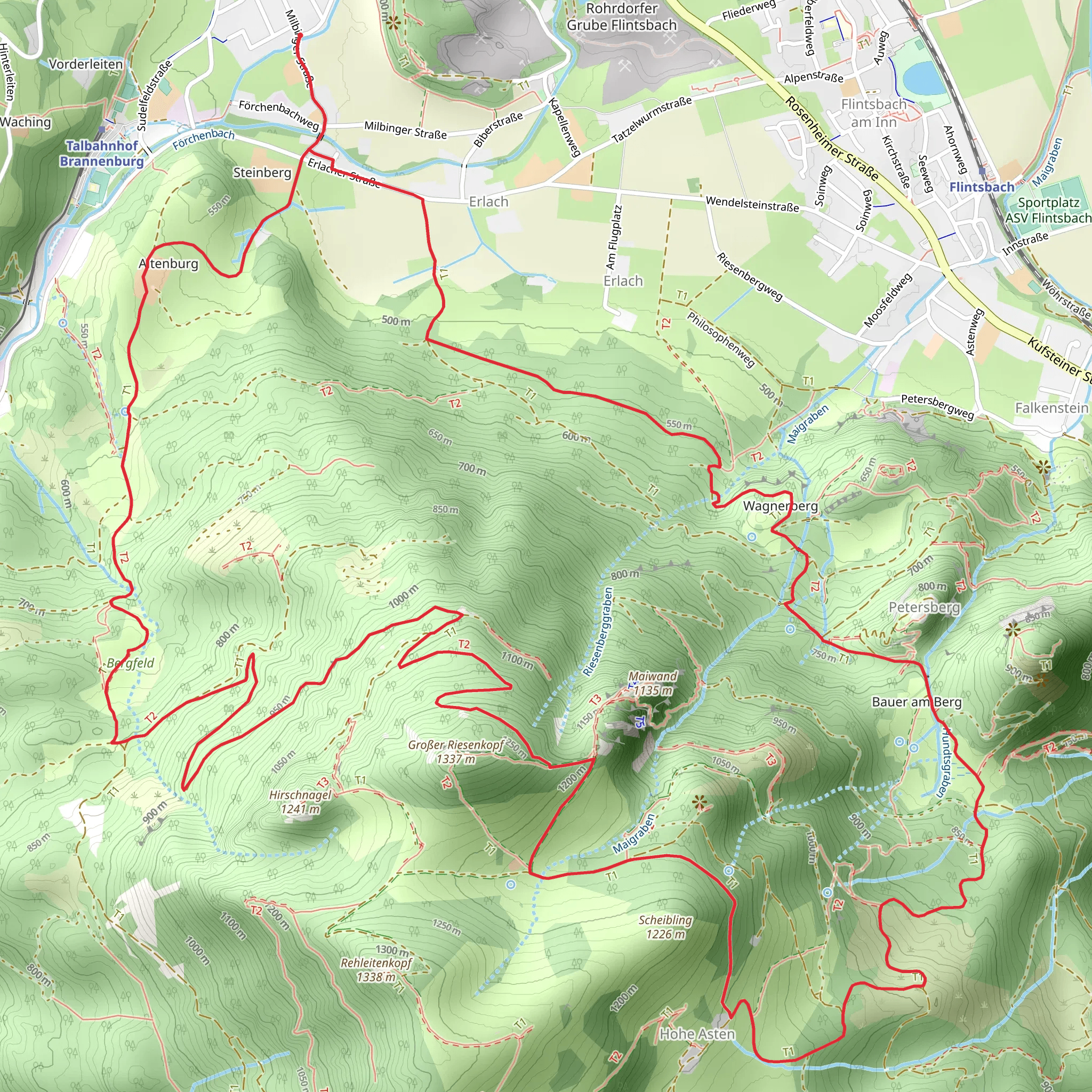
Starting near the picturesque town of Rosenheim, Germany, the OEL Check Trail and Wanderweg 10 is a captivating loop trail that spans approximately 14 km (8.7 miles) with an elevation gain of around 800 meters (2,625 feet). This medium-difficulty trail offers a blend of natural beauty, historical landmarks, and diverse wildlife, making it a rewarding experience for hikers.### Getting There To reach the trailhead, you can either drive or use public transportation. If driving, head towards Rosenheim and look for parking options near the town center. For those using public transport, take a train to Rosenheim Station. From there, local buses or a short taxi ride can get you to the trailhead.### Trail Overview The trail begins near the outskirts of Rosenheim, offering an immediate immersion into lush forests and rolling hills. As you start your ascent, the path winds through dense woodlands, where you might spot native wildlife such as deer, foxes, and a variety of bird species. The initial 3 km (1.9 miles) involve a steady climb, gaining about 300 meters (984 feet) in elevation.### Key Landmarks and Points of Interest - Rosenheimer Tor: Approximately 2 km (1.2 miles) into the hike, you’ll encounter the Rosenheimer Tor, a historical gate that dates back to medieval times. This landmark offers a glimpse into the region's rich history and provides a great spot for a brief rest. - Panoramic Viewpoint: Around the 5 km (3.1 miles) mark, the trail opens up to a stunning panoramic viewpoint. Here, you can take in sweeping views of the Bavarian Alps and the surrounding countryside. This is an ideal location for a photo opportunity and a snack break. - Alpine Meadows: As you continue, the trail meanders through vibrant alpine meadows, especially beautiful during the spring and summer months when wildflowers are in full bloom. This section is relatively flat, offering a respite from the earlier climb.### Historical Significance The region around Rosenheim has a rich history dating back to Roman times. The trail itself passes near several ancient trade routes that were once vital for commerce in the area. Keep an eye out for informational plaques along the way that provide insights into the historical significance of these paths.### Navigation and Safety Given the trail's moderate difficulty, it's advisable to use a reliable navigation tool like HiiKER to stay on track. The trail is well-marked, but having a digital map can be invaluable, especially in the more remote sections. Ensure you have adequate water, snacks, and appropriate clothing, as weather conditions can change rapidly in the mountains.### Wildlife and Flora The diverse ecosystem along the trail includes a variety of flora and fauna. In addition to the common wildlife, you might also encounter rare plant species unique to the Bavarian region. The forested areas are home to ancient oak and beech trees, providing a serene and shaded environment for much of the hike.### Final Stretch The last 3 km (1.9 miles) of the trail involve a descent back towards Rosenheim. This section can be steep in parts, so take your time and watch your footing. As you approach the town, the trail transitions back into more populated areas, eventually leading you back to the starting point.This loop trail offers a perfect blend of natural beauty, historical intrigue, and moderate physical challenge, making it a must-do for any hiking enthusiast visiting the Rosenheim area.
Comments and Reviews
User comments, reviews and discussions about the OEL Check Trail and Wanderweg 10, Germany.
4.6
average rating out of 5
5 rating(s)
