Download
Preview
Add to list
More
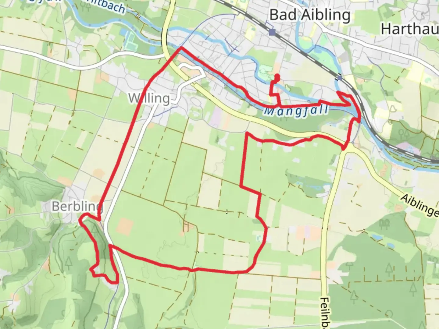
13.6 km
~2 hrs 50 min
79 m
Loop
“Discover Bavarian beauty along a serene, accessible trail rich in nature, history, and charm.”
Nestled near the charming town of Rosenheim, Germany, the Mangfall via Schwer and Bad Aibling trail offers a delightful 14 km (approximately 8.7 miles) loop with virtually no elevation gain, making it an accessible and enjoyable hike for all skill levels. This easy trail is perfect for those looking to immerse themselves in the serene beauty of the Bavarian countryside without the challenge of steep climbs.### Getting ThereTo reach the trailhead, you can conveniently travel by car or public transport. If driving, head towards Rosenheim and look for parking options near the starting point. For those using public transport, take a train to Rosenheim station, which is well-connected to major cities like Munich. From there, local buses or a short taxi ride can bring you to the trailhead.### Trail HighlightsAs you embark on this loop, you'll be greeted by the tranquil flow of the Mangfall River, which accompanies you for much of the journey. The river's gentle presence provides a soothing backdrop as you traverse through lush meadows and dense woodlands. Keep an eye out for the diverse flora and fauna that thrive in this region, including various bird species and small mammals.### Historical SignificanceThe area around Rosenheim and Bad Aibling is steeped in history. Bad Aibling, in particular, is known for its therapeutic spas, which have been a draw for visitors since the 19th century. As you hike, you may come across remnants of historical structures or signage that offer insights into the region's past, including its role as a spa town and its significance during different historical periods.### Navigation and LandmarksThe trail is well-marked, but it's always wise to have a reliable navigation tool like HiiKER to ensure you stay on course. Along the way, you'll encounter several notable landmarks, including the picturesque village of Bad Aibling, where you can take a short detour to explore its charming streets and perhaps enjoy a local delicacy at one of the cafes.### Nature and WildlifeThe Mangfall River is a vital ecosystem supporting a variety of wildlife. As you walk, listen for the melodic calls of birds and watch for deer grazing in the meadows. The trail's flat terrain makes it easy to pause and appreciate the natural beauty around you, from the vibrant wildflowers in spring to the golden hues of autumn leaves.This trail offers a perfect blend of natural beauty, historical intrigue, and easy accessibility, making it an ideal choice for a leisurely day hike in the Bavarian countryside.

Comments and Reviews
User comments, reviews and discussions about the Mangfall via Schwer and Bad Aibling, Germany.
average rating out of 5
0 rating(s)