Download
Preview
Add to list
More
12.4 km
~4 hrs 4 min
952 m
Point-to-Point
“Brünnstein via Wanderweg 658 offers seasoned hikers breathtaking vistas and a challenging alpine adventure.”
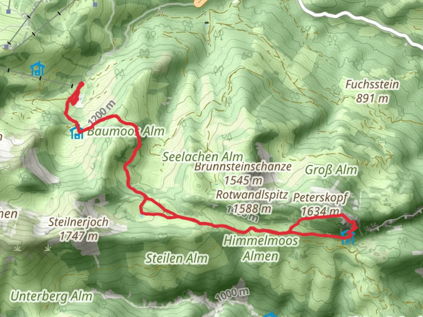
Nestled in the Bavarian Alps, the Brünnstein via Wanderweg 658 offers a challenging yet rewarding adventure for seasoned hikers. This point-to-point trail stretches approximately 12 kilometers (about 7.5 miles) with an elevation gain of around 900 meters (approximately 2,950 feet), making it an extra difficult trek that demands preparation and respect for the mountain environment.
Getting There
The trailhead is conveniently located near Rosenheim, Germany. For those traveling by car, you can reach the starting point by heading towards the small village of Oberaudorf, which is well-signposted from the A93 motorway. Parking is available near the trailhead, but it can fill up quickly, especially during peak hiking seasons. If you prefer public transport, take a train to Oberaudorf station. From there, local buses or a short taxi ride will bring you to the trail's starting point.
Trail Overview
The journey begins with a steady ascent through dense forests, where the air is filled with the scent of pine and the sounds of chirping birds. As you climb, the trail becomes steeper and more rugged, demanding careful footing and a good level of fitness. The path is well-marked, but it's advisable to use HiiKER for navigation to ensure you stay on track, especially in areas where the trail may become less distinct.
Significant Landmarks
About halfway through the hike, you'll encounter the Brünnsteinhaus, a charming mountain hut offering a perfect spot for a rest. Here, you can enjoy traditional Bavarian refreshments and take in the stunning panoramic views of the surrounding peaks. The hut is a popular stop for hikers, so expect a lively atmosphere, especially on weekends.
Continuing onward, the trail leads you to the summit of Brünnstein. The final ascent is steep and rocky, requiring some scrambling over boulders. At the top, you're rewarded with breathtaking vistas of the Inn Valley and the distant peaks of the Austrian Alps. This is a perfect place to pause and soak in the natural beauty that surrounds you.
Nature and Wildlife
The Brünnstein area is rich in biodiversity. As you hike, keep an eye out for local wildlife, including chamois and marmots, which are often seen in the higher elevations. The flora is equally impressive, with alpine flowers dotting the landscape in vibrant colors during the warmer months.
Historical Significance
The region around Brünnstein is steeped in history. The trail itself has been used for centuries by locals and travelers alike. The nearby town of Oberaudorf has historical roots dating back to the Roman era, and remnants of ancient trade routes can still be found in the area. This historical backdrop adds an intriguing layer to your hiking experience, as you walk paths that have been traversed for generations.
Final Descent
The descent from Brünnstein is equally challenging, with steep sections that require careful navigation. As you make your way down, the trail offers different perspectives of the landscape, with views that are just as captivating as those on the ascent. The path eventually leads you back into the forest, where the trailhead awaits, marking the end of this exhilarating journey.
Hiking the Brünnstein via Wanderweg 658 is a demanding endeavor, but for those who are well-prepared, it promises an unforgettable experience filled with natural beauty, historical intrigue, and the satisfaction of conquering one of Bavaria's most challenging trails.

What to expect?
Activity types
Comments and Reviews
User comments, reviews and discussions about the Brünnstein via Wanderweg 658, Germany.
average rating out of 5
0 rating(s)