11.5 km
~2 hrs 36 min
185 m
“Explore the Hexen Route, a captivating 11 km trail rich in natural beauty and historical intrigue.”
Starting your hike near the Rheinisch-Bergischer Kreis in Germany, the Hexen Route is a captivating 11 km (approximately 6.8 miles) loop trail with an elevation gain of around 100 meters (328 feet). This trail is rated as medium difficulty, making it suitable for moderately experienced hikers.### Getting There
To reach the trailhead, you can either drive or use public transport. If driving, set your GPS to the nearest known address, which is the town of Odenthal. There is ample parking available near the trailhead. For those using public transport, take a train to Bergisch Gladbach and then a bus to Odenthal. From there, it's a short walk to the starting point of the trail.### Trail Navigation
For navigation, it is highly recommended to use the HiiKER app, which provides detailed maps and real-time updates to ensure you stay on track.### Trail Highlights
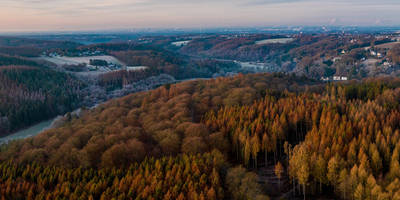
The Hexen Route is rich in both natural beauty and historical significance. As you begin your hike, you'll traverse through dense forests and open meadows, offering a diverse range of flora and fauna. Keep an eye out for native wildlife such as deer, foxes, and a variety of bird species.#### Historical Significance
One of the most intriguing aspects of this trail is its historical background. The name "Hexen Route" translates to "Witches' Route," a nod to the area's folklore and history. During the 17th century, this region was notorious for witch trials, and several landmarks along the trail are linked to these dark times. Approximately 3 km (1.86 miles) into the hike, you'll come across the Hexenplatz, a clearing that was historically believed to be a meeting place for witches.### Key Landmarks
- Hexenplatz: Located about 3 km (1.86 miles) from the start, this clearing is steeped in local legend and offers a unique glimpse into the region's past.
- Burg Berge: Around the 7 km (4.35 miles) mark, you'll encounter the ruins of Burg Berge, a medieval castle that offers panoramic views of the surrounding countryside.
- Witches' Stone: Near the end of the trail, around the 10 km (6.2 miles) point, you'll find a large stone inscribed with symbols and markings. Local lore suggests this stone was used in ancient rituals.### Flora and Fauna
The trail is a haven for nature enthusiasts. The forested sections are dominated by oak, beech, and pine trees, providing a lush canopy overhead. In the spring and summer months, the meadows burst into color with wildflowers such as daisies, poppies, and buttercups. Birdwatchers will be delighted by the presence of species like the European robin, blackbird, and great tit.### Elevation and Terrain
The Hexen Route features a moderate elevation gain of around 100 meters (328 feet), spread out over the course of the hike. The terrain is varied, with some sections featuring well-maintained gravel paths, while others are more rugged and require careful footing. There are a few steep inclines, particularly near the Burg Berge ruins, but these are manageable for most hikers.### Preparation Tips
Given the medium difficulty rating, it's advisable to wear sturdy hiking boots and bring trekking poles if you have them. Pack enough water and snacks, as there are no facilities along the trail. Weather can be unpredictable, so check the forecast and dress in layers.By following these guidelines and using the HiiKER app for navigation, you'll be well-prepared to enjoy the Hexen Route and all its natural and historical wonders.
Reviews
User comments, reviews and discussions about the Hexen Route, Germany.
5.0
average rating out of 5
2 rating(s)
Loading reviews...


