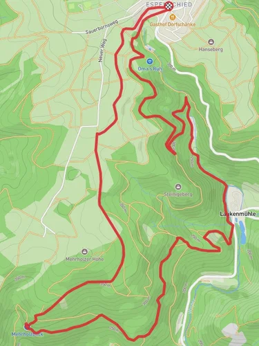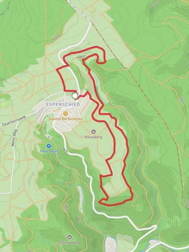
10.5 km
~2 hrs 33 min
271 m
“Experience the captivating Ranseler Hoehenrausch trail's natural beauty, historic landmarks, and diverse wildlife on an 11 km loop.”
Starting near Rheingau-Taunus-Kreis, Germany, the Ranseler Hoehenrausch trail is a captivating 11 km (approximately 6.8 miles) loop with an elevation gain of around 200 meters (656 feet). This medium-difficulty trail offers a blend of natural beauty, historical landmarks, and diverse wildlife, making it a rewarding experience for hikers.
### Getting There To reach the trailhead, you can drive or use public transport. If driving, set your GPS to Rheingau-Taunus-Kreis, and look for parking near the trailhead. For public transport, take a train to the nearest major station, such as Wiesbaden Hauptbahnhof, and then use local buses or taxis to reach the starting point.
### Trail Navigation Using HiiKER for navigation is highly recommended. The app provides detailed maps and real-time updates, ensuring you stay on track throughout your hike.
### Trail Highlights
#### Nature and Wildlife The trail meanders through dense forests, open meadows, and along scenic ridges. Keep an eye out for local wildlife, including deer, foxes, and a variety of bird species. The flora is equally diverse, with oak, beech, and pine trees dominating the landscape. During spring and summer, the meadows burst into a riot of colors with wildflowers.
#### Historical Significance The region is steeped in history, and you'll encounter several landmarks that tell the story of its past. One notable site is the ruins of an old watchtower, approximately 4 km (2.5 miles) into the hike. This tower dates back to the medieval period and offers a glimpse into the area's strategic importance.
### Key Sections of the Trail
#### Initial Ascent The first 2 km (1.2 miles) involve a gradual ascent through a forested area. The elevation gain here is about 100 meters (328 feet), making it a good warm-up for the rest of the hike. The path is well-marked and relatively wide, allowing for easy navigation.
#### Ridge Walk Around the 5 km (3.1 miles) mark, you'll reach a ridge that offers panoramic views of the surrounding countryside. This section is relatively flat and provides a great opportunity to catch your breath and take in the scenery. The elevation gain here is minimal, making it a pleasant stretch.
#### Descent and Return The final 4 km (2.5 miles) involve a gentle descent back to the starting point. This section takes you through open meadows and past a small stream, adding variety to the landscape. The descent is gradual, with an elevation loss of about 100 meters (328 feet), making it a comfortable end to the hike.
### Practical Tips - Footwear: Sturdy hiking boots are recommended due to the varied terrain. - Weather: Check the weather forecast before you go, as conditions can change rapidly. - Supplies: Bring enough water and snacks, as there are no facilities along the trail. - Wildlife: Be respectful of the local wildlife and maintain a safe distance.
### Accessibility The trail is accessible year-round, but the best times to hike are during spring and autumn when the weather is mild, and the scenery is at its most vibrant. Winter hikes are possible but may require additional gear due to snow and ice.
By following these guidelines and using HiiKER for navigation, you'll be well-prepared to enjoy the Ranseler Hoehenrausch trail to its fullest.
Reviews
User comments, reviews and discussions about the Ranseler Hoehenrausch, Germany.
0.0
average rating out of 5
0 rating(s)


