8.5 km
~1 hrs 58 min
167 m
“Explore the Wendmuehle Rundweg for a scenic, historical adventure through forests, brooks, and panoramic views.”
Starting near the picturesque Rhein-Sieg-Kreis in Germany, this 9 km (approximately 5.6 miles) loop trail offers a delightful mix of natural beauty and historical intrigue. With an elevation gain of around 100 meters (328 feet), the Wendmuehle Rundweg is rated as a medium difficulty hike, making it accessible for most hikers with a moderate level of fitness.
### Getting There To reach the trailhead, you can either drive or use public transport. If you're driving, set your GPS to the nearest known address, which is close to the town of Eitorf. For those relying on public transport, take a train to Eitorf station. From there, you can catch a local bus or taxi to the trailhead, which is just a short distance away.
### Trail Navigation For navigation, it's highly recommended to use the HiiKER app, which provides detailed maps and real-time updates. This will help you stay on track and make the most of your hiking experience.
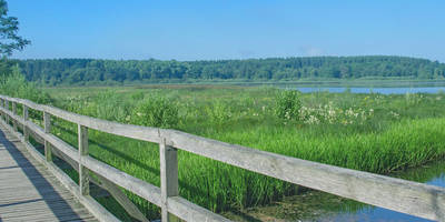
### Trail Highlights As you embark on the Wendmuehle Rundweg, you'll first encounter a serene forested area. The trail meanders through dense woodlands, offering a canopy of trees that provide ample shade, making it a pleasant hike even on warmer days. About 2 km (1.2 miles) into the hike, you'll come across a charming brook, which is a perfect spot for a short break and some nature photography.
### Historical Significance One of the most intriguing aspects of this trail is its historical significance. Around the 4 km (2.5 miles) mark, you'll find the remnants of an old mill, known locally as the Wendmuehle. This mill dates back several centuries and was once a vital part of the local economy. Information plaques provide insights into the mill's history and its role in the community, making it a fascinating stop for history buffs.
### Flora and Fauna The trail is rich in biodiversity. Keep an eye out for various species of birds, including woodpeckers and songbirds, which are commonly spotted in this area. The forest floor is often carpeted with wildflowers, especially in the spring and early summer months. Deer and foxes are also known to inhabit the area, so tread quietly if you wish to catch a glimpse of these elusive creatures.
### Scenic Views As you continue, the trail gradually ascends, offering panoramic views of the surrounding countryside. Around the 6 km (3.7 miles) point, you'll reach a small clearing that provides a perfect vantage point for some breathtaking landscape photography. The elevation gain here is gentle but steady, making it a manageable climb for most hikers.
### Final Stretch The last 3 km (1.9 miles) of the trail take you through open meadows and past small farms, giving you a taste of rural life in this part of Germany. The trail loops back to the starting point, completing a rewarding and varied hiking experience.
### Practical Tips - Wear sturdy hiking boots, as some sections of the trail can be uneven. - Carry enough water and snacks, especially if you plan to take your time exploring the historical sites and natural beauty. - Check the weather forecast before you go, as the trail can become slippery in wet conditions. - Use the HiiKER app for real-time navigation and updates.
This trail offers a perfect blend of natural beauty, historical intrigue, and moderate physical challenge, making it a must-visit for any hiking enthusiast.
Reviews
User comments, reviews and discussions about the Wendmuehle Rundweg, Germany.
4.0
average rating out of 5
3 rating(s)


