Download
Preview
Add to list
More
9.8 km
~2 hrs 47 min
496 m
Point-to-Point
“The 10 km Herchen to Eutscheid Walk via River Sieg combines scenic beauty, historical intrigue, and moderate challenge.”
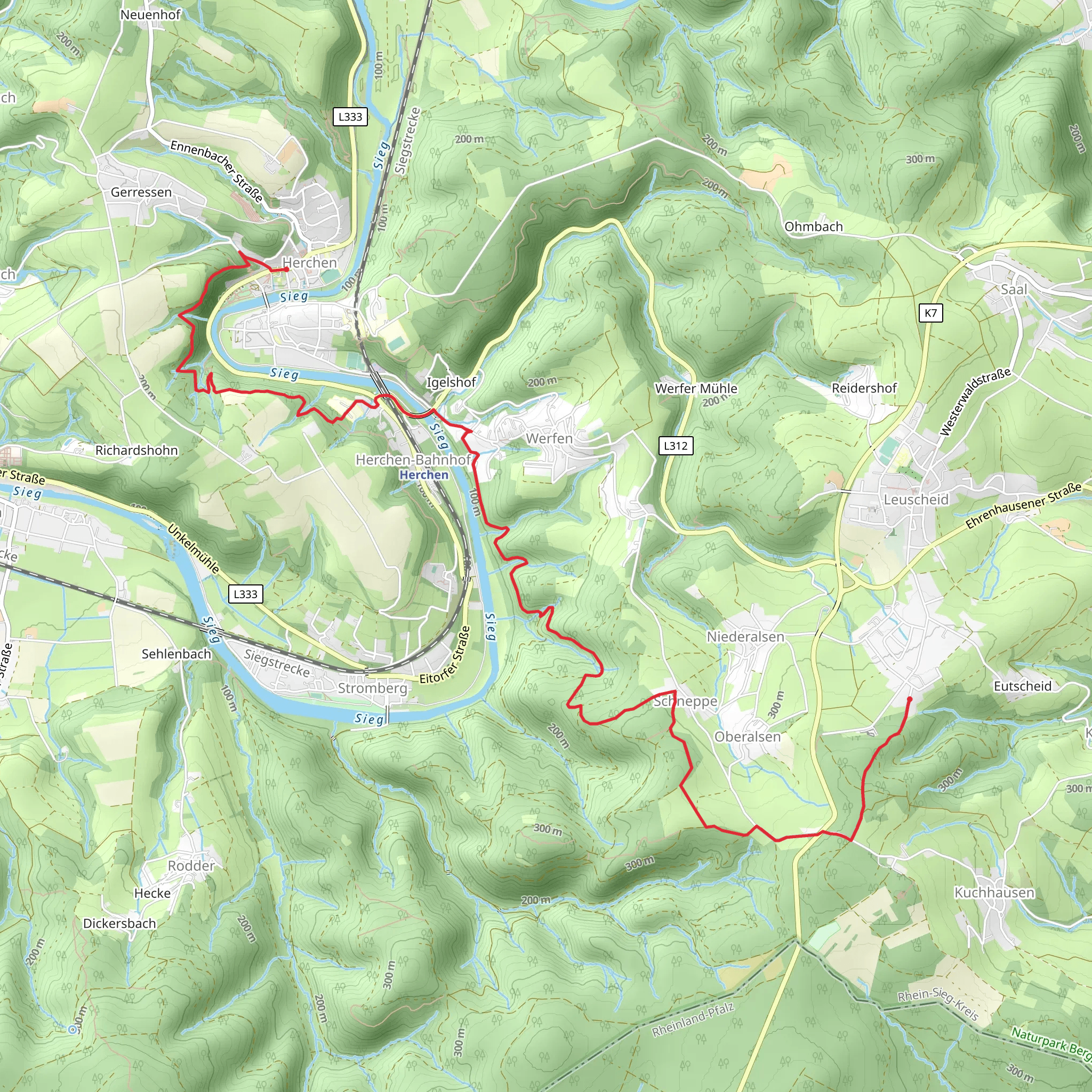
Starting near Rhein-Sieg-Kreis, Germany, the Herchen to Eutscheid Walk via River Sieg is a picturesque point-to-point trail that spans approximately 10 km (6.2 miles) with an elevation gain of around 400 meters (1,312 feet). This trail is rated as medium difficulty, making it suitable for hikers with some experience.
Getting There To reach the trailhead, you can either drive or use public transport. If driving, set your GPS to Herchen, a small village in the Rhein-Sieg-Kreis district. For those using public transport, take a train to Herchen station, which is well-connected via the regional rail network. From the station, the trailhead is just a short walk away.
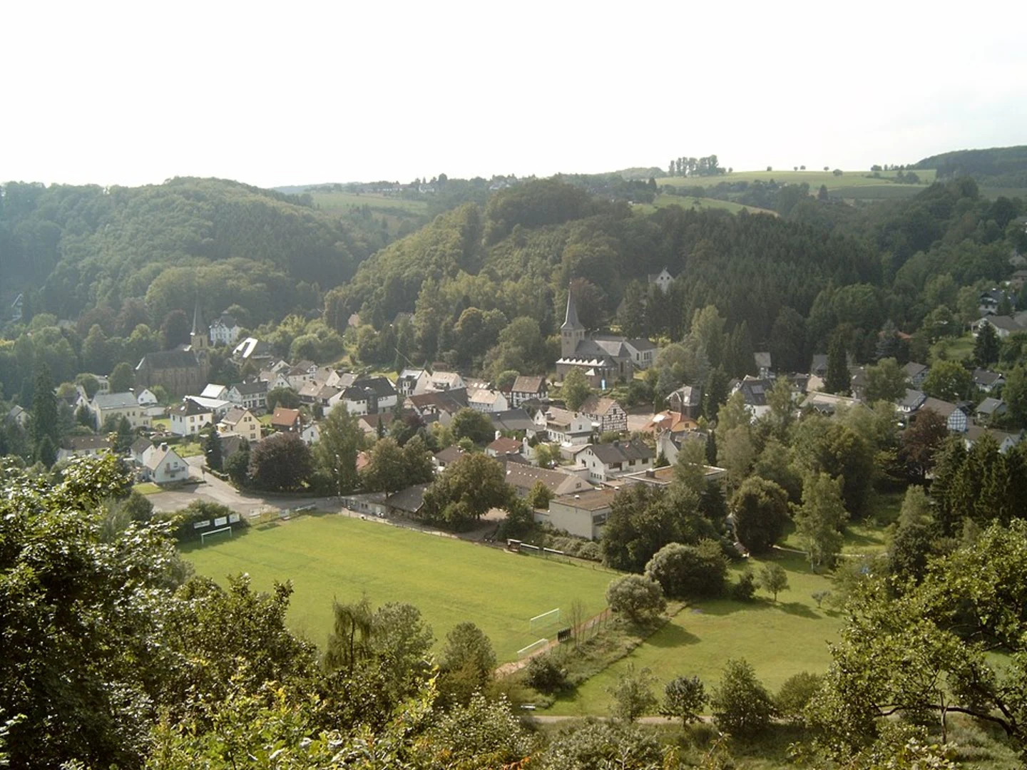
Trail Overview The trail begins in Herchen, a charming village known for its half-timbered houses and serene atmosphere. As you set off, you'll follow the River Sieg, a tributary of the Rhine, which provides a tranquil backdrop for the initial part of your hike. The first 2 km (1.2 miles) are relatively flat, allowing you to ease into the journey while enjoying the riverside scenery.
Elevation and Terrain After the initial flat section, the trail begins to ascend gradually. Around the 3 km (1.9 miles) mark, you'll encounter a more significant incline, gaining approximately 200 meters (656 feet) in elevation over the next 2 km (1.2 miles). The terrain here is a mix of forest paths and open meadows, offering a variety of landscapes to enjoy.
Landmarks and Points of Interest One of the highlights of this trail is the panoramic view from the top of the hill around the 5 km (3.1 miles) point. Here, you'll find a small clearing that provides a perfect spot for a rest and some photos. The view encompasses the lush Sieg Valley and the distant hills, making it a rewarding midpoint.
Continuing on, you'll pass through several small hamlets and farms, where you might catch a glimpse of local wildlife such as deer, foxes, and various bird species. The trail also takes you through sections of dense forest, where the canopy provides a cool respite on warmer days.
Historical Significance The region around the River Sieg has a rich history dating back to Roman times. As you hike, you'll notice remnants of old stone walls and possibly even ancient boundary markers. These historical artifacts add an extra layer of intrigue to your journey, reminding you of the many generations that have traversed these paths before you.
Final Stretch to Eutscheid The last 3 km (1.9 miles) of the trail involve a gentle descent into the village of Eutscheid. This section is less strenuous, allowing you to enjoy the final leg of your hike at a leisurely pace. Eutscheid is a quaint village with a few local eateries where you can relax and refuel after your hike.
Navigation For navigation, it's highly recommended to use the HiiKER app, which provides detailed maps and real-time updates to ensure you stay on track. The trail is well-marked, but having a reliable navigation tool can enhance your hiking experience and provide peace of mind.
Whether you're drawn by the natural beauty, the historical significance, or the challenge of the elevation gain, the Herchen to Eutscheid Walk via River Sieg offers a fulfilling hiking experience that captures the essence of the German countryside.
What to expect?
Activity types
Comments and Reviews
User comments, reviews and discussions about the Herchen to Eutscheid Walk via River Sieg, Germany.
5.0
average rating out of 5
1 rating(s)

