Download
Preview
Add to list
More
12.4 km
~3 hrs 32 min
639 m
Point-to-Point
“A picturesque 12 km hike from Kestert to St Goarshausen, blending natural beauty, history, and moderate challenge.”
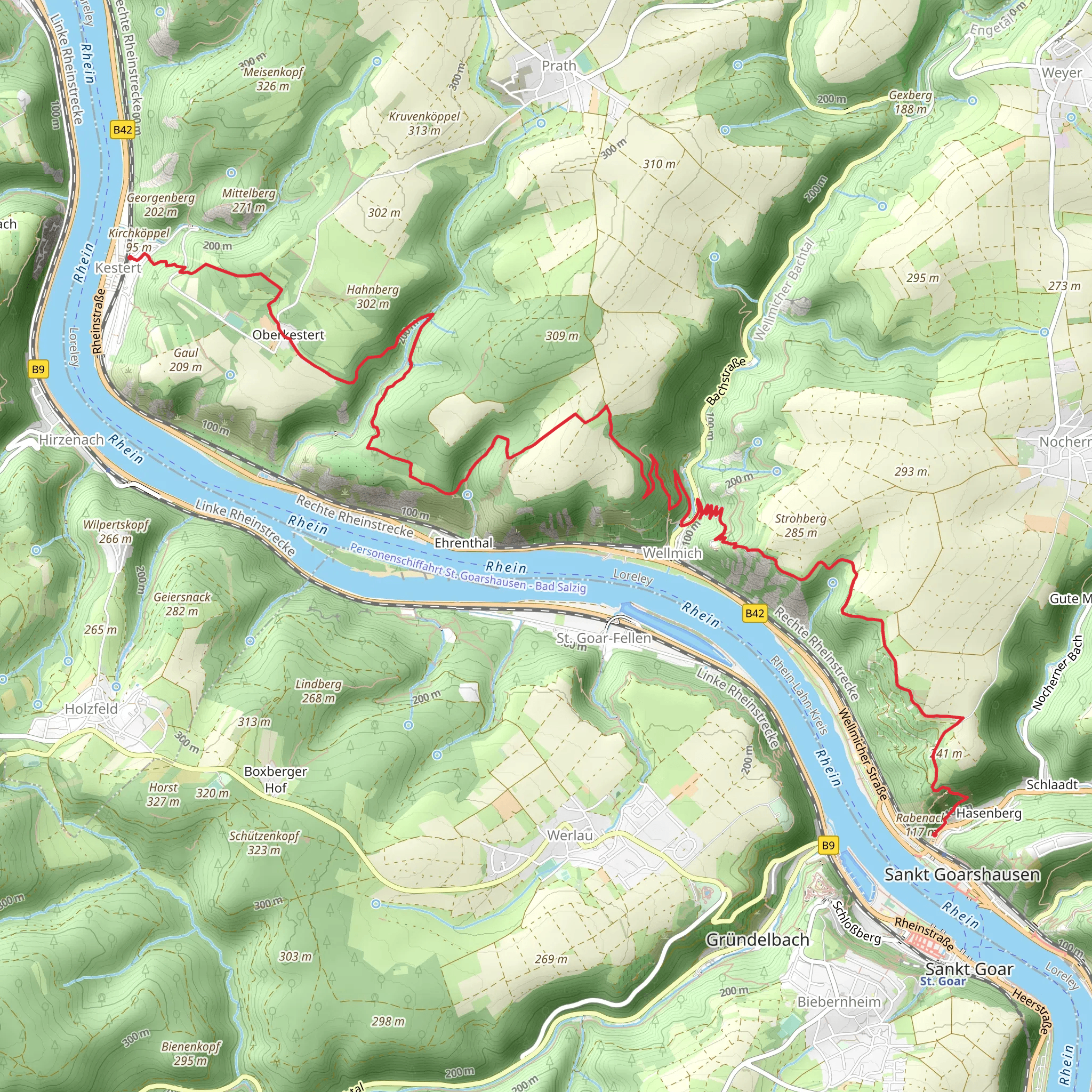
Starting near the picturesque town of Kestert in the Rhein-Lahn-Kreis region of Germany, this 12 km (7.5 miles) point-to-point hike offers a delightful blend of natural beauty, historical landmarks, and moderate physical challenge. The trail begins at the Kestert train station, making it easily accessible by public transport. If you're driving, parking is available near the station.
Initial Ascent and Views
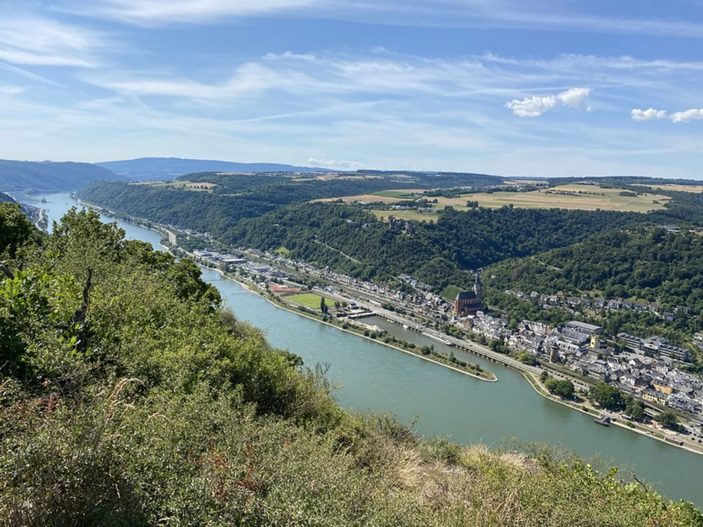
The hike kicks off with a steady ascent, gaining approximately 600 meters (1,970 feet) in elevation. As you climb, you'll be treated to panoramic views of the Rhine River and the surrounding valley. The initial 3 km (1.9 miles) are the most strenuous, so pace yourself and take breaks to enjoy the scenery.
Historical Significance
This region is steeped in history, and you'll encounter several landmarks that tell the story of the Rhine's strategic importance over the centuries. About 4 km (2.5 miles) into the hike, you'll come across the ruins of Burg Maus, a medieval castle built in the 14th century. The castle offers a glimpse into the past and provides a fantastic photo opportunity.
Flora and Fauna
As you continue, the trail meanders through dense forests and open meadows, offering a diverse range of flora and fauna. Keep an eye out for deer, wild boar, and a variety of bird species. The forested sections are particularly beautiful in the autumn when the leaves turn vibrant shades of red and gold.
Midway Point and Rest Areas
Around the halfway mark, approximately 6 km (3.7 miles) in, you'll find a well-maintained rest area with benches and picnic tables. This is a great spot to take a break, have a snack, and soak in the natural beauty around you. The elevation gain levels out here, making the second half of the hike less demanding.
Navigational Tips
For navigation, the trail is well-marked with the distinctive Rheinsteig logo, but it's always a good idea to have a reliable navigation tool like HiiKER to ensure you stay on track. The app provides real-time updates and detailed maps, which can be particularly useful in the more remote sections of the trail.
Final Stretch and Descent
The final 3 km (1.9 miles) involve a gradual descent towards St Goarshausen. As you approach the town, you'll be rewarded with stunning views of the Lorelei Rock, a legendary slate rock that rises 132 meters (433 feet) above the Rhine. The descent is gentle but can be slippery after rain, so watch your footing.
Arrival in St Goarshausen
The trail concludes near the St Goarshausen train station, making it convenient for those looking to return to Kestert or continue their journey along the Rhine. St Goarshausen itself is a charming town worth exploring, with several cafes and restaurants where you can relax and reflect on your hike.
This trail offers a perfect blend of physical challenge, natural beauty, and historical intrigue, making it a must-do for any hiking enthusiast visiting the Rhine region.
What to expect?
Activity types
Comments and Reviews
User comments, reviews and discussions about the Kestert to St Goarshausen Walk via Rheinsteig Zuweg Kestert, Germany.
4.25
average rating out of 5
4 rating(s)

