Burgberg, Langauer Weiher and Muhlbach Loop via In Der Salzau
Download
Preview
Add to list
More
7.4 km
~1 hrs 59 min
314 m
Loop
“A captivating 7 km loop trail with scenic views, historical landmarks, and diverse wildlife in Rhein-Lahn-Kreis.”
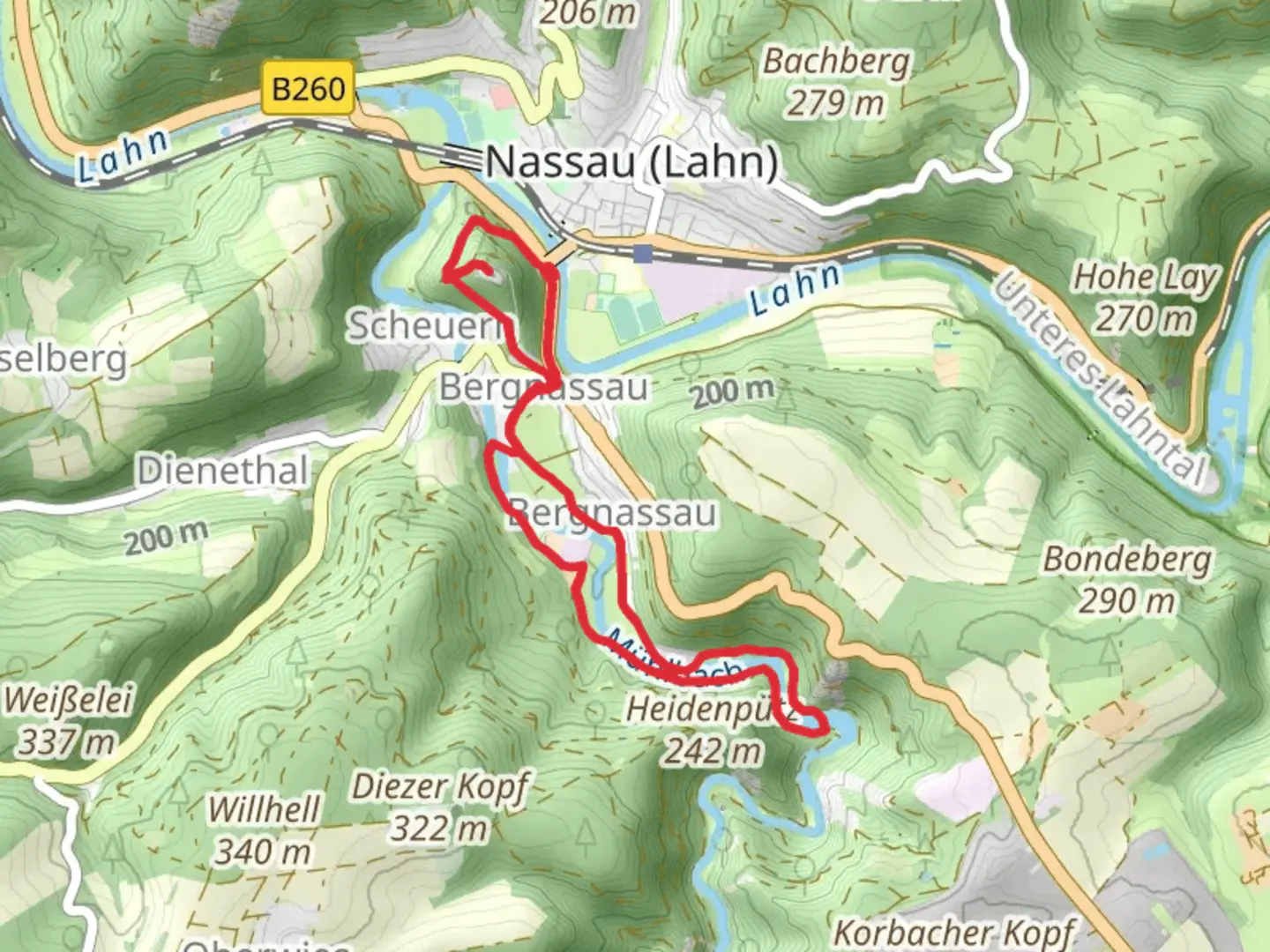
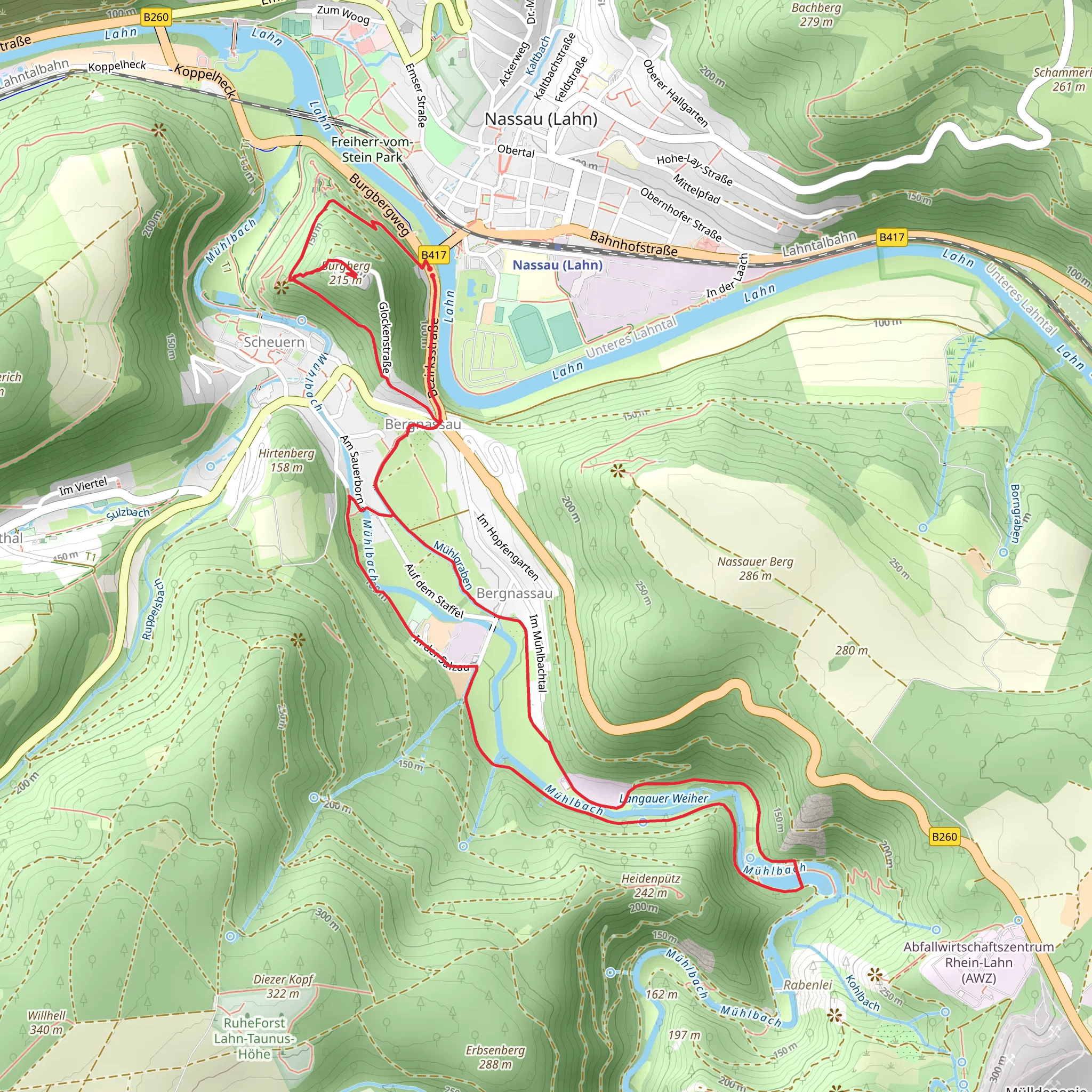
Starting near Rhein-Lahn-Kreis, Germany, the Burgberg, Langauer Weiher, and Muhlbach Loop via In Der Salzau is a captivating 7 km (4.35 miles) loop trail with an elevation gain of approximately 300 meters (984 feet). This medium-difficulty trail offers a blend of natural beauty, historical landmarks, and diverse wildlife, making it a rewarding experience for hikers.### Getting ThereTo reach the trailhead, you can either drive or use public transportation. If driving, set your GPS to Rhein-Lahn-Kreis, Germany, and look for parking near the start of the trail. For those using public transport, the nearest significant landmark is the town of Bad Ems. From Bad Ems, you can take a local bus or taxi to the trailhead.### Trail OverviewThe trail begins with a gentle ascent through a dense forest, offering a serene atmosphere filled with the sounds of chirping birds and rustling leaves. As you progress, the path becomes steeper, leading you to the first significant landmark, Burgberg. This ancient hill offers panoramic views of the surrounding landscape, making it an ideal spot for a short break and some photography.### Langauer WeiherApproximately 3 km (1.86 miles) into the hike, you will reach Langauer Weiher, a picturesque pond surrounded by lush greenery. This area is perfect for a peaceful rest, where you can enjoy the tranquil waters and perhaps spot some local wildlife, such as ducks and frogs. The pond is also a great place for a picnic, so consider packing some snacks.### Muhlbach and Historical SignificanceContinuing on, the trail leads you to Muhlbach, a small stream that has historical significance. The stream was once used to power mills in the region, and remnants of these old mills can still be seen along the path. This part of the trail is relatively flat, making it a pleasant walk as you explore the historical artifacts and enjoy the soothing sounds of flowing water.### Navigation and SafetyThe trail is well-marked, but it's always a good idea to have a reliable navigation tool. HiiKER is an excellent app for this purpose, providing detailed maps and real-time updates. Make sure to wear sturdy hiking boots, as some sections can be rocky and uneven. Carry enough water and snacks, especially if you plan to take extended breaks at Langauer Weiher or Burgberg.### Flora and FaunaThe trail is rich in biodiversity. Keep an eye out for various species of birds, including woodpeckers and finches. The forested areas are home to deer and foxes, while the ponds and streams attract amphibians and insects. The flora is equally diverse, with a mix of deciduous and coniferous trees, wildflowers, and ferns.### Final StretchThe final stretch of the trail loops back towards the starting point, offering a gentle descent through the forest. This section is less strenuous, allowing you to relax and reflect on the journey. As you near the end, you'll pass through open meadows, providing one last opportunity to enjoy the scenic beauty of the region.This trail offers a perfect blend of natural beauty, historical intrigue, and moderate physical challenge, making it a must-visit for any hiking enthusiast.
What to expect?
Activity types
Comments and Reviews
User comments, reviews and discussions about the Burgberg, Langauer Weiher and Muhlbach Loop via In Der Salzau, Germany.
average rating out of 5
0 rating(s)
