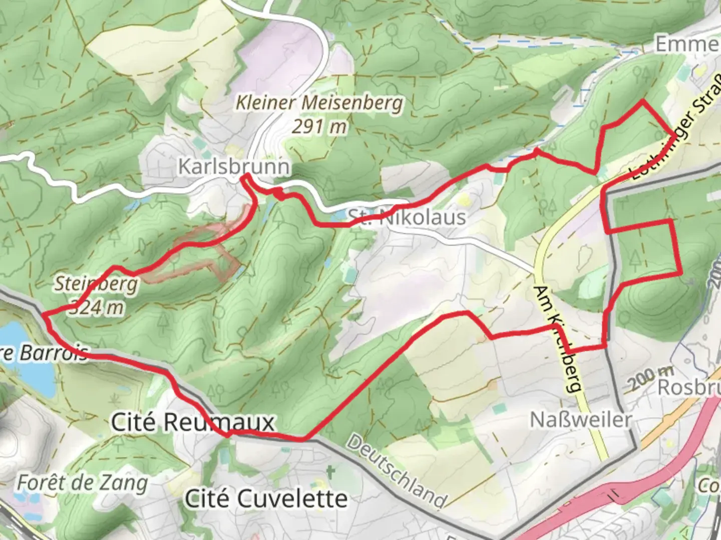
St Nikolaus Weiher via Warndt Wald Weg and Circuit de la Rosselle
Download
Preview
Add to list
More
13.5 km
~3 hrs 13 min
308 m
Loop
“Explore lush forests, historical sites, and panoramic views on this 14 km loop hike near Saarbrücken.”
Starting near the Regionalverband Saarbrücken in Germany, this 14 km (approximately 8.7 miles) loop trail offers a moderate challenge with an elevation gain of around 300 meters (approximately 984 feet). The trailhead is easily accessible by car, with parking available nearby. For those using public transport, the nearest significant landmark is the Saarbrücken Hauptbahnhof (main train station), from where you can take a local bus to the trailhead area.
Initial Ascent and Forest Pathways
The trail begins with a gentle ascent through the Warndt Wald, a dense forest known for its rich biodiversity. As you start your hike, you'll notice the lush greenery and the sound of birds chirping, creating a serene atmosphere. The initial 3 km (1.86 miles) will take you through well-marked forest pathways, gradually increasing in elevation. Keep an eye out for the diverse flora, including oak, beech, and pine trees.
St Nikolaus Weiher
Around the 4 km (2.5 miles) mark, you'll reach the St Nikolaus Weiher, a picturesque pond that serves as a perfect spot for a short break. The pond is surrounded by benches and offers a tranquil setting to enjoy a snack or simply take in the natural beauty. This area is also a habitat for various waterfowl, so birdwatchers should bring their binoculars.
Historical Significance
As you continue, the trail intersects with the Circuit de la Rosselle, a path that holds historical significance. This region was once a bustling area during the coal mining era, and remnants of this industrial past can still be seen. Informational plaques along the way provide insights into the history of coal mining in the Saarland region, making this a culturally enriching experience.
Midpoint and Elevation Gain
The midpoint of the trail, around 7 km (4.35 miles), is where you'll encounter the most significant elevation gain. The path becomes steeper, and the terrain more rugged. This section requires a bit more effort, but the panoramic views from the top are well worth it. You'll be able to see the sprawling forest below and, on clear days, even catch a glimpse of the Saar River.
Wildlife and Natural Beauty
Descending from the high point, the trail meanders through a variety of landscapes, including open meadows and dense woodlands. This area is home to a variety of wildlife, including deer, foxes, and a plethora of bird species. Keep your camera handy, as you might spot some of these creatures along the way.
Final Stretch and Return
The final 3 km (1.86 miles) of the trail loop back towards the starting point, offering a relatively easy descent. The path here is well-maintained and marked, making navigation straightforward. For those using HiiKER, the app provides detailed maps and real-time updates to ensure you stay on track.
Practical Information
Before setting out, make sure to check the weather forecast and wear appropriate clothing and footwear. The trail can be muddy in sections, especially after rain. Carry enough water and snacks, as there are limited facilities along the route. The best time to hike this trail is during the spring and autumn months when the weather is mild, and the foliage is at its most vibrant.
This trail offers a blend of natural beauty, historical significance, and moderate physical challenge, making it a rewarding experience for hikers of all levels.

What to expect?
Activity types
Comments and Reviews
User comments, reviews and discussions about the St Nikolaus Weiher via Warndt Wald Weg and Circuit de la Rosselle, Germany.
4.5
average rating out of 5
4 rating(s)