Download
Preview
Add to list
More
11.5 km
~2 hrs 43 min
256 m
Loop
“Experience a scenic hike through Saarland's lush forests, historical sites, and vibrant wildlife.”
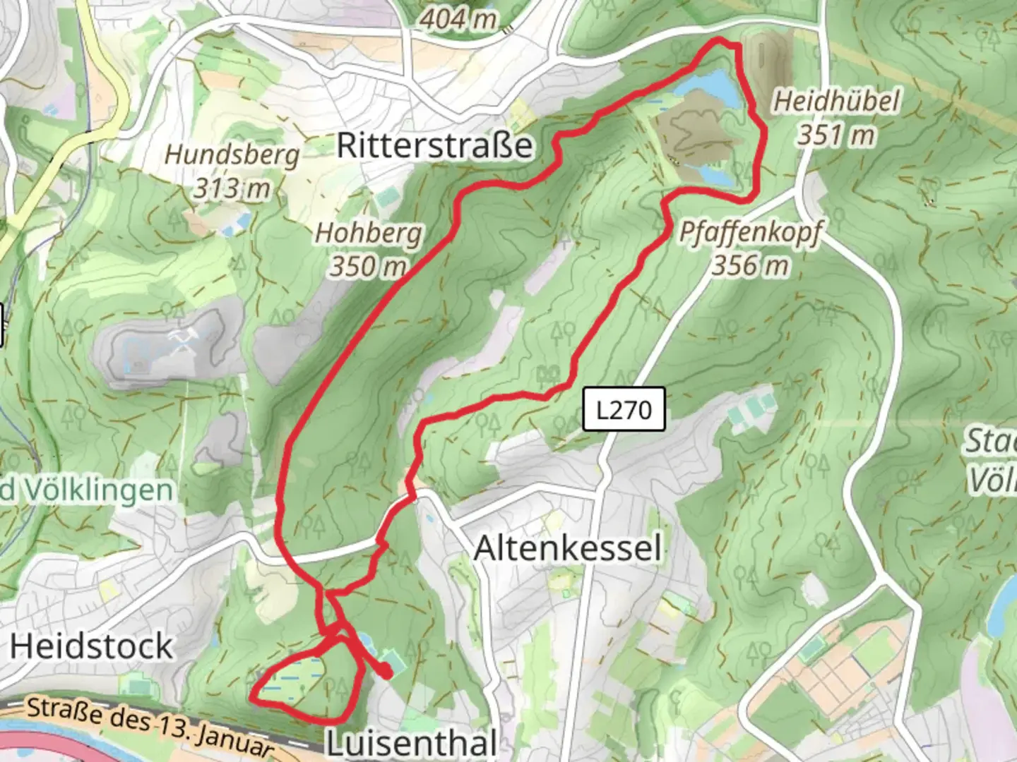
Nestled in the picturesque region of Saarland, Germany, the Haldenrundweg Suedschleife offers a delightful 12 km (approximately 7.5 miles) loop trail with an elevation gain of around 200 meters (about 656 feet). This medium-difficulty hike begins near the Regionalverband Saarbrücken, a vibrant area known for its rich history and natural beauty.
Getting There
To reach the trailhead, you can drive to the Regionalverband Saarbrücken, where ample parking is available. For those preferring public transport, Saarbrücken is well-connected by train and bus services. From the Saarbrücken Hauptbahnhof (main train station), local buses can take you closer to the trailhead. Check the latest schedules and routes to ensure a smooth journey.
Trail Highlights
The Haldenrundweg Suedschleife is renowned for its diverse landscapes, combining lush forests, open meadows, and panoramic views. As you embark on this loop, you'll traverse through dense woodlands that provide a serene atmosphere, especially during the early morning or late afternoon when the light filters beautifully through the trees.
#### Historical Significance
This region is steeped in history, with remnants of its industrial past visible along the trail. The Saarland area was once a hub for coal mining, and the trail passes by several historical sites that offer a glimpse into this bygone era. Look out for the old mining structures and information boards that detail the area's significance in Germany's industrial development.
#### Nature and Wildlife
The trail is a haven for nature enthusiasts. As you hike, keep an eye out for the diverse flora and fauna that call this area home. The forests are rich with native tree species, and during spring and summer, the meadows burst into color with wildflowers. Birdwatchers will delight in spotting various species, from common songbirds to the occasional raptor soaring overhead.
Navigation and Safety
While the trail is well-marked, it's advisable to use HiiKER for navigation to ensure you stay on track and make the most of your hiking experience. The app provides detailed maps and real-time updates, which can be particularly useful if you decide to explore any of the smaller paths branching off the main loop.
Points of Interest
Around the halfway mark, you'll encounter a scenic viewpoint offering sweeping vistas of the surrounding landscape. This is an ideal spot to take a break, enjoy a packed lunch, and soak in the beauty of the Saarland region. Additionally, several benches and picnic areas are scattered along the trail, providing perfect rest stops.
As you near the end of the loop, the trail gently descends back towards the starting point, offering a leisurely finish to your hike. Whether you're a seasoned hiker or a casual walker, the Haldenrundweg Suedschleife promises a rewarding journey through one of Germany's most charming regions.

Comments and Reviews
User comments, reviews and discussions about the Haldenrundweg Suedschleife, Germany.
average rating out of 5
0 rating(s)