Download
Preview
Add to list
More
12.2 km
~3 hrs 12 min
462 m
Loop
“Explore Bavarian Forest's natural beauty and history with the 12 km Unterbreutenau-Geißkopf-Teufelstich Loop.”
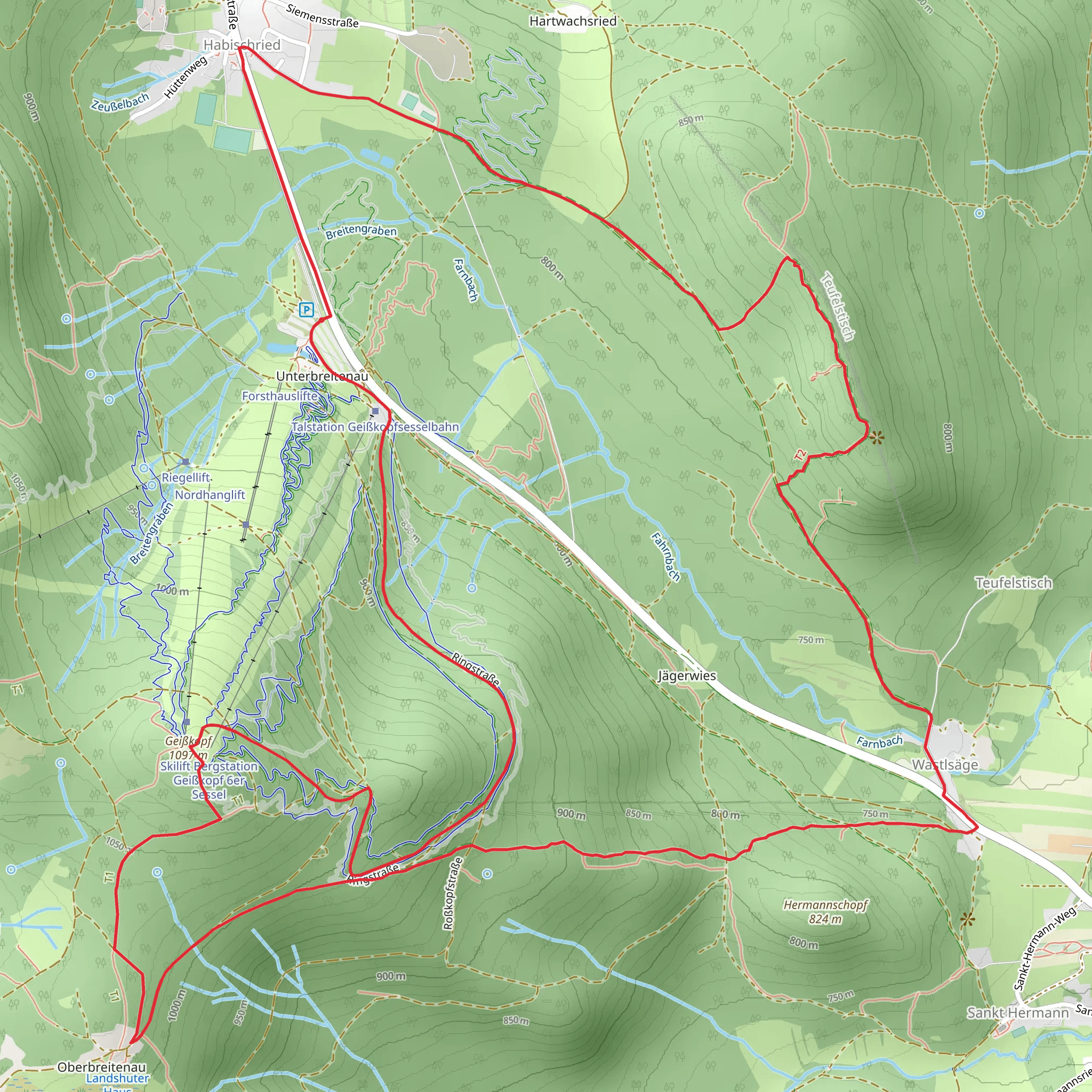
Starting near the charming town of Regen in Germany, the Unterbreutenau, Geißkopf and Teufelstich Loop via Ringstraße offers a delightful 12 km (7.5 miles) journey with an elevation gain of approximately 400 meters (1,312 feet). This medium-difficulty loop trail is perfect for those looking to immerse themselves in the natural beauty and historical richness of the Bavarian Forest.### Getting There To reach the trailhead, you can either drive or use public transport. If driving, head towards Regen and look for parking near the Ringstraße. For those using public transport, take a train to Regen station. From there, local buses or a short taxi ride will get you to the starting point.### Trail Overview The trail begins near the Ringstraße, a well-known road in the area. As you set off, you'll be greeted by dense forests and the serene sounds of nature. The first section of the trail is relatively gentle, allowing you to ease into the hike.### Unterbreutenau Approximately 3 km (1.9 miles) into the hike, you'll reach Unterbreutenau. This area is known for its lush meadows and picturesque landscapes. It's a great spot to take a short break and enjoy the surroundings. The elevation gain here is gradual, making it a pleasant walk.### Geißkopf Continuing on, you'll head towards Geißkopf, which is about 6 km (3.7 miles) from the start. This section of the trail involves a more noticeable ascent, with an elevation gain of around 200 meters (656 feet). Geißkopf is a popular spot for both hikers and mountain bikers, offering stunning panoramic views of the Bavarian Forest. There is also a small hut where you can rest and perhaps grab a snack.### Teufelstich The next landmark is Teufelstich, located approximately 9 km (5.6 miles) into the hike. The trail here becomes a bit steeper, with an additional elevation gain of about 100 meters (328 feet). Teufelstich, which translates to "Devil's Stitch," is a fascinating area with unique rock formations and a rich history. Local legends speak of mysterious occurrences, adding an element of intrigue to your hike.### Flora and Fauna Throughout the hike, you'll encounter a diverse range of flora and fauna. The Bavarian Forest is home to various species of birds, deer, and even the elusive lynx. The forest floor is often carpeted with wildflowers in the spring and summer, while autumn brings a stunning display of fall foliage.### Historical Significance The region around Regen has a deep historical significance. The Bavarian Forest has been inhabited for centuries, and you'll find remnants of old settlements and historical markers along the trail. The area was also a significant route for trade and travel in medieval times, adding a layer of historical depth to your hike.### Navigation For navigation, it's highly recommended to use HiiKER. The app provides detailed maps and real-time updates, ensuring you stay on the right path and can fully enjoy your hike without worrying about getting lost.### Final Stretch As you make your way back towards the starting point near Ringstraße, the trail descends gently, allowing you to relax and reflect on the journey. The final 3 km (1.9 miles) are relatively easy, making for a pleasant end to a rewarding hike.This loop trail offers a perfect blend of natural beauty, moderate physical challenge, and historical intrigue, making it a must-visit for any hiking enthusiast exploring the Bavarian Forest.
What to expect?
Activity types
Comments and Reviews
User comments, reviews and discussions about the Unterbreutenau, Geißkopf and Teufelstich Loop via Ringstraße, Germany.
average rating out of 5
0 rating(s)

