Download
Preview
Add to list
More
12.5 km
~3 hrs 24 min
549 m
Point-to-Point
“"Experience a 12 km journey through Schwarzwald's beauty and history, from Rastatt to serene reservoirs."”
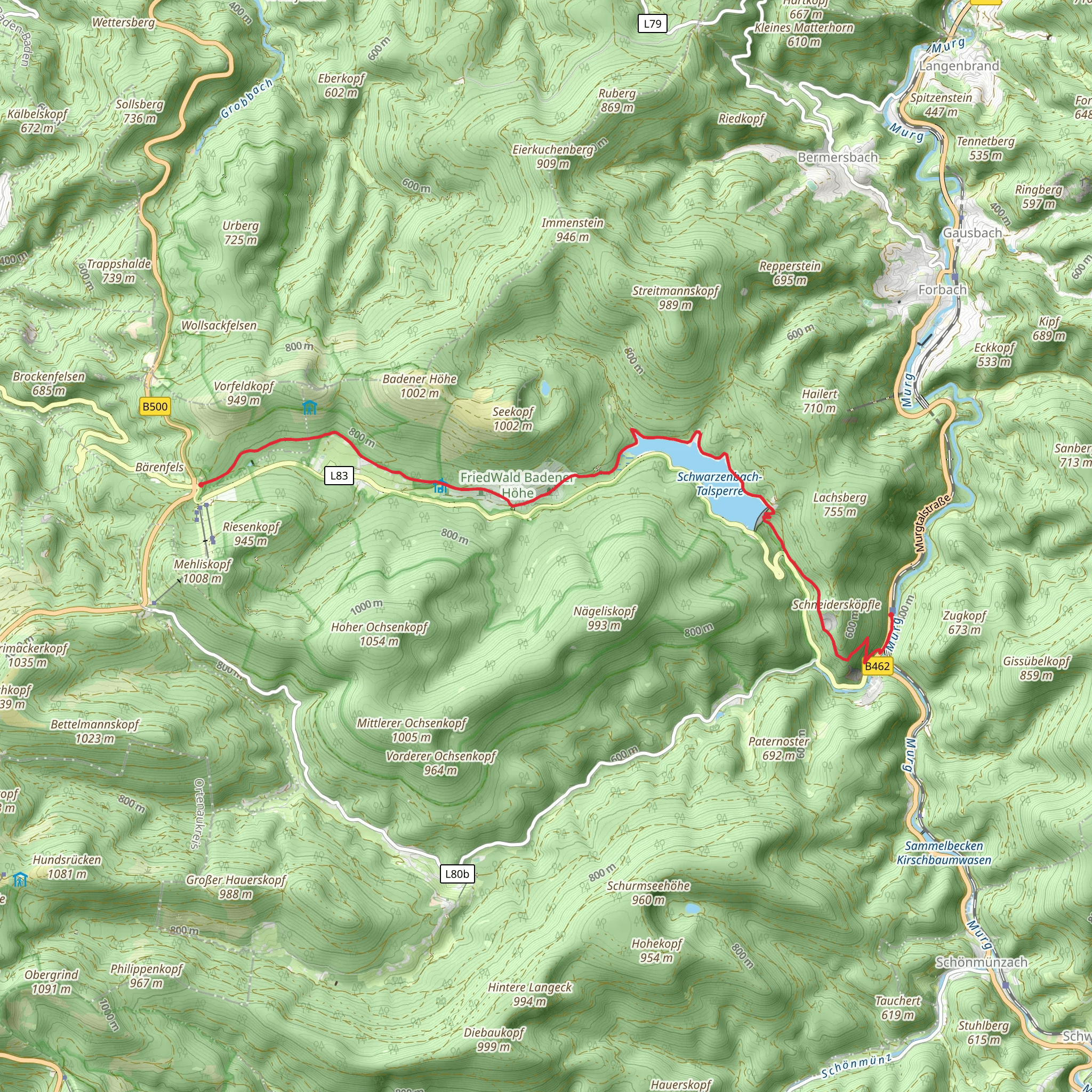
Starting near the town of Rastatt in Germany, this 12 km (7.5 miles) point-to-point trail offers a delightful mix of natural beauty and historical intrigue. The trailhead is conveniently accessible by car or public transport. If you're driving, you can park near the Rastatt train station, which is also a good starting point if you're arriving by train. From there, local buses can take you closer to the trailhead.
Initial Ascent and Forested Pathways
The trail begins with a moderate ascent, gaining approximately 500 meters (1,640 feet) in elevation. The initial climb can be a bit challenging, but it quickly rewards you with stunning views of the surrounding Schwarzwald (Black Forest) region. The path winds through dense forests, where you'll be enveloped by towering pines and the occasional oak. Keep an eye out for local wildlife; deer and various bird species are commonly spotted here.
Schwarzenbach Reservoir
About 5 km (3.1 miles) into the hike, you'll reach the Schwarzenbach Reservoir. This is a great spot to take a break and enjoy the serene waters. The reservoir is not just a pretty sight; it also has historical significance. Constructed in the early 20th century, it was part of a larger hydroelectric project aimed at harnessing the power of the Murg River. The dam and its surroundings offer a picturesque setting for photography enthusiasts.
Talsperre and Surrounding Area
Continuing on, the trail leads you towards the Talsperre, another significant reservoir in the region. This part of the hike is relatively flat, allowing you to catch your breath and enjoy the scenery. The Talsperre area is rich in flora, with wildflowers dotting the landscape during the spring and summer months. The reservoir itself is a popular spot for fishing and picnicking, so you might encounter locals enjoying a leisurely day out.
Navigation and Safety
Given the moderate difficulty of the trail, it's advisable to use a reliable navigation tool like HiiKER to keep track of your progress and ensure you stay on the right path. The trail is well-marked, but having a digital map can be incredibly useful, especially if you decide to explore any of the smaller, less-traveled paths that branch off the main route.
Final Stretch and Arrival
As you approach the final stretch of the hike, the trail descends gradually, leading you through more forested areas and open meadows. The descent offers a different perspective of the landscape, with panoramic views that are particularly breathtaking during sunset. The trail concludes near the Sand area, where you can find local amenities like cafes and small shops to relax and refresh.
This trail offers a balanced mix of natural beauty, moderate physical challenge, and historical significance, making it a rewarding experience for hikers of all levels.
Comments and Reviews
User comments, reviews and discussions about the Raumuenzach-Sand via Schwarzenbach - Talsperre, Germany.
4.4
average rating out of 5
5 rating(s)

