Download
Preview
Add to list
More
11.0 km
~3 hrs 23 min
718 m
Loop
“Explore the Kleines Matterhorn via Hardtkopfrundweg, a 11 km loop with stunning views and rich history.”
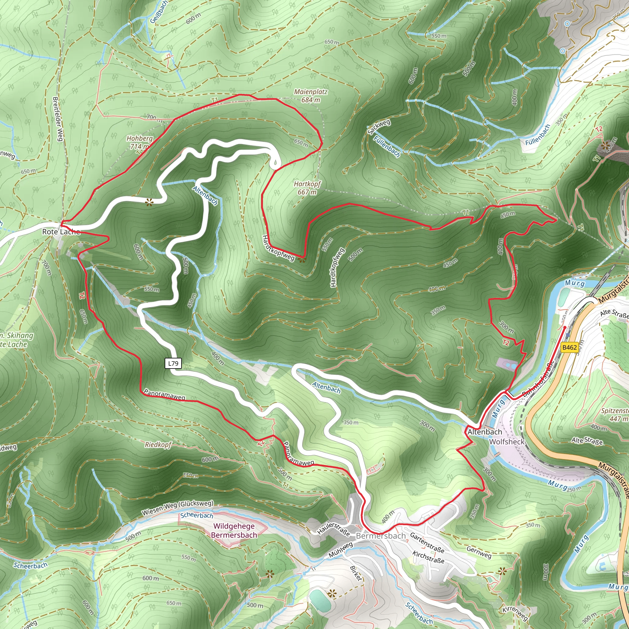
Starting near Rastatt, Germany, the Kleines Matterhorn via Hardtkopfrundweg is a captivating loop trail that spans approximately 11 km (6.8 miles) with an elevation gain of around 700 meters (2,297 feet). This medium-difficulty trail offers a blend of natural beauty, historical landmarks, and diverse wildlife, making it a rewarding experience for hikers.
Getting There To reach the trailhead, you can either drive or use public transport. If driving, head towards Rastatt and look for parking near the Hardtkopf area. For those using public transport, take a train to Rastatt station and then a local bus towards Hardtkopf. The nearest significant landmark to the trailhead is the Rastatt Castle, a baroque masterpiece worth visiting before or after your hike.
Trail Overview The trail begins with a gentle ascent through dense forests, offering a serene start to your journey. As you progress, the path becomes steeper, leading you to the first significant landmark, the Hardtkopf Tower. This tower provides panoramic views of the surrounding Black Forest region, making it an excellent spot for a short break and some photography.
Flora and Fauna The trail is rich in biodiversity. You'll encounter a variety of flora, including oak, beech, and pine trees. In spring and summer, the forest floor is adorned with wildflowers like bluebells and anemones. Wildlife enthusiasts might spot deer, foxes, and a variety of bird species, including woodpeckers and owls.
Historical Significance The region around Rastatt has a rich history. During your hike, you'll come across remnants of old fortifications and bunkers from World War II. These historical sites offer a glimpse into the past and add an educational aspect to your hike.
Navigation and Safety The trail is well-marked, but it's always a good idea to have a reliable navigation tool. HiiKER is highly recommended for this purpose, providing detailed maps and real-time updates. The trail can be slippery after rain, so sturdy hiking boots with good grip are essential. Carry enough water and snacks, as there are no facilities along the trail.
Key Landmarks - **Hardtkopf Tower**: Approximately 3 km (1.86 miles) into the hike, with an elevation gain of about 200 meters (656 feet). - **Kleines Matterhorn**: The highest point of the trail, offering stunning views of the Black Forest and beyond. This peak is reached around the 6 km (3.73 miles) mark, with an elevation gain of 500 meters (1,640 feet) from the start. - **Historical Bunkers**: Scattered along the trail, these bunkers are located around the 8 km (4.97 miles) mark.
Final Stretch The descent from Kleines Matterhorn is gradual, taking you through more forested areas and eventually looping back to the starting point near Hardtkopf. This section of the trail is less strenuous, allowing you to enjoy the natural surroundings and reflect on the hike.
This trail offers a perfect blend of natural beauty, historical intrigue, and physical challenge, making it a must-visit for any hiking enthusiast.
Comments and Reviews
User comments, reviews and discussions about the Kleines Matterhorn via Hardtkopfrundweg, Germany.
5.0
average rating out of 5
3 rating(s)

