Download
Preview
Add to list
More
12.7 km
~3 hrs 52 min
810 m
Loop
“Explore the enchanting 13 km Grundplatz Hohlenstein and Murgtal Wanderweg for natural beauty and historical landmarks.”
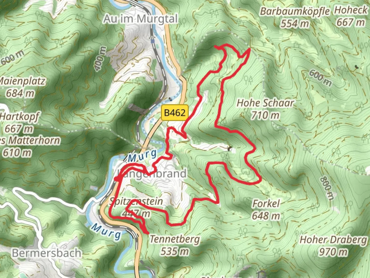
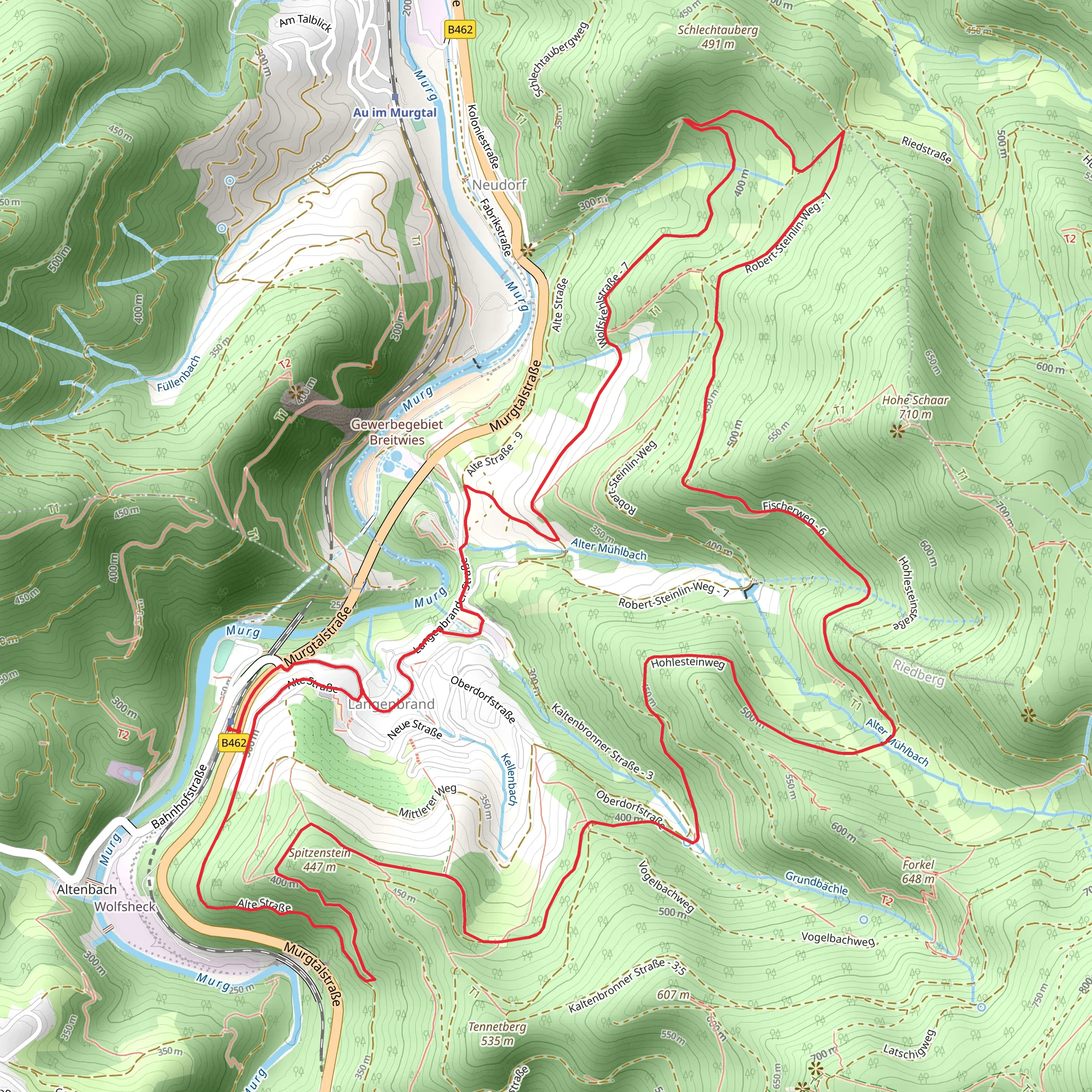
Starting near the charming town of Rastatt, Germany, the Grundplatz Hohlenstein and Murgtal Wanderweg is a captivating 13 km (8 miles) loop trail with an elevation gain of approximately 800 meters (2,625 feet). This medium-difficulty hike offers a blend of natural beauty, historical landmarks, and diverse wildlife, making it a rewarding experience for outdoor enthusiasts.
Getting There To reach the trailhead, you can either drive or use public transport. If driving, head towards Rastatt and look for parking options near the town center. For those using public transport, take a train to Rastatt Bahnhof, which is well-connected to major cities like Karlsruhe and Baden-Baden. From the train station, local buses or a short taxi ride will get you to the trailhead.
Trail Navigation For navigation, it's highly recommended to use the HiiKER app, which provides detailed maps and real-time updates to ensure you stay on the right path.
Key Sections and Landmarks
#### Grundplatz Hohlenstein Starting from the trailhead, the initial section takes you through dense forests and gradually ascends towards Grundplatz Hohlenstein. This area is known for its unique rock formations and offers a great spot for a short break. The elevation gain here is moderate, around 200 meters (656 feet) over the first 3 km (1.9 miles).
#### Murgtal Valley As you continue, the trail descends into the picturesque Murgtal Valley. This section is relatively flat and spans approximately 4 km (2.5 miles). The valley is rich in flora and fauna, so keep an eye out for deer, foxes, and a variety of bird species. The Murgtal River runs parallel to the trail, providing a serene backdrop and opportunities for some beautiful photographs.
#### Historical Significance The region around Rastatt has a rich history, particularly from the 18th century when it was a significant military and administrative center. As you hike, you'll come across several historical markers and ruins, including remnants of old fortifications and watchtowers. These landmarks offer a glimpse into the area's past and are well worth a brief stop.
Final Ascent and Return The final section of the trail involves a more strenuous ascent, gaining around 400 meters (1,312 feet) over the last 3 km (1.9 miles). This part of the hike can be challenging, but the panoramic views from the top are well worth the effort. Once you reach the summit, the trail loops back towards the starting point, descending gradually through lush forests and open meadows.
Wildlife and Flora Throughout the hike, you'll encounter a diverse range of wildlife and plant species. The forested areas are home to oak, beech, and pine trees, while the meadows are dotted with wildflowers, especially in the spring and summer months. Birdwatchers will be delighted by the variety of species, including woodpeckers, owls, and songbirds.
Preparation Tips Given the elevation gain and varied terrain, it's essential to wear sturdy hiking boots and bring plenty of water. Weather can be unpredictable, so pack a rain jacket and some extra layers. Snacks or a packed lunch will come in handy, especially if you plan to take breaks at some of the scenic spots along the way.
By following these guidelines and using the HiiKER app for navigation, you'll be well-prepared to enjoy the Grundplatz Hohlenstein and Murgtal Wanderweg to its fullest.
Comments and Reviews
User comments, reviews and discussions about the Grundplatz Hohlenstein and Murgtal Wanderweg, Germany.
average rating out of 5
0 rating(s)
