Download
Preview
Add to list
More
220.6 km
~13 days
4832 m
Multi-Day
“Embark on the Mittelweg trail for an enchanting 221-km journey through the Black Forest's history and natural splendor.”
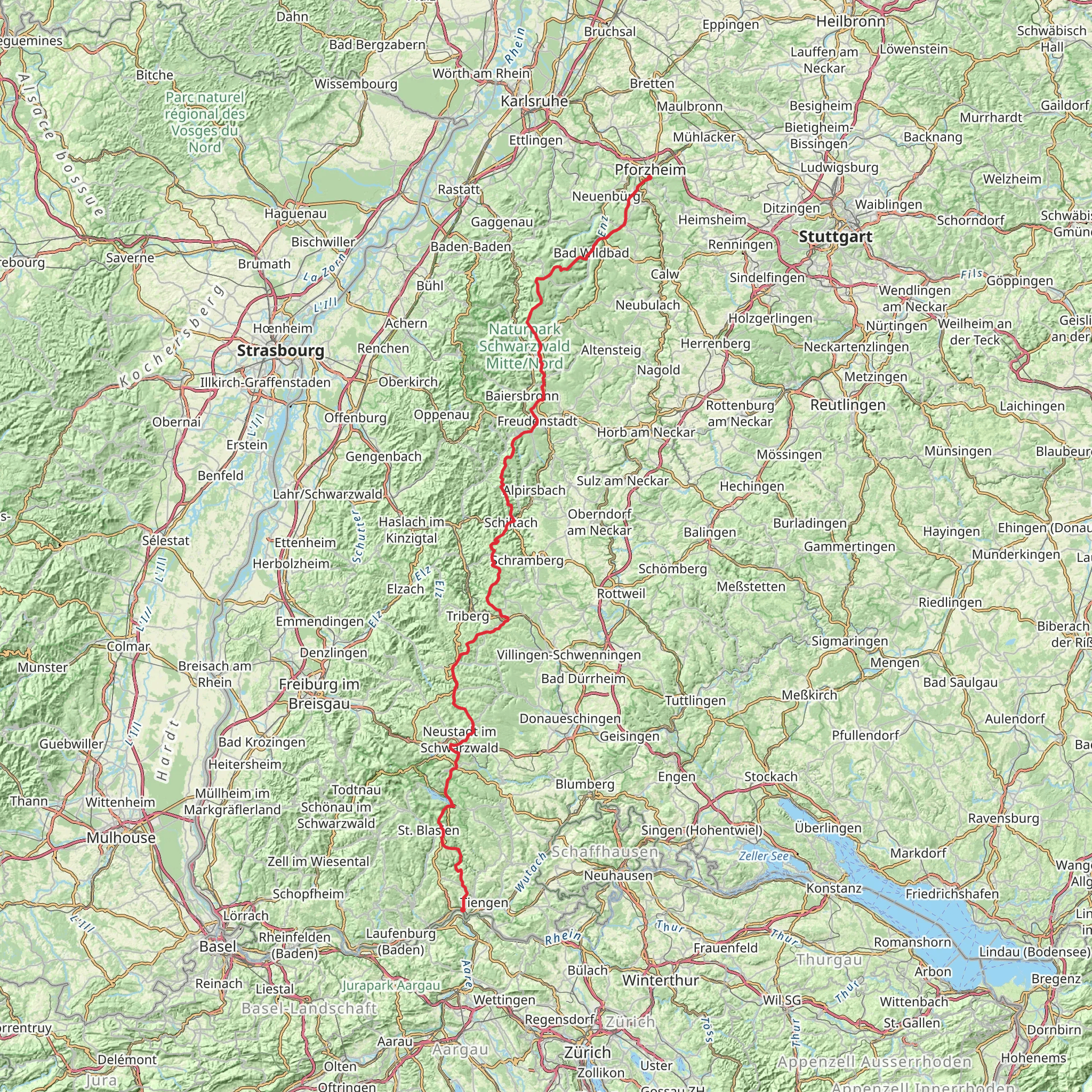
The Mittelweg trail, spanning approximately 221 kilometers (137 miles) with an elevation gain of around 4800 meters (15,748 feet), is a captivating journey through the heart of the Black Forest in Germany. Starting near Pforzheim, a city known for its jewelry and watch-making industry, the trailhead can be accessed by public transport or car. For those arriving by train, Pforzheim Hauptbahnhof is the main station, with local buses and taxis available to reach the trail's starting point. By car, the trailhead is conveniently located with parking facilities nearby.
Navigating the Trail
As you embark on this point-to-point trail, the use of a navigation tool like HiiKER can be invaluable for staying on track and being aware of upcoming waypoints. The trail is well-marked, but having a digital map can help in planning your daily hiking segments and locating campsites or accommodation along the route.
Natural Beauty and Wildlife
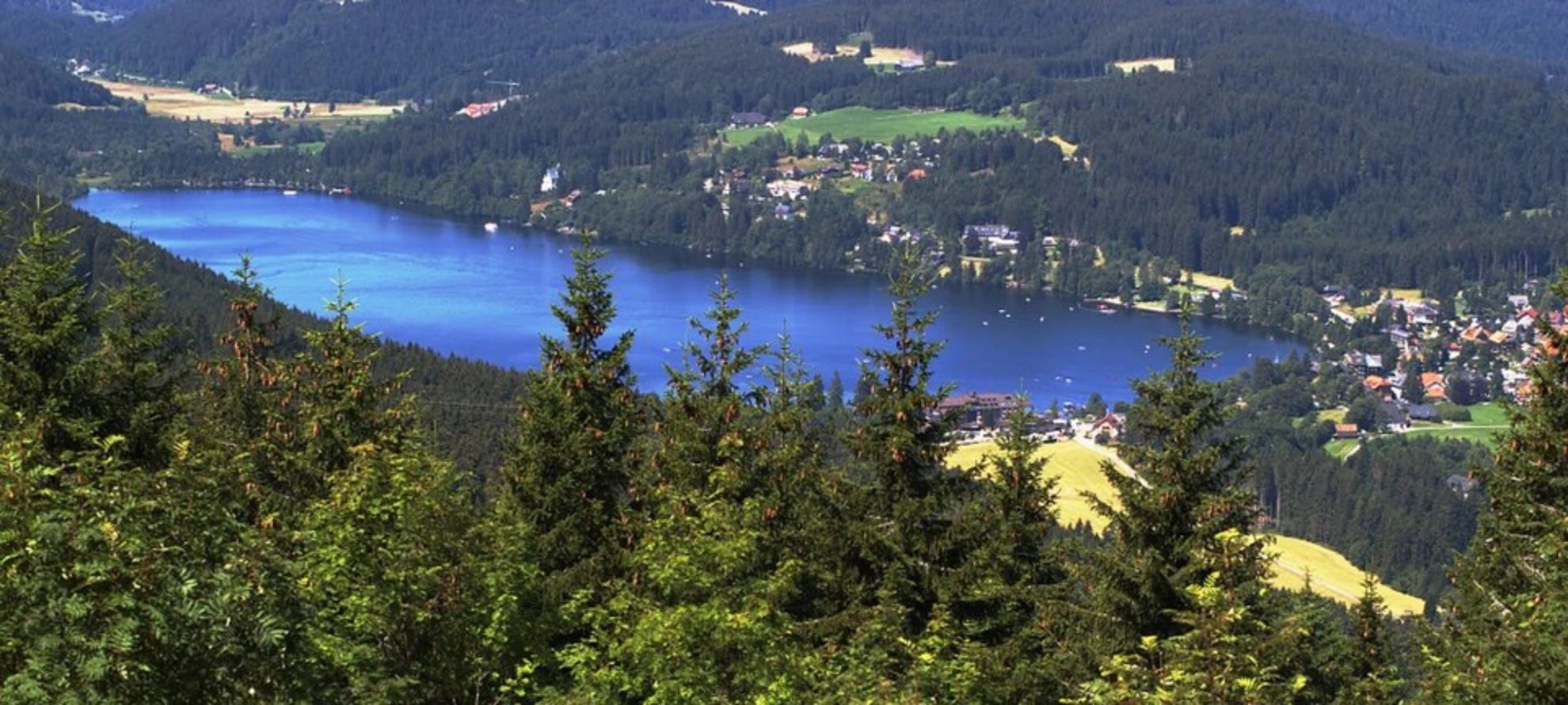
The Mittelweg trail meanders through dense forests, serene meadows, and past tranquil lakes, offering a diverse range of flora and fauna. Hikers can expect to be surrounded by towering pines and firs, with the changing seasons painting the landscape in vibrant colors. Wildlife sightings may include deer, foxes, and a variety of bird species, so keep your binoculars handy.
Historical Significance
The Black Forest region is steeped in history, and the Mittelweg trail is no exception. As you traverse this path, you'll be walking in the footsteps of generations past. The area has been a crucial part of Germany's cultural and economic development, with historical landmarks dotted along the trail. Keep an eye out for traditional farmhouses and remnants of old forestry practices.
Key Landmarks and Sections
- Northern Section (Pforzheim to Bad Wildbad): The trail begins with a gentle ascent through mixed woodlands, leading to the spa town of Bad Wildbad approximately 23 kilometers (14 miles) in. Here, hikers can explore the town's thermal baths and take a rest before continuing.
- Central Section (Bad Wildbad to Schonach): This 70-kilometer (43-mile) stretch is where you'll encounter some of the trail's most picturesque landscapes, including the idyllic Glaswaldsee, a lake nestled within the forest. The elevation gain is more pronounced here, offering rewarding views.
- Southern Section (Schonach to Waldshut-Tiengen): The final leg of the journey, covering around 128 kilometers (80 miles), takes you through the southern Black Forest with its rolling hills and deep valleys. The trail concludes in the town of Waldshut-Tiengen, close to the Swiss border.
Preparation and Planning
Given the trail's medium difficulty rating, hikers should be prepared for several days of walking with varying terrain. It's recommended to carry a reliable map, adequate food and water supplies, and suitable clothing for changeable weather conditions. Accommodations along the trail range from campsites to guesthouses, allowing for flexibility in planning overnight stays.
Access and Transportation
To return to Pforzheim or travel onwards after completing the trail, Waldshut-Tiengen has a train station with connections to major cities. Public transport options are available for those who prefer not to use a car, making the logistics of this long-distance hike manageable.
The Mittelweg offers a unique opportunity to immerse oneself in the natural beauty and historical richness of the Black Forest. With careful planning and respect for the environment, hikers can enjoy a memorable experience on one of Germany's classic trails.
Comments and Reviews
User comments, reviews and discussions about the Mittelweg, Germany.
4.0
average rating out of 5
6 rating(s)

