Download
Preview
Add to list
More
5.8 km
~1 hrs 52 min
433 m
Loop
“Embark on a thrilling alpine adventure through stunning landscapes and historical paths in Ostallgäu, Germany.”
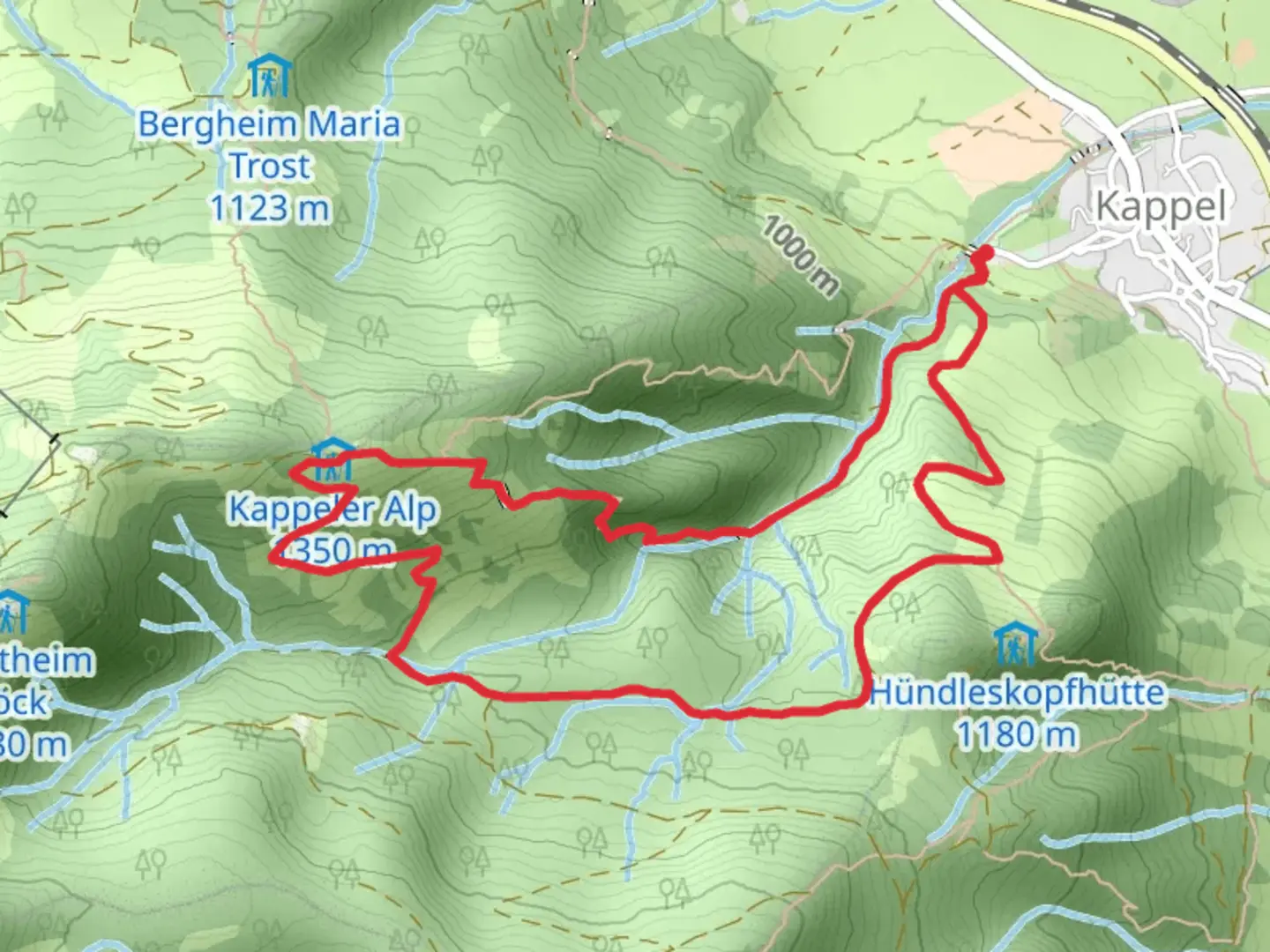
Nestled in the picturesque region of Ostallgäu, Germany, the Hollschlucht, Kappeler Alpe, and Hunndeleskopf Loop is a challenging yet rewarding hiking experience. This loop trail spans approximately 6 kilometers (about 3.7 miles) with an elevation gain of around 400 meters (approximately 1,312 feet), offering hikers a demanding trek through stunning alpine landscapes.### Getting ThereThe trailhead is conveniently located near Ostallgäu, making it accessible by both car and public transport. If you're driving, you can park near the village of Pfronten, which serves as a good starting point. For those relying on public transport, Pfronten is well-connected by train and bus services from major cities like Munich and Augsburg. From Pfronten, local buses or a short taxi ride can take you to the trailhead.### Trail OverviewThe loop begins with a steep ascent through the Hollschlucht, a narrow gorge that captivates with its rugged beauty. As you navigate the rocky terrain, the sound of cascading water from the nearby streams accompanies your journey, creating a serene atmosphere. This section requires careful footing, especially after rain, as the rocks can become slippery.### Kappeler AlpeApproximately halfway through the trail, you'll reach the Kappeler Alpe, a traditional alpine hut that offers a perfect spot for a rest. Here, you can enjoy panoramic views of the surrounding mountains and valleys. The hut often serves local delicacies, providing a taste of Bavarian hospitality. It's a great place to refuel before continuing your hike.### Hunndeleskopf SummitThe trail then leads you to the summit of Hunndeleskopf, the highest point of the loop. At an elevation of about 1,300 meters (4,265 feet), the summit offers breathtaking vistas of the Allgäu Alps and the distant peaks of the Tyrol region. This is a prime location for photography enthusiasts, with sweeping views that capture the essence of the alpine landscape.### Flora and FaunaThroughout the hike, you'll encounter a diverse range of flora and fauna. The trail is home to various alpine flowers, especially vibrant in the spring and summer months. Wildlife enthusiasts might spot chamois or marmots along the way, adding to the trail's natural allure.### Historical SignificanceThe region around Ostallgäu is steeped in history, with the trail passing near ancient trade routes that once connected Bavaria with the Tyrol region. The area is dotted with remnants of old settlements and offers a glimpse into the past, where these paths served as vital links for commerce and communication.### Navigation and SafetyGiven the trail's extra difficult rating, it's crucial to be well-prepared. Ensure you have sturdy hiking boots, sufficient water, and weather-appropriate clothing. The trail is well-marked, but using a navigation tool like HiiKER can provide additional guidance and reassurance. Always check weather conditions before setting out, as the alpine weather can change rapidly.This loop trail promises an exhilarating adventure for seasoned hikers, combining physical challenge with the serene beauty of the Bavarian Alps.

What to expect?
Activity types
Comments and Reviews
User comments, reviews and discussions about the Hollschlucht, Kappeler Alpe and Hunndeleskopf Loop, Germany.
average rating out of 5
0 rating(s)