Gleitschirm- und Drachenstartplatz Tegelberg to Hohenschwangau Walk via Maximiliansweg
Download
Preview
Add to list
More
6.1 km
~1 hrs 29 min
163 m
Point-to-Point
“Journey through lush landscapes and historic castles on the captivating 6 km Tegelberg to Hohenschwangau hike.”
Starting near Ostallgäu, Germany, the Gleitschirm- und Drachenstartplatz Tegelberg to Hohenschwangau Walk via Maximiliansweg is a captivating 6 km (approximately 3.7 miles) point-to-point trail with an elevation gain of around 100 meters (328 feet). This trail is rated as medium difficulty, making it accessible for most hikers with a moderate level of fitness.
Getting to the Trailhead To reach the trailhead, you can either drive or use public transport. If driving, head towards the Tegelberg Cable Car station near Schwangau, which is well-signposted and has ample parking facilities. For those using public transport, take a train to Füssen, and from there, a bus to the Tegelberg Cable Car station. The bus services are frequent and well-coordinated with train arrivals.
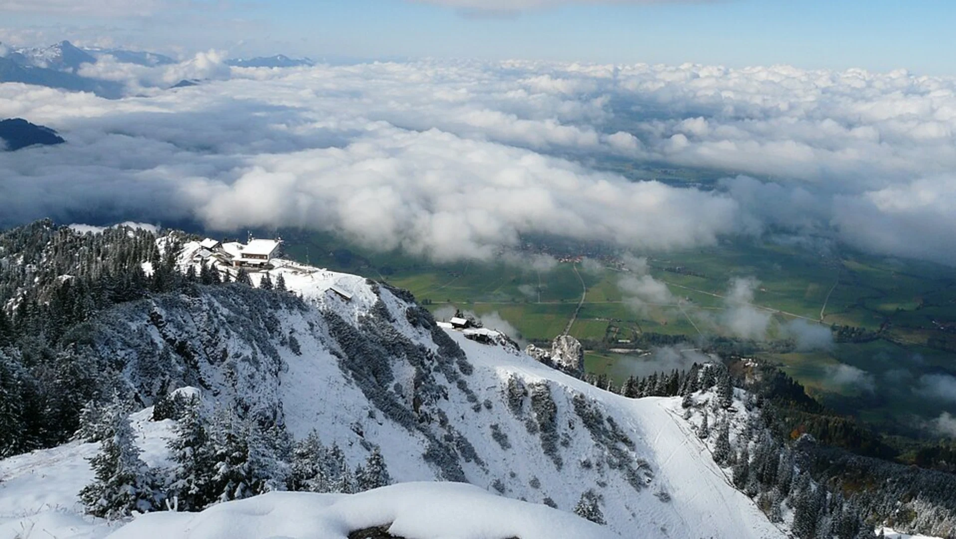
Trail Overview The trail begins at the Gleitschirm- und Drachenstartplatz Tegelberg, a popular paragliding and hang-gliding launch site. From here, you will follow the Maximiliansweg, a historic route named after King Maximilian II of Bavaria, who was known for his love of nature and hiking.
Key Landmarks and Points of Interest - **Tegelberg Cable Car Station**: Starting your hike here, you can take a moment to enjoy the panoramic views of the surrounding Alps and the Allgäu region. - **Marienbrücke (Mary's Bridge)**: About 2 km (1.2 miles) into the hike, you will come across this iconic bridge, which offers stunning views of Neuschwanstein Castle and the Pöllat Gorge. The bridge is a popular spot for photographs, so expect some crowds. - **Neuschwanstein Castle**: Approximately 4 km (2.5 miles) into the hike, you will pass near this world-famous fairy-tale castle. Built by King Ludwig II, it is one of the most visited castles in Europe. While the trail does not take you inside the castle, the views from the outside are breathtaking. - **Hohenschwangau Castle**: As you approach the end of the trail, you will come across Hohenschwangau Castle, the childhood residence of King Ludwig II. This castle is less crowded than Neuschwanstein but equally rich in history and beauty.
Nature and Wildlife The trail traverses through lush forests, alpine meadows, and rocky outcrops. Keep an eye out for local wildlife such as deer, marmots, and various bird species. The flora is equally diverse, with wildflowers blooming in the spring and summer months, adding a splash of color to the landscape.
Navigation and Safety Given the moderate difficulty of the trail, it is advisable to use a reliable navigation tool like HiiKER to stay on track. The trail is well-marked, but having a digital map can be very helpful, especially in areas where the path may be less obvious.
Final Stretch The trail concludes in the village of Hohenschwangau, where you can find several amenities including restaurants, cafes, and souvenir shops. Public transport options are available here to take you back to Füssen or other nearby destinations.
This hike offers a perfect blend of natural beauty, historical landmarks, and moderate physical challenge, making it a must-do for anyone visiting the Ostallgäu region.

What to expect?
Activity types
Comments and Reviews
User comments, reviews and discussions about the Gleitschirm- und Drachenstartplatz Tegelberg to Hohenschwangau Walk via Maximiliansweg, Germany.
4.14
average rating out of 5
7 rating(s)