Download
Preview
Add to list
More
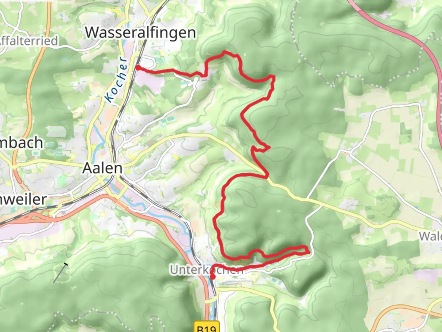
15.8 km
~4 hrs 9 min
594 m
Point-to-Point
“Traverse picturesque landscapes and historical sites on this Swabian Jura hike through diverse nature.”
Nestled in the picturesque Ostalbkreis region of Germany, the trail from Wasseralfingen to Unterkochen offers a delightful journey through the Swabian Jura's rolling landscapes. Spanning approximately 16 kilometers (about 10 miles) with an elevation gain of around 500 meters (approximately 1,640 feet), this point-to-point trail is rated as medium difficulty, making it suitable for hikers with a moderate level of fitness.
Getting There
To reach the trailhead near Wasseralfingen, travelers can opt for public transport or drive. If you're using public transport, the nearest major hub is the city of Aalen. From Aalen, local buses or trains can take you to Wasseralfingen, where the trail begins. For those driving, Wasseralfingen is accessible via the B29 highway, with ample parking available near the trailhead.
Trail Highlights
As you embark on this scenic hike, you'll traverse a variety of landscapes, from dense woodlands to open meadows. The trail meanders through the Swabian Jura, a region known for its limestone hills and karst formations. Keep an eye out for the unique rock formations that dot the landscape, offering a glimpse into the area's geological history.
Nature and Wildlife
The trail is a haven for nature enthusiasts, with a rich tapestry of flora and fauna. In spring and summer, the meadows burst into color with wildflowers, while the forests provide a habitat for deer, foxes, and a variety of bird species. Birdwatchers should bring binoculars to spot the region's diverse avian population, including woodpeckers and songbirds.
Historical Significance
The region around Wasseralfingen and Unterkochen is steeped in history. As you hike, you'll pass near remnants of ancient settlements and medieval structures, offering a window into the past. The Swabian Jura has been inhabited since prehistoric times, and the trail occasionally intersects with paths that have been used for centuries.
Navigation and Safety
For navigation, the HiiKER app is an invaluable tool, providing detailed maps and real-time updates to ensure you stay on track. The trail is well-marked, but it's always wise to have a reliable navigation aid. Be prepared for changes in weather, as the region can experience sudden shifts, especially in the higher elevations.
Final Stretch
As you approach Unterkochen, the trail descends gently, offering panoramic views of the surrounding valleys. The endpoint in Unterkochen is well-connected, with options to return to Aalen via public transport or continue exploring the charming local villages. This hike not only offers a physical challenge but also a journey through the natural and historical tapestry of the Swabian Jura.

Comments and Reviews
User comments, reviews and discussions about the Wasseralfingen to Unterkochen Walk, Germany.
average rating out of 5
0 rating(s)