Download
Preview
Add to list
More
10.7 km
~3 hrs 24 min
754 m
Loop
“The Geniesserpfad - Gebirger Hoefe Weg offers a scenic 11-kilometer hike with diverse landscapes and historic landmarks.”
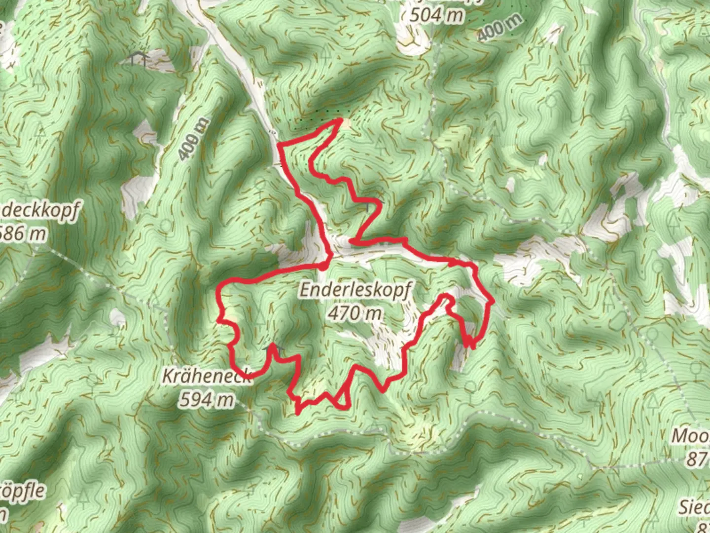
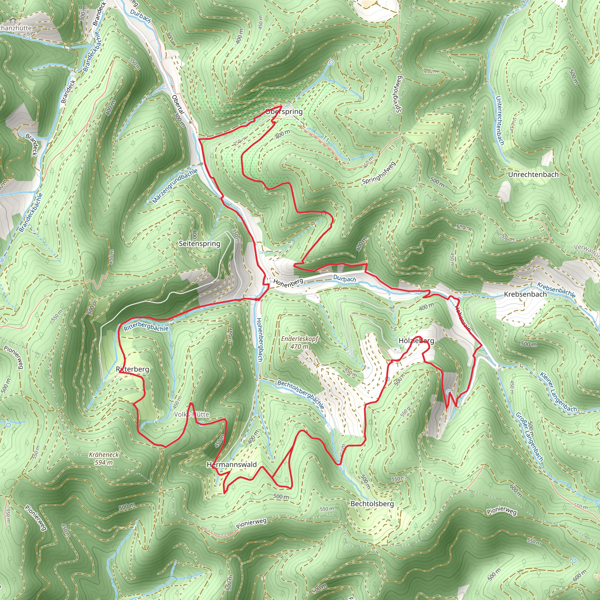
Starting near Ortenaukreis, Germany, the Geniesserpfad - Gebirger Hoefe Weg is a delightful loop trail that spans approximately 11 kilometers (around 6.8 miles) with an elevation gain of about 700 meters (2,297 feet). This medium-difficulty trail offers a rich blend of natural beauty, historical landmarks, and cultural experiences.
Getting There To reach the trailhead, you can drive or use public transport. If driving, set your GPS to Ortenaukreis, Germany, and look for parking near the trailhead. For those using public transport, the nearest significant landmark is the town of Oberkirch. From Oberkirch, you can take a local bus or taxi to the trailhead.
Trail Overview The trail begins with a gentle ascent through lush forests, offering a serene start to your hike. As you progress, the path becomes steeper, leading you through a series of switchbacks. The initial 3 kilometers (1.86 miles) will see you gaining approximately 300 meters (984 feet) in elevation, so be prepared for a bit of a workout.
Landmarks and Points of Interest Around the 4-kilometer (2.5-mile) mark, you'll encounter the first significant landmark: the historic Gebirger Hoefe, a collection of traditional Black Forest farmhouses. These structures offer a glimpse into the region's agricultural past and are perfect for a short break and some photos.
Continuing on, the trail meanders through open meadows and dense woodlands, providing a diverse range of flora and fauna. Keep an eye out for local wildlife such as deer, foxes, and a variety of bird species. The next 2 kilometers (1.24 miles) are relatively flat, allowing you to catch your breath and enjoy the scenery.
Midpoint and Elevation Gain At approximately the 6-kilometer (3.7-mile) mark, you'll reach the highest point of the trail, with an elevation gain of around 700 meters (2,297 feet). Here, you'll be rewarded with panoramic views of the Ortenaukreis region, including the distant Vosges Mountains in France. This is an ideal spot for a picnic or a rest.
Descending and Return The descent begins gradually, winding through more forested areas and past several small streams. The final 3 kilometers (1.86 miles) will take you back to the trailhead, completing the loop. This section is less strenuous, allowing you to enjoy the final stretch of your hike.
Navigation and Safety For navigation, it's highly recommended to use the HiiKER app, which provides detailed maps and real-time updates. The trail is well-marked, but having a reliable navigation tool will ensure you stay on track.
Historical Significance The Ortenaukreis region has a rich history dating back to Roman times. The trail itself passes through areas that were once vital trade routes. The Gebirger Hoefe farmhouses are a testament to the region's long-standing agricultural traditions, offering a unique historical perspective.
Final Tips Wear sturdy hiking boots, bring plenty of water, and pack some snacks or a light meal. Weather can be unpredictable, so dress in layers and carry a rain jacket. Enjoy the hike and take your time to absorb the natural beauty and historical richness of the Geniesserpfad - Gebirger Hoefe Weg.
Comments and Reviews
User comments, reviews and discussions about the Geniesserpfad - Gebirger Hoefe Weg, Germany.
4.0
average rating out of 5
2 rating(s)
