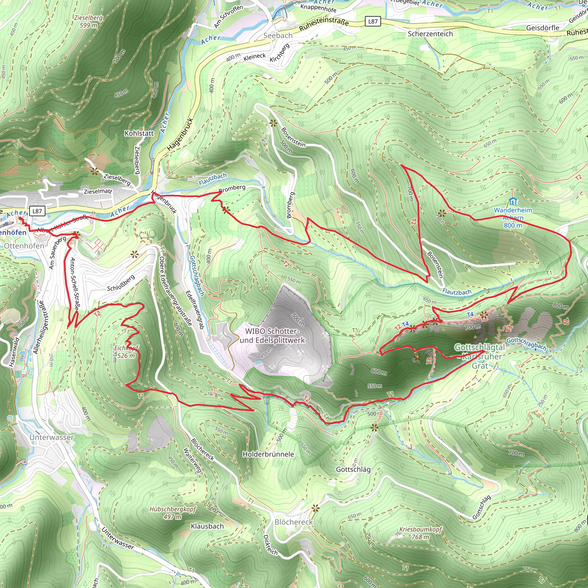
Eichkopf and Gottschlägtal - Karlsruher Grat via Geniesserpfad Karisruher Grat
Download
Preview
Add to list
More
12.2 km
~3 hrs 55 min
886 m
Loop
“Explore the scenic 12 km Eichkopf and Karlsruher Grat trail, blending natural beauty, history, and moderate challenge.”
Starting near Ortenaukreis, Germany, the Eichkopf and Gottschlägtal - Karlsruher Grat via Geniesserpfad Karisruher Grat trail is a captivating 12 km (7.5 miles) loop with an elevation gain of approximately 800 meters (2,625 feet). This trail is rated as medium difficulty, making it suitable for moderately experienced hikers.
Getting There To reach the trailhead, you can drive or use public transport. If driving, set your GPS to the nearest known address: "Ortenaukreis, Germany." For those using public transport, take a train to the nearest major station, Offenburg, and then a local bus to the Ortenaukreis area. From there, it's a short walk to the trailhead.
Trail Overview The trail begins with a gentle ascent through dense forests, offering a serene start to your hike. As you progress, the path becomes steeper, leading you to the Eichkopf summit. This section covers about 3 km (1.9 miles) with an elevation gain of around 300 meters (984 feet). The summit provides panoramic views of the Black Forest, a perfect spot for a short break.
Eichkopf to Gottschlägtal Descending from Eichkopf, the trail takes you through the picturesque Gottschlägtal valley. This section is relatively flat and spans approximately 4 km (2.5 miles). The valley is rich in flora and fauna, so keep an eye out for local wildlife such as deer and various bird species. The Gottschlägtal stream runs parallel to the trail, adding a soothing soundtrack to your hike.
Karlsruher Grat The highlight of the trail is the Karlsruher Grat, a rugged ridge that offers both challenge and reward. This section is about 2 km (1.2 miles) long and involves some scrambling over rocks. The elevation gain here is around 200 meters (656 feet). The ridge provides breathtaking views and is a popular spot for rock climbing enthusiasts. Ensure you have good footwear and take your time navigating this part.
Historical Significance The region has a rich history dating back to Roman times. The Black Forest was a significant boundary during the Roman Empire, and remnants of ancient fortifications can still be found. The trail itself passes near several historical landmarks, including old mining sites and traditional Black Forest farmhouses.
Final Stretch The last 3 km (1.9 miles) of the trail lead you back to the starting point. This section is a mix of gentle descents and flat terrain, allowing you to cool down after the more strenuous parts of the hike. You'll pass through open meadows and small patches of forest, offering a variety of landscapes to enjoy.
Navigation and Safety For navigation, use the HiiKER app to ensure you stay on track. The trail is well-marked, but having a reliable navigation tool is always a good idea. Carry enough water, snacks, and a first-aid kit. Weather can change rapidly, so pack layers and be prepared for sudden shifts.
This trail offers a blend of natural beauty, historical intrigue, and physical challenge, making it a must-visit for any hiking enthusiast.
What to expect?
Activity types
Comments and Reviews
User comments, reviews and discussions about the Eichkopf and Gottschlägtal - Karlsruher Grat via Geniesserpfad Karisruher Grat, Germany.
4.45
average rating out of 5
11 rating(s)
