Download
Preview
Add to list
More
15.1 km
~4 hrs 10 min
696 m
Loop
“Experience the enchanting Brandenkopf Loop, blending lush forests, panoramic views, and rich historical allure.”
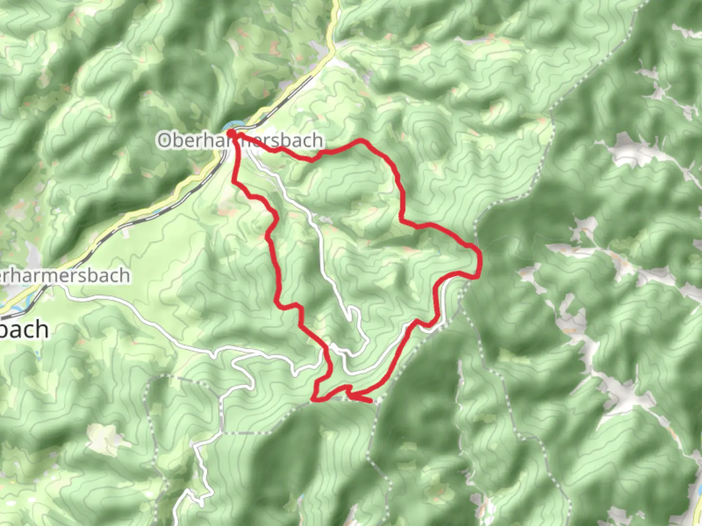
Nestled in the heart of the Black Forest, the Brandenkopf Loop from Oberharmersbach offers a captivating journey through lush landscapes and rich history. This 15 km (approximately 9.3 miles) loop trail, with an elevation gain of around 600 meters (about 1,970 feet), is a medium-difficulty hike that promises both challenge and reward.### Getting ThereThe trailhead is conveniently located near Ortenaukreis, Germany. If you're traveling by car, you can park in Oberharmersbach, a charming village that serves as the gateway to this adventure. For those relying on public transport, the nearest train station is in Oberharmersbach Dorf, which is well-connected to larger cities like Offenburg. From the station, it's a short walk to the trailhead.### Trail Highlights#### Scenic Views and Natural BeautyAs you embark on the loop, you'll be greeted by the dense, verdant forests that the Black Forest is renowned for. The trail meanders through a variety of landscapes, from towering pine trees to open meadows, offering hikers a diverse array of flora and fauna. Keep an eye out for local wildlife, including deer and a variety of bird species that call this region home.#### Brandenkopf SummitOne of the most significant landmarks along the trail is the Brandenkopf summit, which stands at 945 meters (3,100 feet) above sea level. This is the highest point in the central Black Forest and offers panoramic views that stretch across the Rhine Valley and, on clear days, even to the distant Vosges Mountains in France. The summit is marked by a historic observation tower, which provides an excellent vantage point for photography and a well-deserved rest.#### Historical SignificanceThe Brandenkopf area is steeped in history. The observation tower at the summit has been a fixture since the late 19th century, serving as a testament to the region's long-standing appeal to visitors. The surrounding area has been inhabited for centuries, and remnants of ancient settlements can occasionally be spotted along the trail.### Navigation and SafetyThe trail is well-marked, but it's always wise to have a reliable navigation tool. HiiKER is an excellent choice for this trail, providing detailed maps and real-time updates to ensure you stay on course. Given the elevation changes and potential for inclement weather, it's advisable to wear sturdy hiking boots and bring layers to adjust to varying temperatures.### Points of InterestAs you descend from the summit, the trail leads you through picturesque hamlets and past traditional Black Forest farmhouses. These structures, with their distinctive architecture, offer a glimpse into the rural life of the region. The trail also passes by several small streams and waterfalls, which provide tranquil spots for a break and a chance to enjoy the soothing sounds of nature.### Final StretchThe loop concludes back in Oberharmersbach, where you can explore the village's quaint streets and perhaps enjoy a meal at a local inn. The village is known for its hospitality and offers a perfect end to a day of hiking in one of Germany's most beautiful regions.

Comments and Reviews
User comments, reviews and discussions about the Brandenkopf Loop from Oberharmersbach, Germany.
average rating out of 5
0 rating(s)