12.5 km
~2 hrs 55 min
252 m
“Explore lush landscapes and historic sites on the 12 km Wupper loop trail in Oberbergischer Kreis.”
Starting near the picturesque region of Oberbergischer Kreis in Germany, this 12 km (7.5 miles) loop trail offers a delightful mix of natural beauty and historical intrigue. With an elevation gain of approximately 200 meters (656 feet), the Wupper via Wupperweg and Muehlenweg Rundweg is rated as medium difficulty, making it suitable for moderately experienced hikers.
### Getting There To reach the trailhead, you can drive or use public transport. If driving, set your GPS to Oberbergischer Kreis, Germany, and look for parking near the Wupper River. For those using public transport, take a train to Wuppertal and then a local bus to the nearest stop at Beyenburg, which is a short walk from the trailhead.
### Trail Navigation For navigation, it's highly recommended to use the HiiKER app, which provides detailed maps and real-time updates. The trail is well-marked, but having a reliable navigation tool will ensure you stay on track.
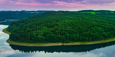
### Trail Highlights The trail begins near the serene Wupper River, offering immediate immersion into lush greenery and the soothing sounds of flowing water. As you start your hike, you'll notice the gentle ascent, gaining about 100 meters (328 feet) in the first 3 km (1.9 miles). This section is shaded by dense forest, providing a cool and refreshing atmosphere.
### Historical Significance Around the 4 km (2.5 miles) mark, you'll encounter the first significant landmark: the historic Beyenburg Abbey. This medieval monastery, dating back to the 12th century, offers a glimpse into the region's rich history. Take a moment to explore the abbey grounds and appreciate the well-preserved architecture.
### Nature and Wildlife Continuing along the trail, you'll traverse through diverse landscapes, including open meadows and dense woodlands. The Wupper River is home to a variety of wildlife, including kingfishers, herons, and even the occasional beaver. Keep your eyes peeled for these creatures, especially in the quieter sections of the trail.
### Midpoint and Elevation Gain At approximately 6 km (3.7 miles), you'll reach the highest point of the trail, with an elevation gain of around 200 meters (656 feet). This section offers panoramic views of the surrounding countryside, making it an ideal spot for a rest and some photography.
### Muehlenweg Rundweg As you descend, you'll join the Muehlenweg Rundweg, a path that takes you past several historic mills. These mills, some of which date back to the 18th century, were once vital to the local economy. Information plaques along the way provide fascinating insights into their operation and significance.
### Final Stretch The final 3 km (1.9 miles) of the trail bring you back along the Wupper River, offering a gentle descent and a chance to reflect on the journey. The trail loops back to the starting point, completing a rewarding and enriching hike.
### Practical Tips - Wear sturdy hiking boots, as some sections can be uneven and muddy. - Bring plenty of water and snacks, especially if you plan to take your time exploring the historical sites. - Check the weather forecast before you go, as the trail can be slippery after rain. - Use the HiiKER app for real-time navigation and updates.
This trail offers a perfect blend of natural beauty, historical landmarks, and moderate physical challenge, making it a must-visit for any hiking enthusiast.
Reviews
User comments, reviews and discussions about the Wupper via Wupperweg and Muehlenweg Rundweg, Germany.
0.0
average rating out of 5
0 rating(s)


