Download
Preview
Add to list
More
12.1 km
~3 hrs 2 min
374 m
Loop
“Explore Oberbergischer Kreis's scenic landscapes, rich history, and vibrant wildlife on this captivating 12 km hike.”
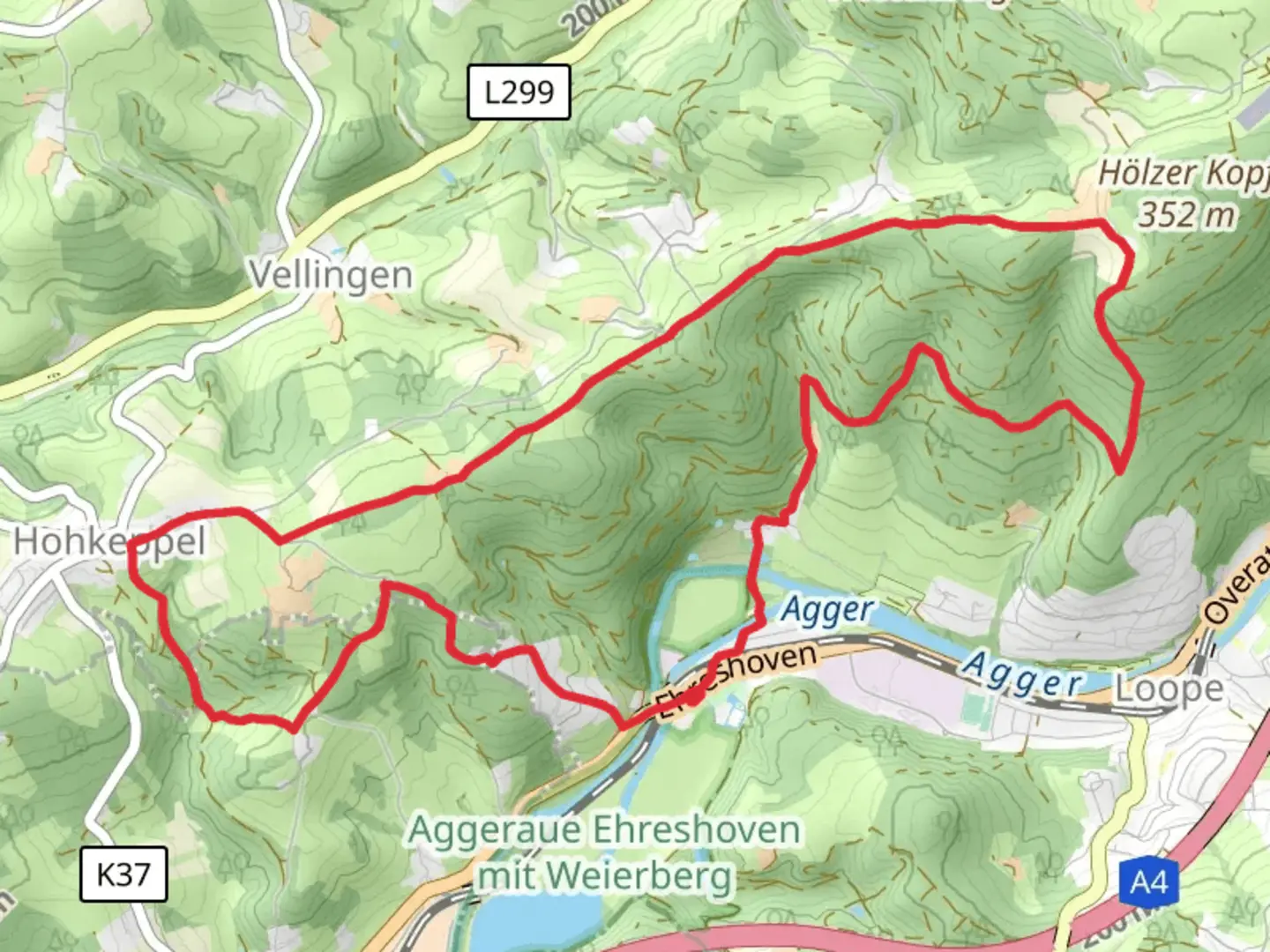
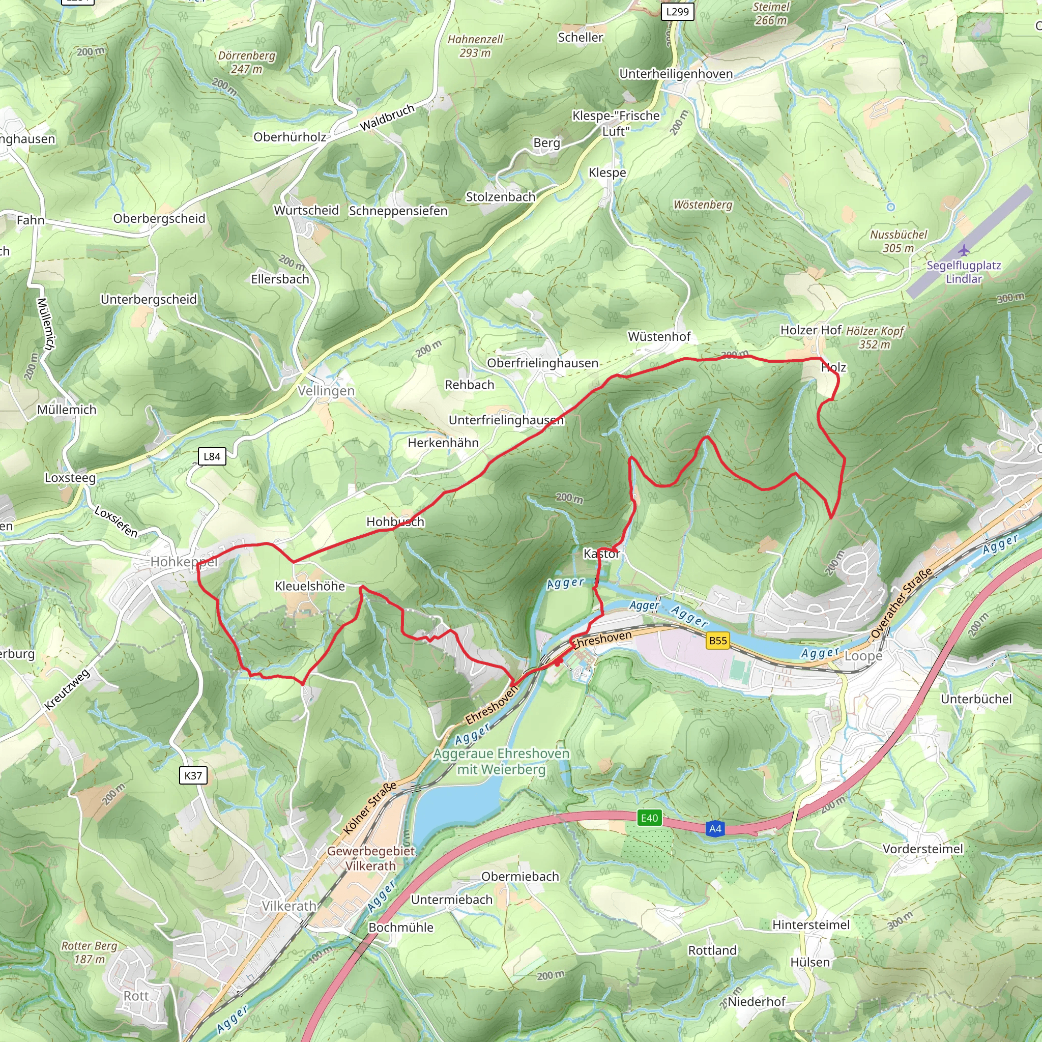
Nestled in the picturesque region of Oberbergischer Kreis, Germany, the Rheinscher Weg and Bergische Schweiz Rundweg A7 offer a delightful 12 km (approximately 7.5 miles) loop trail with an elevation gain of around 300 meters (about 984 feet). This medium-difficulty hike is perfect for those looking to explore the natural beauty and historical richness of the area.### Getting ThereTo reach the trailhead, you can drive to the vicinity of Oberbergischer Kreis, where ample parking is available. For those relying on public transport, the nearest major town is Gummersbach. From Gummersbach, you can take a local bus or taxi to the trailhead. The area is well-connected, making it accessible for both local and international visitors.### Trail Highlights#### Scenic LandscapesAs you embark on the trail, you'll be greeted by the lush greenery and rolling hills characteristic of the Bergisches Land region. The trail meanders through dense forests, open meadows, and along serene streams, offering a diverse range of landscapes. The elevation gain is gradual, making it manageable for most hikers while still providing rewarding views from higher vantage points.#### Flora and FaunaThe trail is a haven for nature enthusiasts, with a rich variety of flora and fauna. Depending on the season, you might encounter wildflowers, ferns, and a variety of tree species such as beech and oak. Birdwatchers will delight in spotting local species, and if you're lucky, you might catch a glimpse of deer or other wildlife native to the region.#### Historical SignificanceThe Oberbergischer Kreis area is steeped in history, and the trail offers glimpses into its past. Along the way, you'll find remnants of old stone structures and traditional half-timbered houses that tell the story of the region's cultural heritage. The trail also passes near several historical landmarks, including ancient mills and chapels, which are worth a brief detour.### Navigation and SafetyFor navigation, it's recommended to use the HiiKER app, which provides detailed maps and real-time updates on the trail conditions. The trail is well-marked, but having a reliable navigation tool ensures you stay on track and can explore any interesting side paths with confidence.### Points of Interest- Bergische Schweiz: This area within the trail is known for its striking resemblance to the Swiss landscape, with its rugged terrain and panoramic views. - Local Villages: Small villages along the trail offer a glimpse into rural German life. Consider stopping for a traditional meal or a refreshing drink at a local inn. - Natural Springs: Keep an eye out for natural springs along the route, where you can refill your water bottle with fresh, cool water.### Trail Tips- Weather: The weather in this region can be unpredictable, so it's advisable to check the forecast and dress in layers. - Footwear: Sturdy hiking boots are recommended due to the varied terrain. - Timing: Allocate around 4-5 hours to complete the loop, allowing time for breaks and exploration.This trail offers a perfect blend of natural beauty, historical intrigue, and cultural insights, making it a must-visit for any hiking enthusiast exploring the Oberbergischer Kreis region.
Comments and Reviews
User comments, reviews and discussions about the Rheinscher Weg and Bergische Schweiz Rundweg A7, Germany.
4.33
average rating out of 5
3 rating(s)
