Download
Preview
Add to list
More
2.9 km
~59 min
249 m
Out and Back
“Explore Oberallgäu’s natural beauty and history on a scenic, medium-difficulty 3 km trail.”
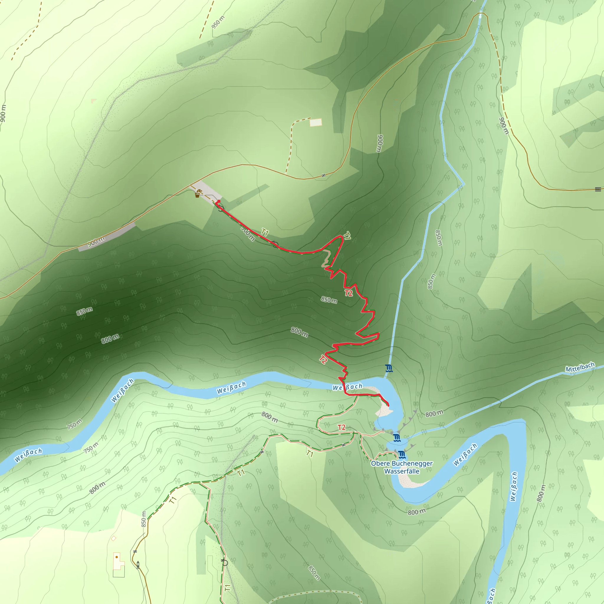
Starting near Oberallgäu, Germany, the Weissach via Oberallgäuer Rundwanderweg is a delightful out-and-back trail that spans approximately 3 kilometers (1.86 miles) with an elevation gain of around 200 meters (656 feet). This medium-difficulty hike offers a blend of natural beauty, historical significance, and accessible navigation.
Getting There To reach the trailhead, you can either drive or use public transportation. If driving, set your GPS to Oberallgäu, Germany, and look for parking near the starting point. For those using public transport, take a train or bus to the nearest station in Oberallgäu. From there, local buses or a short taxi ride will get you to the trailhead.
Trail Navigation For navigation, HiiKER is an excellent tool to use. It provides detailed maps and real-time updates to ensure you stay on track.
Trail Description The trail begins near the picturesque town of Oberallgäu, a region known for its lush landscapes and charming Bavarian architecture. As you start your hike, you'll immediately notice the well-marked path that winds through dense forests and open meadows. The initial stretch is relatively flat, making it a good warm-up for the more challenging sections ahead.
Flora and Fauna As you progress, the trail gradually ascends, offering stunning views of the surrounding Allgäu Alps. Keep an eye out for local wildlife such as deer, foxes, and a variety of bird species. The flora is equally impressive, with seasonal wildflowers adding splashes of color to the verdant landscape.
Significant Landmarks Around the 1.5-kilometer (0.93-mile) mark, you'll come across a small, serene stream known as the Weissach. This is a great spot to take a short break and enjoy the tranquil surroundings. The trail then continues to ascend, reaching its highest point at approximately 200 meters (656 feet) of elevation gain. Here, you'll be rewarded with panoramic views of the Oberallgäu region, a perfect photo opportunity.
Historical Significance The Oberallgäu area is steeped in history, with roots dating back to the Roman era. As you hike, you'll notice remnants of ancient pathways and possibly even old stone markers that were once used to guide travelers through this rugged terrain. The region was also a significant area during the medieval period, serving as a trade route between various European regions.
Final Stretch The return journey follows the same path, allowing you to enjoy the scenery from a different perspective. The descent is easier on the legs, giving you a chance to relax and take in the beauty of the Allgäu Alps one last time before reaching the trailhead.
This hike is perfect for those looking to experience the natural and historical richness of the Oberallgäu region in a relatively short amount of time. Make sure to bring adequate water, snacks, and a camera to capture the breathtaking views.
What to expect?
Activity types
Comments and Reviews
User comments, reviews and discussions about the Weissach via Oberallgaeuer Rundwanderweg, Germany.
4.5
average rating out of 5
6 rating(s)

