Download
Preview
Add to list
More
12.6 km
~3 hrs 59 min
890 m
Loop
“Embark on a challenging hike through lush forests and panoramic vistas in picturesque Oberallgäu, Germany.”
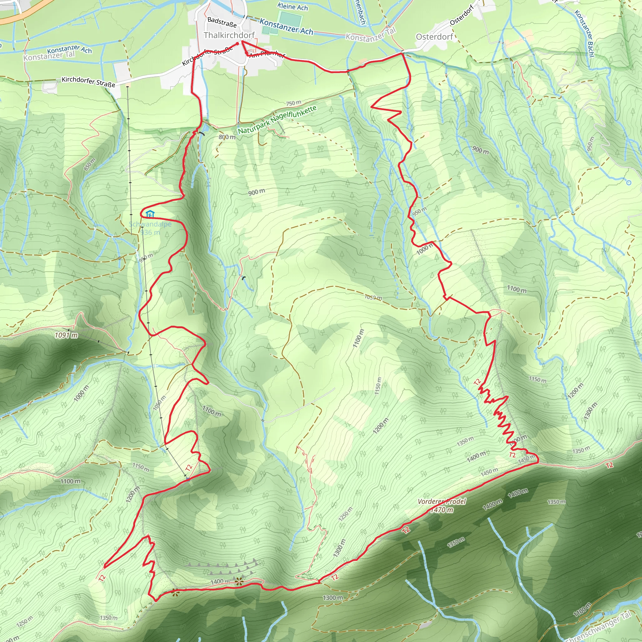
Nestled in the picturesque region of Oberallgäu, Germany, the Wandergebiet Oberstaufen and Himmeleck Trail offers an exhilarating loop hike of approximately 13 kilometers (about 8 miles) with an elevation gain of around 800 meters (approximately 2,625 feet). This trail is renowned for its challenging terrain, making it suitable for experienced hikers seeking a demanding adventure.### Getting ThereTo reach the trailhead near Oberallgäu, you can opt for public transport or drive. If you're using public transport, the nearest major town is Oberstaufen, which is well-connected by train. From Oberstaufen, local buses or taxis can take you to the trailhead. For those driving, there are parking facilities available near the starting point, which is conveniently located close to the town of Oberstaufen.### Trail OverviewThe loop begins with a steady ascent through lush forests, where the scent of pine fills the air. As you climb, the trail offers glimpses of the surrounding Allgäu Alps, a breathtaking backdrop that accompanies you throughout the hike. The initial section is steep, with rocky paths that require careful navigation, so sturdy hiking boots are essential.### Significant Landmarks and NatureAs you progress, you'll encounter the Himmeleck, a notable peak that offers panoramic views of the region. This vantage point is a perfect spot to pause and take in the sweeping vistas of rolling hills and distant mountains. The area is rich in biodiversity, with opportunities to spot local wildlife such as deer and various bird species. Keep an eye out for the vibrant alpine flowers that dot the landscape, especially during the spring and summer months.### Historical SignificanceThe region around Oberallgäu is steeped in history, with evidence of human settlement dating back to ancient times. The trail itself passes near several historical landmarks, including remnants of old farmsteads and traditional Bavarian architecture. These sites offer a glimpse into the cultural heritage of the area, reflecting the lifestyle and traditions of the people who have inhabited this region for centuries.### Navigation and SafetyGiven the trail's extra difficult rating, it's crucial to be well-prepared. The path can be narrow and uneven in places, with potential for slippery conditions, especially after rain. Utilizing a reliable navigation tool like HiiKER is recommended to ensure you stay on track. Weather conditions can change rapidly in the mountains, so packing layers and rain gear is advisable.### Final StretchThe descent back towards the trailhead is equally challenging, with steep declines that test your endurance and balance. As you make your way down, the trail winds through serene meadows and dense woodlands, offering a peaceful conclusion to your hike. The loop eventually brings you back to the starting point near Oberallgäu, where you can reflect on the rewarding journey through one of Germany's most stunning natural landscapes.
Comments and Reviews
User comments, reviews and discussions about the Wandergebiet Oberstaufen and Himmeleck Trail, Germany.
average rating out of 5
0 rating(s)
