Download
Preview
Add to list
More
5.7 km
~1 hrs 44 min
361 m
Out and Back
“Embark on the Steineberg Peak Scenic Walk for breathtaking views, rich history, and diverse flora and fauna.”
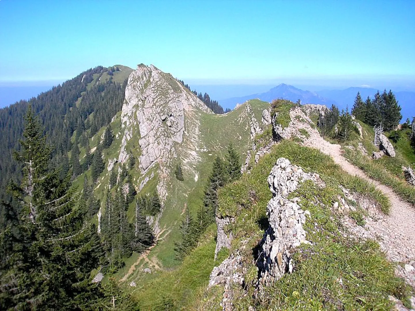
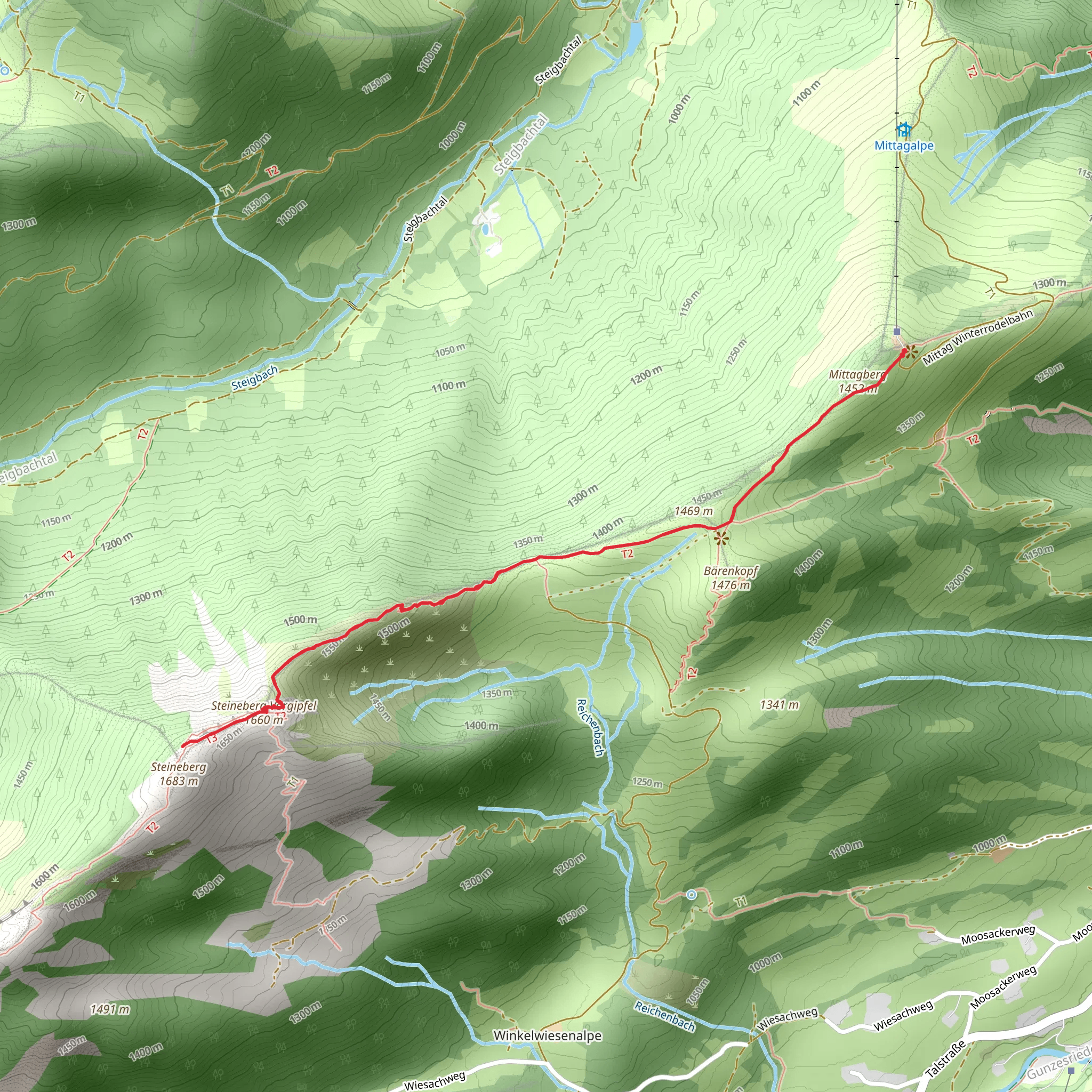
Starting your adventure near Oberallgäu, Germany, the Steineberg Peak Scenic Walk via Mittagberg is a captivating out-and-back trail that spans approximately 6 km (3.7 miles) with an elevation gain of around 300 meters (984 feet). This medium-difficulty hike offers a blend of natural beauty, historical significance, and panoramic views that make it a must-visit for outdoor enthusiasts.### Getting There To reach the trailhead, you can either drive or use public transport. If you're driving, set your GPS to the nearest known address: Immenstadt im Allgäu, a charming town that serves as a gateway to the Allgäu Alps. For those opting for public transport, take a train to Immenstadt im Allgäu station. From there, local buses or taxis can take you to the trailhead near Mittagbahn Talstation, the base station of the Mittag cable car.### Trail Overview The trail begins at the base of Mittagberg, where you can either start your hike or take the cable car up to save some energy for the more challenging sections. As you ascend, you'll be greeted by lush meadows and dense forests, home to a variety of flora and fauna. Keep an eye out for wildflowers in the spring and summer, and if you're lucky, you might spot some local wildlife like deer or alpine marmots.### Key Landmarks and Sections - Mittagberg Summit (Approx. 2 km / 1.2 miles in): The first significant landmark is the summit of Mittagberg. At an elevation of 1,451 meters (4,760 feet), this spot offers breathtaking views of the surrounding Allgäu Alps and the distant Lake Constance. There’s a small hut here where you can take a break and enjoy some refreshments.
- Ridge Walk to Steineberg (Approx. 3 km / 1.9 miles in): From Mittagberg, the trail continues along a scenic ridge. This section is particularly stunning, offering 360-degree views of the alpine landscape. The path can be narrow and rocky, so take your time and watch your footing.- Steineberg Peak (Approx. 3 km / 1.9 miles in): The final ascent to Steineberg Peak involves some scrambling, but the effort is well worth it. At 1,683 meters (5,522 feet), the peak provides unparalleled views of the Allgäu region. On a clear day, you can see as far as the Swiss Alps.### Historical Significance The Allgäu region has a rich history dating back to Roman times. The area around Immenstadt was once a Roman settlement, and remnants of ancient roads and structures can still be found. The trail itself has been used for centuries by shepherds and traders, adding a layer of historical depth to your hike.### Navigation and Safety Given the trail's moderate difficulty, it's advisable to use a reliable navigation tool like HiiKER to keep track of your progress and ensure you stay on the right path. The trail is well-marked, but weather conditions can change rapidly in the mountains, so always be prepared with appropriate gear, including sturdy hiking boots, a map, and plenty of water.### Flora and Fauna The diverse ecosystem along the trail is one of its highlights. In the lower sections, you'll find mixed forests of beech and spruce, while higher elevations are characterized by alpine meadows. Birdwatchers will be delighted by the variety of species, including golden eagles and alpine choughs.### Return Journey After reaching Steineberg Peak, retrace your steps back to the trailhead. The descent offers a different perspective of the landscape, allowing you to appreciate the beauty of the Allgäu Alps from a new angle.This hike is a perfect blend of natural beauty, historical intrigue, and physical challenge, making it an unforgettable experience for any hiker.
What to expect?
Activity types
Comments and Reviews
User comments, reviews and discussions about the Steineberg Peak Scenic Walk via Mittagberg, Germany.
4.25
average rating out of 5
8 rating(s)

