Download
Preview
Add to list
More
10.2 km
~3 hrs 10 min
682 m
Loop
“Venture through the breathtaking Allgäu landscapes on the challenging Reuterwanne Loop, rich in history and nature.”
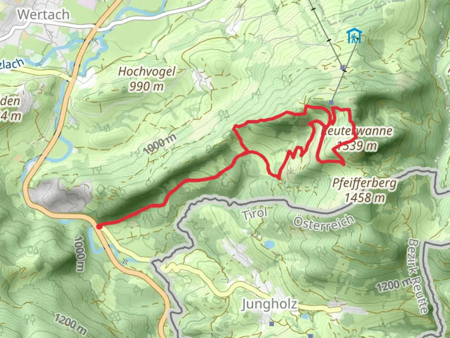
Nestled in the picturesque region of Oberallgäu, Germany, the Reuterwanne Loop offers a challenging yet rewarding hiking experience. This 10 km (approximately 6.2 miles) loop trail boasts an elevation gain of around 600 meters (about 1,970 feet), making it a demanding trek suitable for experienced hikers. The trailhead is conveniently located near the charming town of Oberallgäu, which can be accessed by car or public transport.### Getting ThereFor those traveling by car, Oberallgäu is well-connected via the A7 motorway. From there, follow the signs to the trailhead, which is situated near the village of Wertach. Parking is available near the start of the trail. If you prefer public transport, take a train to Kempten, the nearest major railway station. From Kempten, local buses run regularly to Wertach, where you can begin your hike.### Trail HighlightsThe Reuterwanne Loop takes you through a diverse landscape, offering a mix of dense forests, open meadows, and rugged mountain terrain. As you ascend, you'll be treated to panoramic views of the Allgäu Alps, with their dramatic peaks and lush valleys. The trail is well-marked, but it's advisable to use the HiiKER app for navigation to ensure you stay on track.#### Flora and FaunaThe trail is a haven for nature enthusiasts. In the spring and summer months, the meadows burst into color with wildflowers, including the iconic Alpine gentian and edelweiss. Keep an eye out for local wildlife such as chamois, red deer, and a variety of bird species, including the golden eagle soaring above.#### Historical SignificanceThe region around Oberallgäu is steeped in history. As you hike, you'll pass through areas that have been inhabited since the Roman times. The trail itself winds near ancient trade routes that once connected the Roman Empire with the northern tribes. The nearby village of Wertach is one of the oldest settlements in the Allgäu, with historical buildings that reflect its rich past.### Trail Conditions and SafetyThe Reuterwanne Loop is rated as difficult due to its steep ascents and uneven terrain. Hikers should be prepared for a strenuous workout, with sections that require careful footing, especially in wet or icy conditions. It's essential to wear sturdy hiking boots and carry sufficient water and snacks. Weather in the Alps can change rapidly, so pack layers and a rain jacket.### Points of InterestApproximately halfway through the loop, you'll reach the summit of Reuterwanne, standing at 1,541 meters (5,056 feet). This is a perfect spot to take a break and enjoy the breathtaking views of the surrounding peaks and valleys. On clear days, you can see as far as the Zugspitze, Germany's highest mountain.As you descend, the trail leads you past the idyllic Grüntensee, a serene lake perfect for a refreshing dip in the warmer months. The lake is also a popular spot for picnics, offering a peaceful setting to relax before completing the loop back to the trailhead.Embarking on the Reuterwanne Loop is a journey through some of Germany's most stunning natural landscapes, offering both a physical challenge and a chance to connect with the rich history and vibrant ecosystem of the Allgäu region.

What to expect?
Activity types
Comments and Reviews
User comments, reviews and discussions about the Reuterwanne Loop, Germany.
average rating out of 5
0 rating(s)