Download
Preview
Add to list
More
10.7 km
~2 hrs 52 min
444 m
Point-to-Point
“Explore scenic meadows, historic landmarks, and panoramic alpine views on this moderately challenging 11-kilometer hike.”
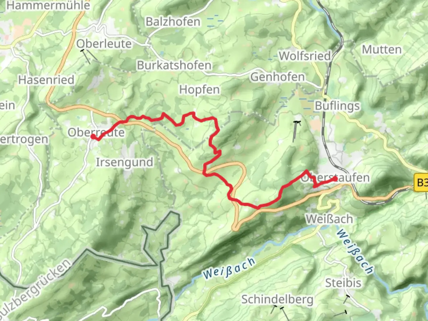
Starting near Oberallgäu, Germany, the trail from Oberstaufen to Oberreute spans approximately 11 kilometers (around 6.8 miles) with an elevation gain of about 400 meters (1,312 feet). This point-to-point trail is rated as medium difficulty, making it suitable for moderately experienced hikers.### Getting There To reach the trailhead, you can either drive or use public transport. If driving, head towards Oberallgäu and look for parking options near the starting point in Oberstaufen. For those using public transport, take a train or bus to Oberstaufen, which is well-connected to major cities like Munich and Stuttgart. From the Oberstaufen train station, the trailhead is just a short walk away.### Trail Overview The trail begins in the picturesque town of Oberstaufen, known for its charming Bavarian architecture and vibrant local culture. As you set off, you'll be greeted by rolling meadows and the distant silhouette of the Allgäu Alps. The initial part of the trail is relatively flat, allowing you to ease into the hike.### Key Landmarks and Nature At around the 3-kilometer (1.9-mile) mark, you'll encounter the first significant ascent, gaining approximately 150 meters (492 feet) in elevation. This section offers stunning views of the surrounding valleys and is a great spot for a short break. Keep an eye out for local wildlife such as deer and various bird species that inhabit the area.Continuing on, you'll pass through dense forests that provide ample shade and a serene atmosphere. The trail here is well-marked, but it's advisable to use the HiiKER app for navigation to ensure you stay on the right path. Around the 7-kilometer (4.3-mile) point, you'll reach the highest elevation of the trail, offering panoramic views that are perfect for photography enthusiasts.### Historical Significance The region is steeped in history, with several ancient trade routes crossing through these lands. Oberstaufen itself has a rich history dating back to the Roman era, and remnants of old Roman roads can still be found in the area. As you hike, you'll come across several informational plaques detailing the historical significance of various landmarks.### Final Stretch The descent towards Oberreute begins after the highest point, with a gradual decline that makes for a comfortable end to the hike. The final 4 kilometers (2.5 miles) take you through more open meadows and small hamlets, offering a glimpse into rural Bavarian life. As you approach Oberreute, the trail becomes more level, making for an easy finish.### Wildlife and Flora The trail is home to a diverse range of flora and fauna. Depending on the season, you might see wildflowers in full bloom, adding a splash of color to the landscape. The forests are primarily composed of beech and spruce trees, providing a lush green canopy.### Ending the Hike Upon reaching Oberreute, you'll find several options for refreshments and rest. The town is known for its hospitality and offers a variety of local eateries where you can enjoy traditional Bavarian cuisine. Public transport options are available from Oberreute for your return journey, making it convenient to get back to Oberstaufen or other nearby destinations.This trail offers a balanced mix of natural beauty, historical intrigue, and moderate physical challenge, making it a rewarding experience for any hiker.
Comments and Reviews
User comments, reviews and discussions about the Oberstaufen to Oberreute, Germany.
4.0
average rating out of 5
2 rating(s)
