Download
Preview
Add to list
More
Trail length
11.8 km
Time
~2 hrs 56 min
Elevation Gain
349 m
Hike Type
Loop
“The Oberstaufen and Eibele Wasserfälle Loop offers stunning landscapes, historical sites, and diverse wildlife in a 12 km hike.”
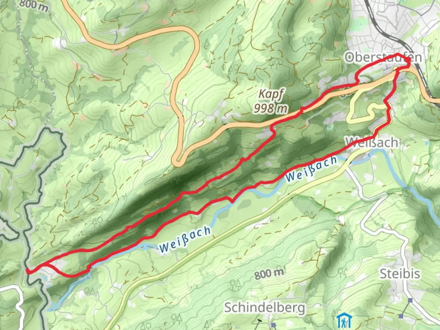
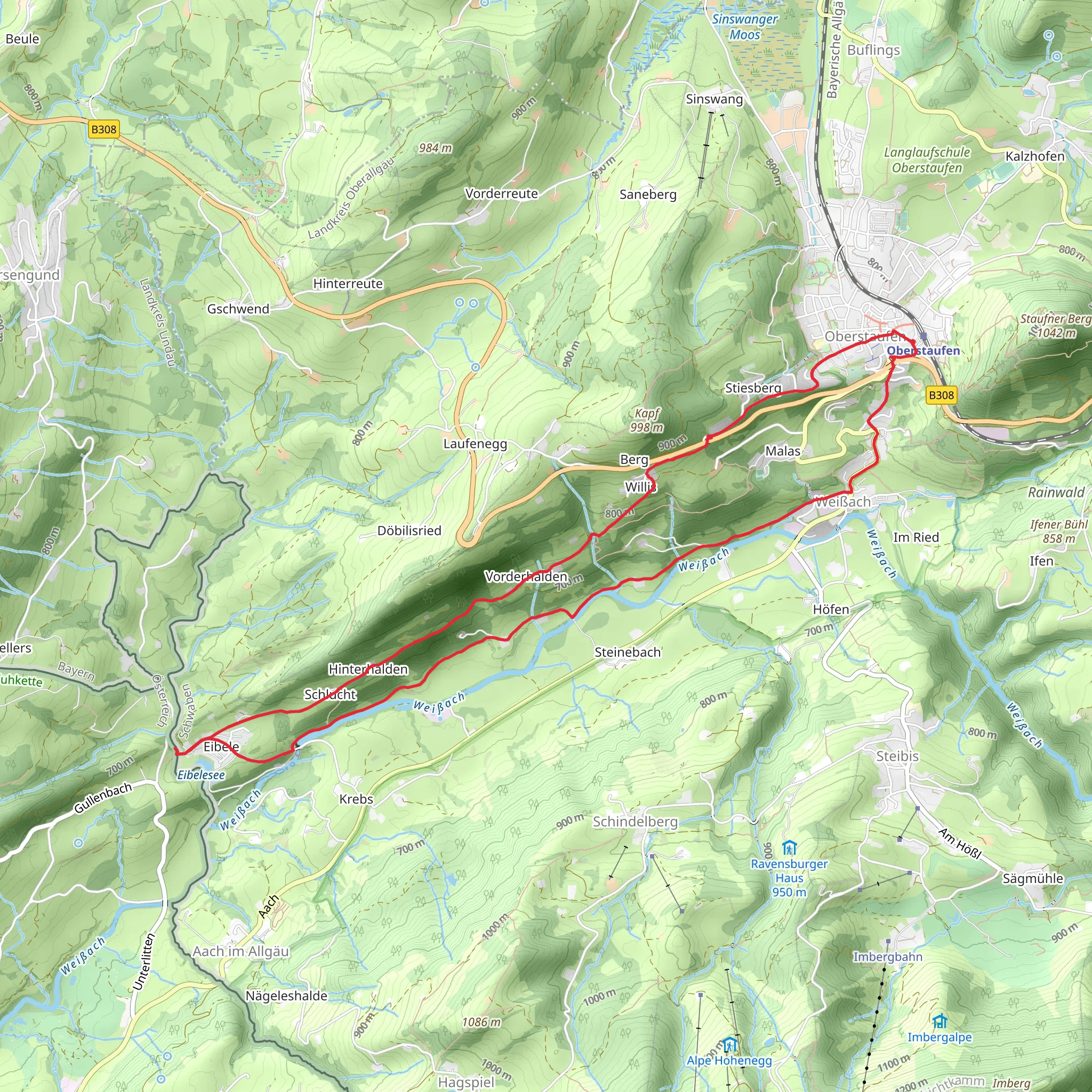
Starting near Oberallgäu, Germany, the Oberstaufen and Eibele Wasserfälle Loop via Weißachtalrunde is a picturesque 12 km (7.5 miles) loop trail with an elevation gain of approximately 300 meters (984 feet). This medium-difficulty trail offers a delightful mix of natural beauty, historical landmarks, and opportunities for wildlife spotting.
Getting There To reach the trailhead, you can drive to Oberallgäu, where parking is available near the starting point. For those using public transport, take a train to Oberstaufen station. From there, local buses or a short taxi ride will get you to the trailhead.
Trail Overview The trail begins with a gentle ascent through lush meadows and dense forests, offering a serene start to your hike. As you progress, you'll encounter the Weißachtal valley, known for its stunning landscapes and tranquil atmosphere. The initial 3 km (1.9 miles) of the trail are relatively easy, making it a good warm-up for the more challenging sections ahead.
Eibele Waterfalls Around the 4 km (2.5 miles) mark, you'll reach the Eibele Waterfalls, one of the trail's main highlights. The cascading waters provide a perfect spot for a short break and some photography. The area around the waterfalls is rich in flora and fauna, so keep an eye out for various bird species and small mammals.
Historical Significance As you continue, you'll pass through areas with historical significance. The region has a rich history dating back to medieval times, and you may come across old farmhouses and remnants of ancient settlements. These landmarks offer a glimpse into the area's past and add an educational element to your hike.
Mid-Trail Challenges The middle section of the trail presents a moderate challenge with steeper inclines and rocky terrain. This part of the hike requires careful footing, especially if the ground is wet. The elevation gain here is around 150 meters (492 feet) over a distance of 2 km (1.2 miles), making it the most strenuous part of the loop.
Scenic Views and Wildlife As you reach higher elevations, the trail opens up to panoramic views of the surrounding mountains and valleys. This is an excellent spot for a rest and some photos. The area is also home to various wildlife, including deer and foxes, so keep your camera ready.
Descent and Return The final 3 km (1.9 miles) of the trail involve a gradual descent back to the starting point. This section is less demanding and allows you to enjoy the scenery at a leisurely pace. You'll pass through more meadows and forests, with the opportunity to spot wildflowers and other plant life.
Navigation For navigation, it's highly recommended to use the HiiKER app, which provides detailed maps and real-time updates to ensure you stay on track. The trail is well-marked, but having a reliable navigation tool can enhance your hiking experience.
Final Stretch As you approach the end of the loop, you'll find yourself back near Oberallgäu, where you can relax and reflect on your hike. The trail offers a perfect blend of natural beauty, historical landmarks, and moderate challenges, making it a rewarding experience for hikers of all levels.
Comments and Reviews
User comments, reviews and discussions about the Oberstaufen and Eibele Wasserfälle Loop via Weißachtalrunde, Germany.
4.33
average rating out of 5
6 rating(s)
