Kemptner Hütte to Alpe Eschbach Walk via Bockkarkopf Peak and Wanderweg 432
Download
Preview
Add to list
More
14.4 km
~4 hrs 25 min
926 m
Point-to-Point
“Embark on a captivating 14 km hike from Kemptner Hütte to Alpe Eschbach, blending natural beauty and historical intrigue.”
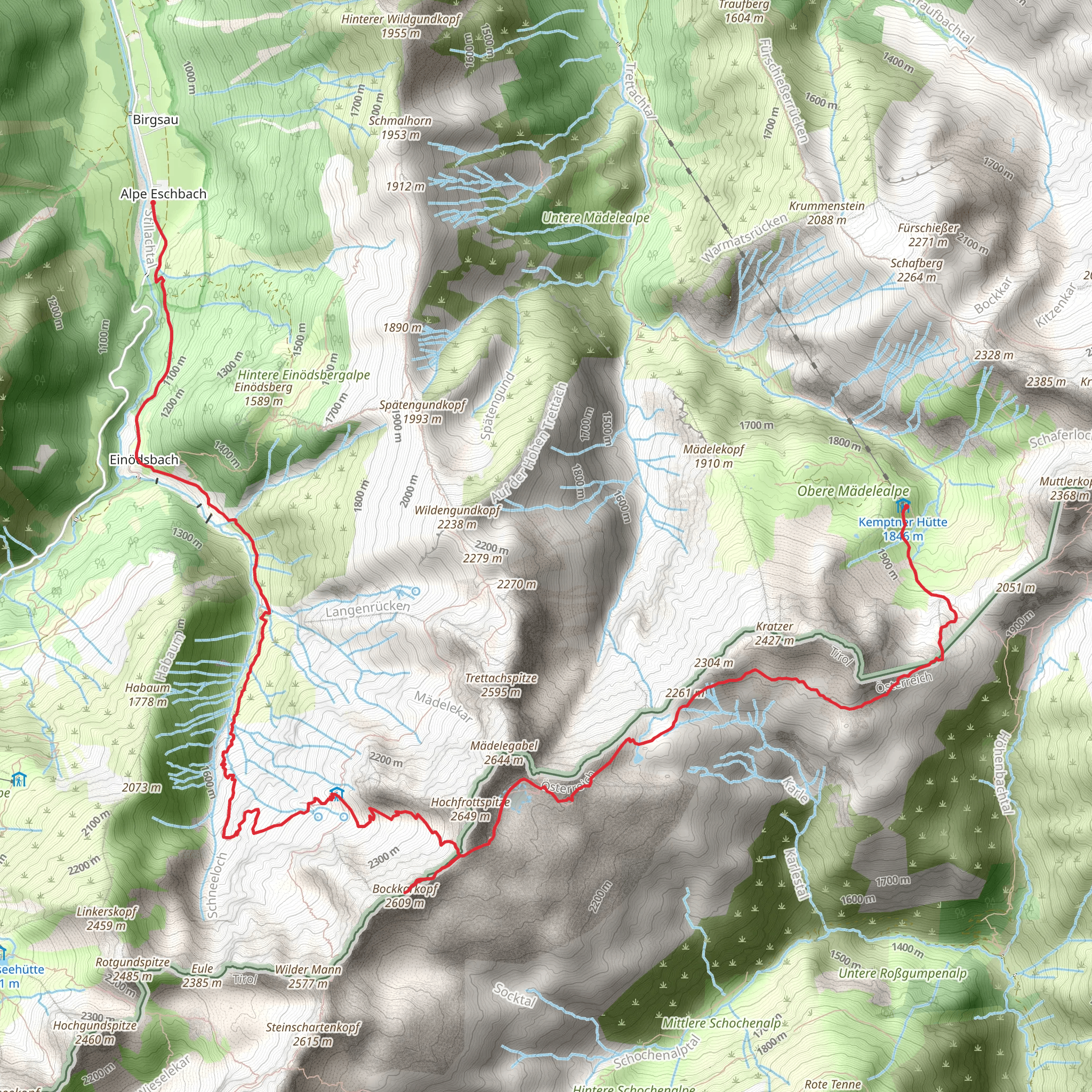
Starting near Oberallgäu, Germany, the Kemptner Hütte to Alpe Eschbach Walk via Bockkarkopf Peak and Wanderweg 432 is a captivating 14 km (8.7 miles) point-to-point trail with an elevation gain of approximately 900 meters (2,950 feet). This medium-difficulty hike offers a blend of natural beauty, historical significance, and challenging terrain.
Getting There
To reach the trailhead, you can either drive or use public transport. If driving, head towards Oberallgäu, where parking is available near the starting point. For those using public transport, take a train to Oberstdorf, followed by a bus to Spielmannsau, which is the nearest significant landmark to the trailhead.
Trail Overview
The journey begins at Kemptner Hütte, a well-known mountain hut that serves as a popular starting point for various hikes in the region. From here, the trail ascends steadily, offering panoramic views of the surrounding Allgäu Alps. The initial part of the hike is relatively gentle, allowing you to acclimate to the altitude and enjoy the lush alpine meadows.
Bockkarkopf Peak
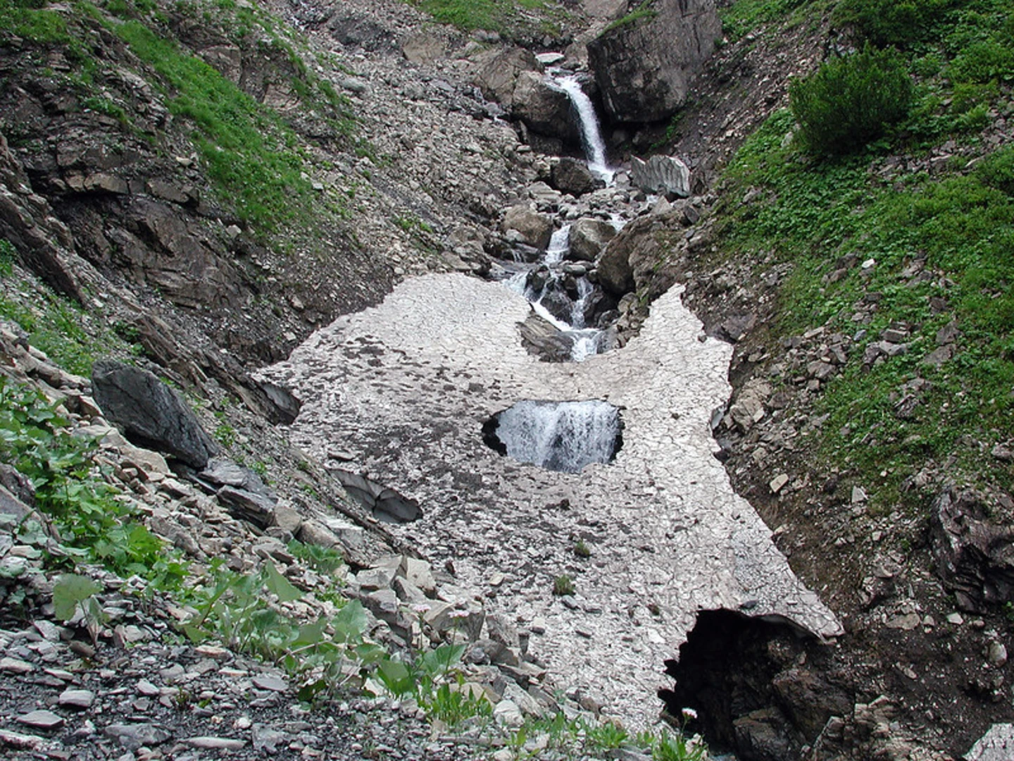
Approximately 6 km (3.7 miles) into the hike, you will reach the Bockkarkopf Peak, standing at an elevation of 2,609 meters (8,560 feet). This section is the most challenging part of the trail, with steep ascents and rocky terrain. However, the effort is well worth it, as the peak offers breathtaking 360-degree views of the Allgäu Alps and the Lechtal Alps. Be prepared for some scrambling and ensure you have sturdy hiking boots for this section.
Wanderweg 432
After descending from Bockkarkopf Peak, you will join Wanderweg 432. This well-marked trail takes you through a series of picturesque valleys and ridges. The path is less strenuous here, allowing you to enjoy the diverse flora and fauna. Keep an eye out for alpine marmots and golden eagles, which are commonly spotted in this area.
Historical Significance
The region around Oberallgäu has a rich history, with evidence of human settlement dating back to the Bronze Age. The trail itself passes through areas that were historically used for transhumance, the seasonal movement of livestock between fixed summer and winter pastures. You may notice ancient stone walls and old shepherd huts along the way, remnants of this traditional practice.
Final Stretch to Alpe Eschbach
The final 4 km (2.5 miles) of the hike descend gradually towards Alpe Eschbach. This section is relatively easy, allowing you to relax and take in the serene alpine landscapes. Alpe Eschbach is a charming alpine pasture, where you can rest and enjoy some local Bavarian delicacies. The area is known for its cheese and dairy products, so be sure to try some before you leave.
Navigation and Safety
Given the varied terrain and potential for sudden weather changes, it's advisable to use a reliable navigation tool like HiiKER to stay on track. Ensure you have adequate water, snacks, and layers of clothing to adapt to changing conditions. Always check the weather forecast before setting out and inform someone of your plans.
This hike offers a perfect blend of natural beauty, challenging terrain, and historical intrigue, making it a must-do for any avid hiker exploring the Allgäu Alps.
What to expect?
Activity types
Comments and Reviews
User comments, reviews and discussions about the Kemptner Hütte to Alpe Eschbach Walk via Bockkarkopf Peak and Wanderweg 432, Germany.
4.5
average rating out of 5
2 rating(s)
