Download
Preview
Add to list
More
12.2 km
~3 hrs 27 min
610 m
Loop
“Experience panoramic Alpine views, rich history, and diverse wildlife on the scenic Imberg-Hochbuhl-Waltners Alpe Loop.”
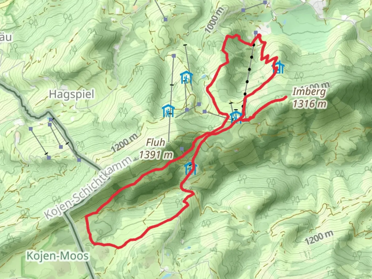
Starting near Oberallgäu, Germany, the Imberg, Hochbuhl, and Waltners Alpe Loop is a picturesque 12 km (7.5 miles) trail with an elevation gain of approximately 600 meters (1,970 feet). This loop trail is rated as medium difficulty, making it suitable for moderately experienced hikers.### Getting There To reach the trailhead, you can either drive or use public transport. If driving, head towards Oberallgäu and look for parking near the Imbergbahn cable car station. For those using public transport, take a train to Oberstaufen and then a bus to the Imbergbahn station. The trailhead is conveniently located near this station.### Trail Navigation For navigation, it is highly recommended to use the HiiKER app, which provides detailed maps and real-time GPS tracking to ensure you stay on the correct path.### Trail Highlights
Imberg
Starting from the Imbergbahn station, the trail ascends gradually through lush meadows and dense forests. After about 3 km (1.9 miles) and an elevation gain of 200 meters (656 feet), you will reach the Imberg summit. This area offers panoramic views of the Allgäu Alps and is a great spot for a short break.#### Hochbuhl Continuing from Imberg, the trail leads you towards Hochbuhl. This section is approximately 4 km (2.5 miles) long with an additional elevation gain of 150 meters (492 feet). The path meanders through alpine pastures, where you might encounter grazing cattle and a variety of wildflowers, especially during the summer months. Hochbuhl itself is a scenic viewpoint, providing stunning vistas of the surrounding valleys and peaks.#### Waltners Alpe From Hochbuhl, the trail descends slightly before ascending again towards Waltners Alpe. This segment is around 3 km (1.9 miles) with an elevation gain of 100 meters (328 feet). Waltners Alpe is a traditional alpine hut where you can stop for refreshments and enjoy some local Bavarian cuisine. The hut is often surrounded by alpine wildlife, including marmots and various bird species.### Historical Significance The region around Oberallgäu has a rich history dating back to the Roman era. The trail itself passes through areas that were historically used for transhumance, the seasonal movement of livestock between fixed summer and winter pastures. This practice has shaped the landscape and culture of the region, and you can still see remnants of old shepherd paths and ancient boundary markers along the way.### Final Stretch The final leg of the loop takes you back towards the Imbergbahn station. This 2 km (1.2 miles) stretch is mostly downhill, making for a pleasant and easy end to your hike. The descent offers more beautiful views and the opportunity to spot additional wildlife.### Wildlife and Flora Throughout the hike, keep an eye out for local wildlife such as deer, foxes, and various bird species. The flora is equally impressive, with alpine flowers like gentians and edelweiss dotting the landscape. The forests are primarily composed of spruce and fir trees, providing a cool and shaded environment during the warmer months.This trail offers a balanced mix of natural beauty, moderate physical challenge, and cultural history, making it a rewarding experience for any hiker.

What to expect?
Activity types
Comments and Reviews
User comments, reviews and discussions about the Imberg, Hochbuhl and Waltners Alpe Loop, Germany.
4.56
average rating out of 5
9 rating(s)