Download
Preview
Add to list
More
4.3 km
~1 hrs 22 min
304 m
Loop
“The Hochgrat and Gütlealpe Loop via Panoramaweg offers breathtaking views, rich history, and vibrant alpine meadows.”
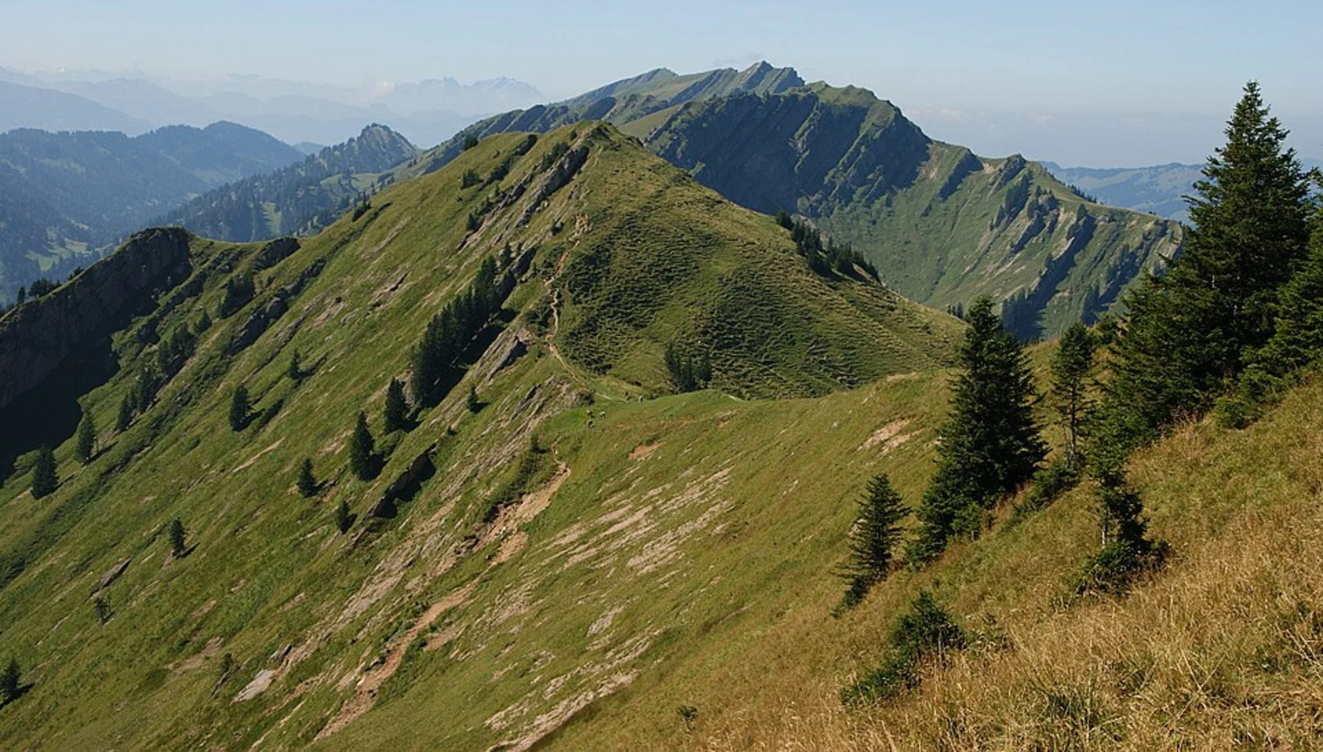
Starting near Oberallgäu, Germany, the Hochgrat and Gütlealpe Loop via Panoramaweg is a scenic 4 km (2.5 miles) loop trail with an elevation gain of approximately 300 meters (984 feet). This medium-difficulty trail offers a blend of natural beauty, panoramic views, and a touch of historical significance.### Getting There To reach the trailhead, you can drive or use public transport. If driving, head towards the Hochgratbahn Talstation, a well-known cable car station in Oberallgäu. For those using public transport, take a train to Oberstaufen and then a bus to the Hochgratbahn Talstation. The trailhead is conveniently located near this station.### Trail Overview The trail begins with a gentle ascent, allowing hikers to ease into the journey. As you start, you'll be surrounded by lush alpine meadows, which are particularly vibrant during the spring and summer months. The initial section of the trail is well-marked and easy to follow.### Key Landmarks and Sections#### Panoramaweg About 1 km (0.6 miles) into the hike, you'll reach the Panoramaweg section. This part of the trail offers breathtaking views of the Allgäu Alps. On clear days, you can see as far as Lake Constance. The panoramic views make this section a highlight of the hike, so take your time to enjoy the scenery.#### Hochgrat Summit Continuing along the trail, you'll gradually ascend towards the Hochgrat summit. This section involves a steeper climb, contributing to the overall elevation gain. The summit, standing at 1,834 meters (6,017 feet), is the highest peak in the Nagelfluhkette Nature Park. Here, you'll find a small hut where you can take a break and enjoy the views.#### Gütlealpe Descending from the summit, the trail leads you to Gütlealpe, a charming alpine pasture. This area is known for its traditional Bavarian huts and grazing cattle. It's a great spot to rest and perhaps enjoy a snack. The Gütlealpe area is also rich in flora, with various alpine flowers dotting the landscape.### Wildlife and Nature The trail is home to diverse wildlife, including marmots, chamois, and a variety of bird species. Keep an eye out for golden eagles soaring above. The flora is equally impressive, with alpine roses, gentians, and edelweiss adding splashes of color to the meadows.### Historical Significance The region has a rich history, with evidence of human settlement dating back to the Bronze Age. The Hochgrat area was historically significant for its strategic location and natural resources. The traditional huts and pastures you see along the trail are a testament to the region's long-standing agricultural practices.### Navigation For navigation, it's recommended to use HiiKER, which provides detailed maps and real-time updates. The trail is well-marked, but having a reliable navigation tool ensures you stay on track and can fully enjoy the hike without any worries.### Final Stretch The final stretch of the loop brings you back to the starting point near the Hochgratbahn Talstation. This section is relatively easy, allowing you to cool down and reflect on the stunning landscapes and experiences of the hike.This trail offers a perfect blend of natural beauty, challenging climbs, and historical insights, making it a rewarding experience for any hiker.

What to expect?
Activity types
Comments and Reviews
User comments, reviews and discussions about the Hochgrat and Gütlealpe Loop via Panoramaweg, Germany.
4.88
average rating out of 5
8 rating(s)