Download
Preview
Add to list
More
10.9 km
~3 hrs 43 min
930 m
Out and Back
“Experience stunning alpine vistas, rich history, and diverse wildlife on the rewarding Engeratsgundsee Walk.”
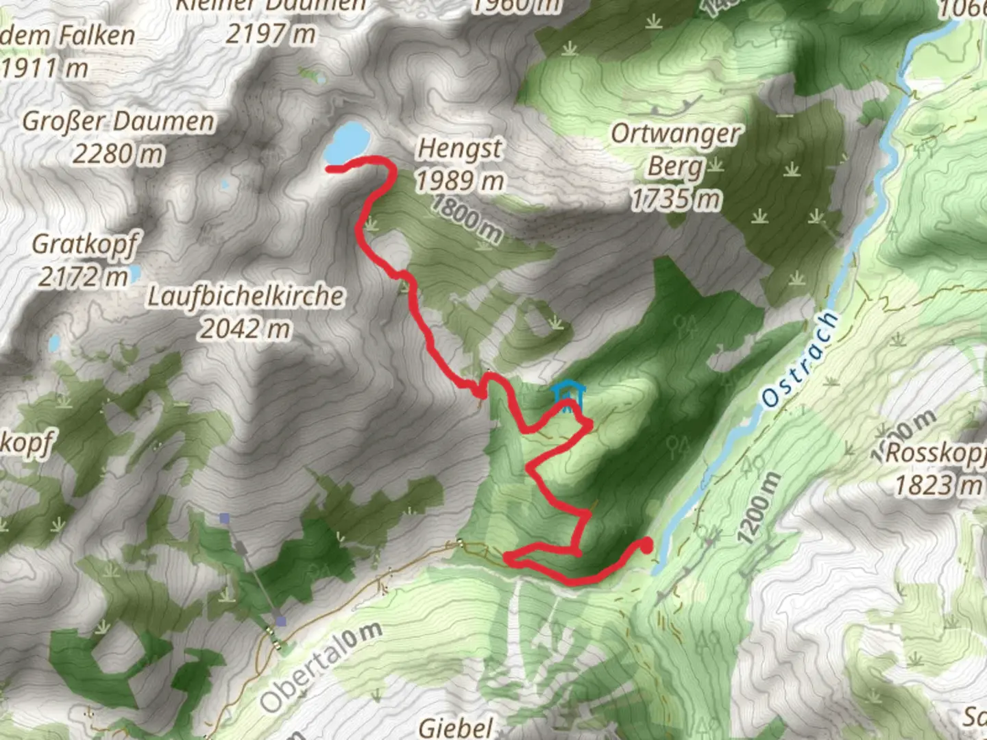
Starting near Oberallgäu, Germany, the Engeratsgundsee Walk via Untere Schwarzenbergalpe is an 11 km (approximately 6.8 miles) out-and-back trail with an elevation gain of around 900 meters (approximately 2,950 feet). This trail is rated as medium difficulty, making it suitable for hikers with some experience and a good level of fitness.### Getting There To reach the trailhead, you can drive or use public transport. If driving, head towards Oberallgäu and look for parking near the trail's starting point. For those using public transport, take a train to Oberstdorf, which is the nearest major town. From Oberstdorf, you can catch a local bus to the trailhead area. The nearest significant landmark to the trailhead is the village of Hinterstein.### Trail Overview The trail begins with a gentle ascent through lush meadows and dense forests. As you progress, the path becomes steeper, offering a more challenging climb. The first significant landmark you'll encounter is the Untere Schwarzenbergalpe, a traditional alpine hut located about 3 km (1.9 miles) from the start. This is a great spot to take a short break and enjoy the picturesque surroundings.### Flora and Fauna The trail is rich in biodiversity. In the lower sections, you'll find a variety of wildflowers, including alpine roses and gentians. As you ascend, the vegetation changes to hardy alpine shrubs and grasses. Keep an eye out for local wildlife such as chamois, marmots, and golden eagles soaring above.### Historical Significance The region has a rich history, with evidence of human settlement dating back to the Bronze Age. The alpine huts, or "alpes," like Untere Schwarzenbergalpe, have been used for centuries by local herders. These huts are part of a long-standing tradition of transhumance, where livestock is moved to higher pastures during the summer months.### Reaching Engeratsgundsee After passing Untere Schwarzenbergalpe, the trail continues to climb steeply. The final stretch to Engeratsgundsee is the most challenging, with rocky terrain and switchbacks. The lake itself is a stunning alpine gem, nestled in a cirque surrounded by towering peaks. It's located approximately 5.5 km (3.4 miles) from the trailhead, making it the perfect halfway point for your hike.### Navigation and Safety Given the elevation gain and the sometimes rugged terrain, it's essential to be well-prepared. Use HiiKER for accurate trail maps and real-time navigation. Ensure you have sturdy hiking boots, sufficient water, and weather-appropriate clothing. The weather in the Alps can change rapidly, so be prepared for sudden shifts.### Return Journey The return journey follows the same path back to the trailhead. While descending, take the opportunity to enjoy the panoramic views and perhaps spot some wildlife you missed on the way up. The descent is easier but still requires caution, especially on the steeper sections.This trail offers a rewarding hike with stunning natural beauty, rich history, and a good physical challenge. Whether you're a seasoned hiker or looking to push your limits, the Engeratsgundsee Walk via Untere Schwarzenbergalpe is a memorable adventure.
What to expect?
Activity types
Comments and Reviews
User comments, reviews and discussions about the Engeratsgundsee Walk via Untere Schwarzenbergalpe, Germany.
4.0
average rating out of 5
1 rating(s)
