Download
Preview
Add to list
More
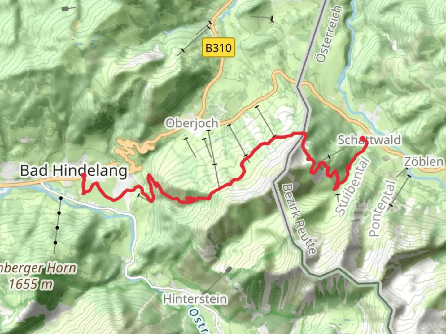
15.1 km
~4 hrs 56 min
1157 m
Point-to-Point
“Embark on a breathtaking adventure through the Allgäu Alps, blending natural beauty with rich history.”
Starting your adventure near Oberallgäu, Germany, the trail from Bad Hindelang to Schattwald via the Himmelsstürmer Route is a challenging yet rewarding journey through the stunning Allgäu Alps. This point-to-point trail spans approximately 15 kilometers (about 9.3 miles) with an elevation gain of around 1,100 meters (3,609 feet), making it suitable for experienced hikers seeking a demanding trek.
Getting There
To reach the trailhead, you can drive to Bad Hindelang, which is well-connected by road. If you prefer public transport, take a train to Sonthofen, the nearest major railway station. From Sonthofen, a bus service will take you directly to Bad Hindelang. The trailhead is conveniently located near the town center, making it easily accessible.
Trail Overview
The trail begins in the picturesque town of Bad Hindelang, known for its charming Bavarian architecture and rich cultural heritage. As you set off, you'll quickly find yourself immersed in the natural beauty of the Allgäu region. The initial section of the trail is a steady ascent through lush alpine meadows, where you might spot local wildlife such as chamois and marmots.
Key Landmarks and Nature
As you climb higher, the landscape transforms into rugged alpine terrain. Around the 5-kilometer (3.1-mile) mark, you'll reach the Himmelsstürmer, a notable peak offering breathtaking panoramic views of the surrounding mountains. This is a perfect spot to take a break and soak in the scenery.
Continuing along the trail, you'll pass through dense forests and rocky outcrops. The flora here is diverse, with vibrant wildflowers dotting the landscape in the warmer months. Keep an eye out for the rare Edelweiss flower, a symbol of the Alps.
Historical Significance
The region is steeped in history, with evidence of human settlement dating back to the Bronze Age. The trail itself has been used for centuries, serving as a vital link between communities in Germany and Austria. As you hike, you'll be walking in the footsteps of traders and travelers from bygone eras.
Navigation and Safety
Given the trail's difficulty, it's crucial to be well-prepared. Ensure you have a detailed map or use the HiiKER app for navigation. Weather conditions in the Alps can change rapidly, so pack appropriate clothing and gear. The trail can be steep and rocky in sections, requiring good footwear and a high level of fitness.
Final Stretch
The descent into Schattwald offers a gentler gradient, allowing you to enjoy the serene beauty of the Tannheimer Valley. As you approach the end of the trail, you'll be greeted by the quaint village of Schattwald, where you can relax and reflect on your journey through this remarkable alpine landscape.

Comments and Reviews
User comments, reviews and discussions about the Bad Hindelang to Schattwald via Himmelsstruermer Route, Germany.
5.0
average rating out of 5
1 rating(s)