Download
Preview
Add to list
More
7.9 km
~1 hrs 51 min
174 m
Loop
“Explore Pegnitz's 8 km trail for stunning karst landscapes, historical sites, and panoramic river valley views.”
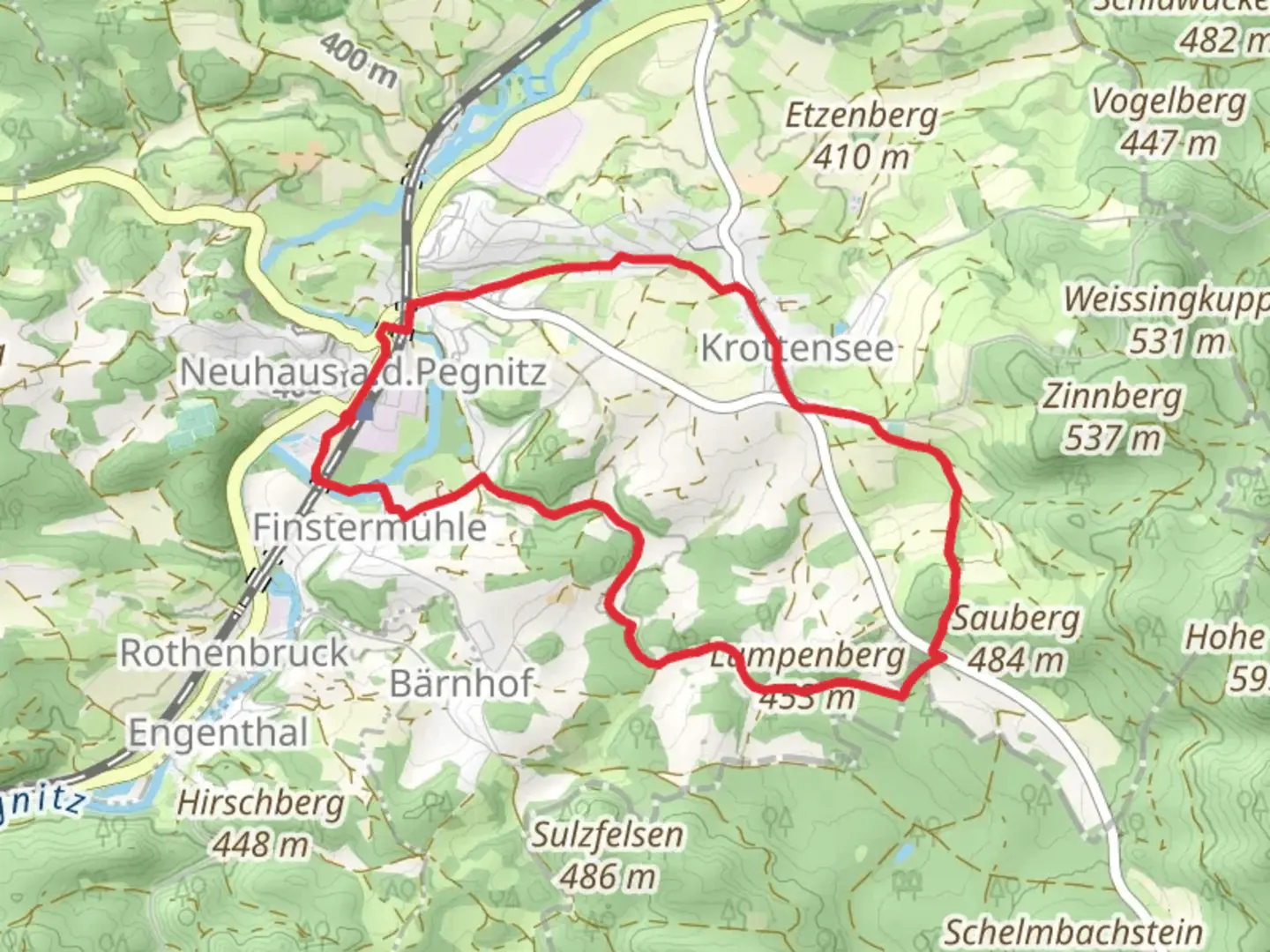
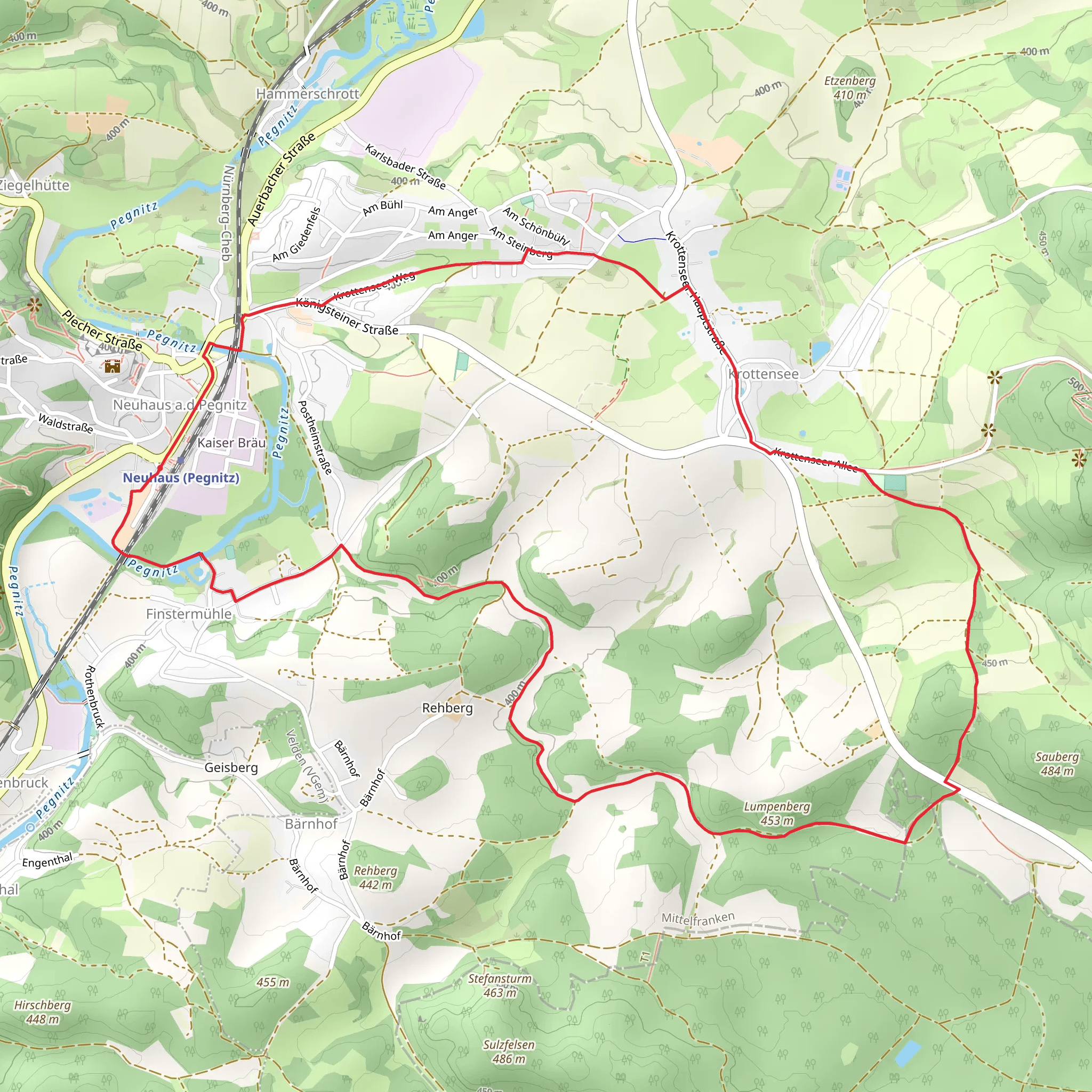
Starting near Nürnberger Land, Germany, the Pegnitz via Karstkundlicher Wanderpfad is an 8 km (approximately 5 miles) loop trail with an elevation gain of around 100 meters (328 feet). This medium-difficulty trail offers a blend of natural beauty and historical intrigue, making it a rewarding experience for hikers.### Getting There To reach the trailhead, you can either drive or use public transport. If driving, set your GPS to the vicinity of Nürnberger Land, specifically near the town of Velden. For those using public transport, take a train to Velden (Pegnitz) station. From there, local buses or a short taxi ride will get you to the trailhead.### Trail Overview The trail begins with a gentle ascent through lush forests, where you’ll be greeted by a variety of flora and fauna. Keep an eye out for native bird species and small mammals that inhabit the area. The initial 2 km (1.2 miles) of the trail are relatively easy, making it a good warm-up for the more challenging sections ahead.### Karst Landscapes and Geological Features As you progress, the trail takes you through fascinating karst landscapes. These geological formations are characterized by soluble rocks such as limestone, which have been eroded over time to create unique features like sinkholes, caves, and underground streams. The Karstkundlicher Wanderpfad is particularly known for its educational plaques that explain these natural phenomena in detail. This section of the trail is both visually stunning and intellectually stimulating, offering a unique opportunity to learn about the region's geology.### Historical Significance Around the 4 km (2.5 miles) mark, you’ll encounter remnants of historical significance. The area has been inhabited since prehistoric times, and you may come across ancient stone structures and old mining sites. These landmarks offer a glimpse into the lives of early settlers and their interaction with the natural environment. Be sure to take a moment to appreciate the historical context and the enduring legacy of human activity in this region.### Scenic Views and Wildlife As you reach the halfway point, the trail opens up to offer panoramic views of the Pegnitz River valley. This is an excellent spot for a break and some photography. The elevation gain here is about 50 meters (164 feet), providing a moderate challenge but rewarding you with stunning vistas. Look out for deer and other wildlife that are often seen grazing in the open meadows.### Return Loop The return loop takes you back through dense forests and along the banks of the Pegnitz River. This section is relatively flat, making for a leisurely end to your hike. The final 2 km (1.2 miles) are particularly serene, with the gentle sounds of the river providing a calming backdrop.### Navigation and Safety For navigation, it’s highly recommended to use the HiiKER app, which provides detailed maps and real-time updates. The trail is well-marked, but having a reliable navigation tool ensures you stay on track and can fully enjoy the experience without any worries.### Final Stretch As you near the end of the trail, you’ll pass through a small village where you can find local eateries and shops. This is a great opportunity to sample some regional cuisine and perhaps pick up a souvenir to remember your hike.This trail offers a perfect blend of natural beauty, geological wonders, and historical landmarks, making it a must-visit for any hiking enthusiast.
Comments and Reviews
User comments, reviews and discussions about the Pegnitz via Karstkundlicher Wanderpfad, Germany.
4.4
average rating out of 5
5 rating(s)
